Home
States
Colorado
Connecticut
Maine
Massachusetts
New Hampshire
New York
Rhode Island
Utah
Vermont
View All
Lists
NE 4,000 Footers
NE 100 Highest
NH 4,000 Footers
NH 100 Highest
NH 52 With A View
NH Belknap Range
NH Ossipee 10
Links
Trail Conditions
Trip Log
Sunrises
Sunsets
About
|
Bear Mountain
Salisbury, CT
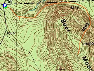
Trailheads, measurements, times, distances, and maps are all approximate and relative to the hike(s) as shown below.
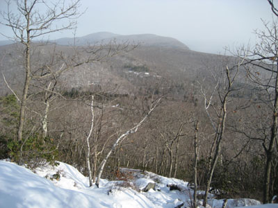
Looking down the Appalachian Trail on the north side of Bear Mountain
The day of extreme winter hiking, Connecticut style, didn't quite start off as planned - a few miles down the road, I realized I didn't have a jacket or fleece with me. No worries, especially after having an unsuccessful attempt at pumping gas in Dalton (frozen pumps). Nonetheless, I carried on.
It was around 6 or so degrees at the trailhead - tropical weather, for sure. After looking at the AMC Hut briefly, I started down the trail, the footprints showing that I was been the first person on it in the last few days. Until the Appalachian Trail is reached, it is a very gradual walk.
The Appalachian Trail does almost a straight shot up the ledgy north face of Bear Mountain - lots of slipping and sliding since I wasn't using crampons or Stablicers. Fortunately, due to the exposure, there was very little wind until reaching the summit.
The big pile of rocks at the summit provides strong views to the north, while some ledges south of it provide views to the west and south. There appeared to be a few snow squals southeast and north of the mountain while I was at the summit.
| Hike Ratings |
|
Getting To Trailhead: |
Easy |
| Destination: |
Bear Mountain |
|
Length: |
Easy |
|
Steepness: |
Difficult |
|
Navigation: |
Easy |
|
Views: |
Excellent |
|
Crowds: |
Minimal |
|
| Hike Stats |
|
Date Hiked: |
Wednesday, February 7, 2007 |
| Hike Commenced: |
9:24 AM |
| Parking Elevation: |
1,830' |
| Destination: |
Bear Mountain |
| Ascent Commenced: |
9:25 AM |
| Summit Reached: |
9:58 AM |
| Trailhead Elevation: |
1,828' |
| Summit Elevation: |
2,316' |
| Vertical Gain: |
686' |
| Hike Ended: |
10:38 AM |
| Hike Distance: |
2.3 miles |
| Hike Vertical Gain: |
884' |
|
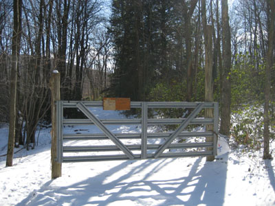
Trailhead to the AMC Hut and Appalachian Trail access
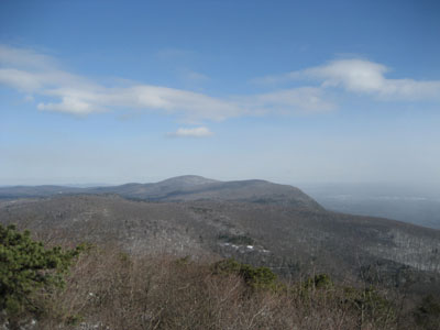
Looking north at Mt. Race and Mt. Everett

Directions to trailhead: Take East Street south from Mount Washington, MA to the border marker (left side of road). Small parking lot is just after this on the left (AMC sign) - trailhead is at the metal gate.
Back to Bear Mountain Profile
|

