Home
States
Colorado
Connecticut
Maine
Massachusetts
New Hampshire
New York
Rhode Island
Utah
Vermont
View All
Lists
NE 4,000 Footers
NE 100 Highest
NH 4,000 Footers
NH 100 Highest
NH 52 With A View
NH Belknap Range
NH Ossipee 10
Links
Trail Conditions
Trip Log
Sunrises
Sunsets
About
|
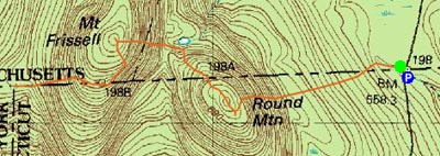
Mt. Frissell
Round Mountain
Mt. Washington, MA, and Salisbury, CT
Trailheads, measurements, times, distances, and maps are all approximate and relative to the hike(s) as shown below.
Mt. Frissell Trail at the CT highpoint
Arriving at the parking lot, I was only the second vehicle there. After the hike I determined this person must have gone up Bear Mountain, as there was not a soul to be seen on the hike I went on.
The first part of the hike, from the MA/CT marker trailhead to the fork in the trail, was terrible. The recent rains had submerged the trail in up to half a foot of water. After attempting to walk on the side of the trail (and running out of dry ground), I paused for a few minutes, gave up on the trail, and pushed my way through the mountain laurel on the south side of the trail.
The next challenge was the snow storm that had just moved in. The open ledge of Round Mountain and Mt. Frissell made for extremely windy conditions. Visibility dropped rather quickly, however it came back after I summitted, as some blue sky opened up briefly.
Though most of the hike is flat to moderate, there are a few steep sections on both mountains that may require some very minor climbing.
| Hike Ratings |
|
Getting To Trailhead: |
Easy |
| Destination: |
Round Mountain |
|
Length: |
Easy |
|
Steepness: |
Difficult |
|
Navigation: |
Easy |
|
Views: |
Excellent |
|
Crowds: |
Minimal |
| Destination: |
Mt. Frissell |
|
Length: |
Moderate |
|
Steepness: |
Difficult |
|
Navigation: |
Easy |
|
Views: |
Excellent |
|
Crowds: |
Minimal |
| Destination: |
Mt. Frissell (CT highpoint) |
|
Length: |
Moderate |
|
Steepness: |
Moderate |
|
Navigation: |
Easy |
|
Views: |
Excellent |
|
Crowds: |
Minimal |
| Destination: |
Tri State Marker |
|
Length: |
Moderate |
|
Steepness: |
Difficult |
|
Navigation: |
Easy |
|
Views: |
Excellent |
|
Crowds: |
Minimal |
|
| Hike Stats |
|
Date Hiked: |
Sunday, October 29, 2006 |
| Hike Commenced: |
8:18 AM |
| Parking Elevation: |
1,830' |
| Destination: |
Round Mountain |
| Ascent Commenced: |
8:19 AM |
| Summit Reached: |
8:43 AM |
| Trailhead Elevation: |
1,832' |
| Summit Elevation: |
2,296' |
| Vertical Gain: |
464' |
| Destination: |
Mt. Frissell |
| Ascent Commenced: |
8:43 AM |
| Summit Reached: |
8:59 AM |
| Trailhead Elevation: |
2,296' |
| Summit Elevation: |
2,453' |
| Vertical Gain: |
323' |
| Destination: |
Mt. Frissell (CT highpoint) |
| Ascent? Commenced: |
8:59 AM |
| Highpoint Reached: |
9:05 AM |
| Trailhead Elevation: |
2,453' |
| Highpoint Elevation: |
2,380' |
| Vertical Gain: |
20' |
| Destination: |
Tri State Marker |
| Ascent? Commenced: |
9:05 AM |
| Marker Reached: |
9:15 AM |
| Trailhead Elevation: |
2,380' |
| Marker Elevation: |
2,145' |
| Vertical Gain: |
5' |
| Hike Ended: |
10:10 AM |
| Hike Vertical Gain: |
1,318' |
|
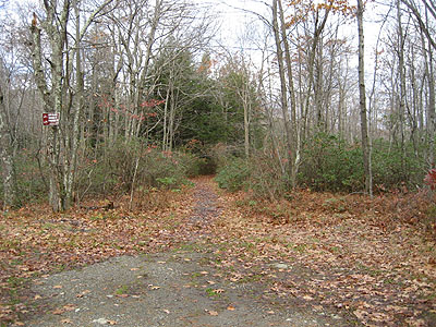
Mt. Frissell Trail trailhead on East Street
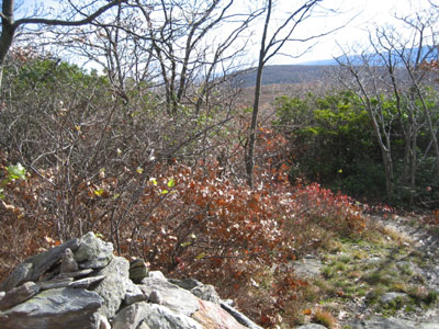
Mt. Frissell Trail on Round Mountain

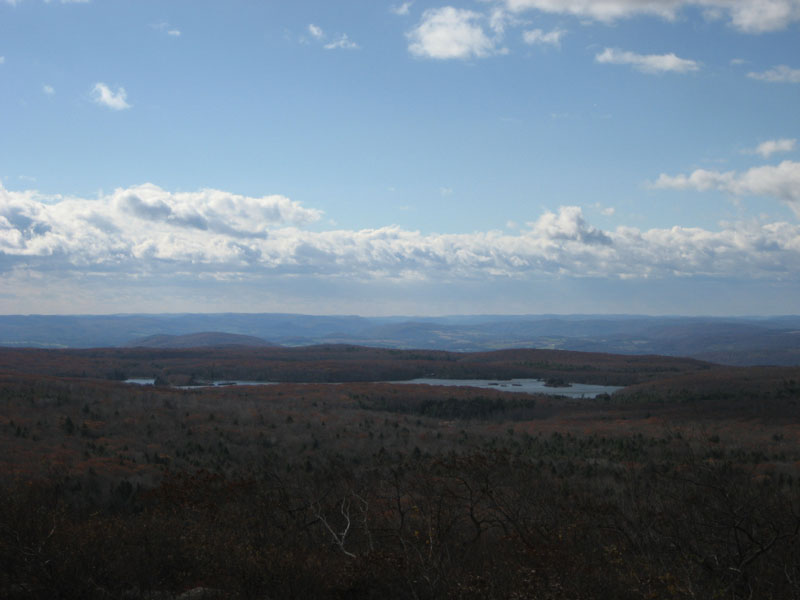
Round Mountain summit, looking south at Riga Lake
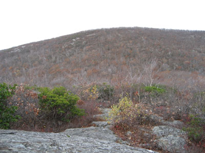
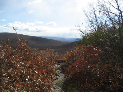
Looking west at Mt. Frissell from Round Mountain
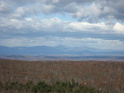
Looking west at the Catskills from the west face of Mt. Frissell
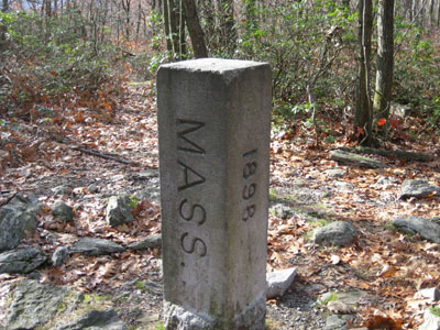
Tri State marker west of Mt. Frissell

Directions to trailhead: Take East Street south from Mount Washington, MA to the border marker (left side of road, trailhead is on the right) Small parking lot is just after this on the left (AMC sign).
Back to Round Mountain Profile
Back to Mt. Frissell Profile
|