Home
States
Colorado
Connecticut
Maine
Massachusetts
New Hampshire
New York
Rhode Island
Utah
Vermont
View All
Lists
NE 4,000 Footers
NE 100 Highest
NH 4,000 Footers
NH 100 Highest
NH 52 With A View
NH Belknap Range
NH Ossipee 10
Links
Trail Conditions
Trip Log
Sunrises
Sunsets
About
|
Burnt Hill
Carrabassett Valley, ME
Trailheads, measurements, times, distances, and maps are all approximate and relative to the hike(s) as shown below.

The lower Burnt Mountain Trail
Route: Burnt Mountain Trail
Burnt Hill (aka Burnt Mountain), the subpeak of Sugarloaf.
Below treeline, the Burnt Mountain Trail was a wet mess of standing and running water from the previous day's rain. Probably 3/4s of it on the ascent to the ridge was flooded, making for slow going and wet feet.
Once on the ridge, the winds were fairly significant, especially once clearing treeline. Sustained winds were probably in the 30s with gusts probably in the 50s at times, making it difficult to stand/walk. Very impressive open ridgewalk and summit, but hard to stay there long with the wind!
| Hike Ratings |
|
Getting To Trailhead: |
Moderate |
| Destination: |
Burnt Hill |
|
Length: |
Moderate |
|
Steepness: |
Moderate |
|
Navigation: |
Moderate |
|
Views: |
Excellent |
|
Crowds: |
Minimal |
|
| Hike Stats |
|
Date Hiked: |
Saturday, July 5, 2014 |
| Parking Elevation: |
1,740' |
| Destination: |
Burnt Hill |
| Time Elapsed: |
02:13 |
| Trailhead Elevation: |
1,740' |
| Summit Elevation: |
3,609' |
| Vertical Gain: |
1,919' |
|
|
| Hike Time Elapsed: |
04:29 |
| Hike Vertical Gain: |
1,969' |
|

The Burnt Mountain Trail trailhead at the end of Bigelow Mountain Drive

The upper Burnt Mountain Trail

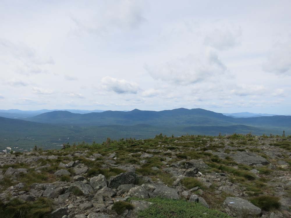
Looking at the Bigelows from Burnt Hill


Directions to trailhead: Trailhead as at the end of Bigelow Mountain Drive off Mountain Side Road. This short side road (in a condo development) is permit parking only. The Sugarloaf base lodge is roughly on the same contour, so you could park there and walk over.
Back to Burnt Hill Profile
|