Home
States
Colorado
Connecticut
Maine
Massachusetts
New Hampshire
New York
Rhode Island
Utah
Vermont
View All
Lists
NE 4,000 Footers
NE 100 Highest
NH 4,000 Footers
NH 100 Highest
NH 52 With A View
NH Belknap Range
NH Ossipee 10
Links
Trail Conditions
Trip Log
Sunrises
Sunsets
About
|
Burnt Mountain
Nesourdnahunk, ME
Trailheads, measurements, times, distances, and maps are all approximate and relative to the hike(s) as shown below.
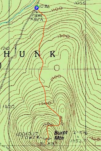
The Burnt Mountain Trail
Route: Burnt Mountain Trail
After spraining my ankle a day earlier, I was finding it difficult to walk. Originally hoping to do a leisurely hike up Doubletop, I realized after about 100 feet that it was unrealistic. Thus, I headed up the road and to the Burnt Mountain picnic area.
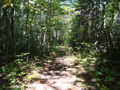
The Burnt Mountain Trail was essentially an old road - never steep, never particularly scenic, and by the looks of it, never heavily travelled. While the bad ankle was none too happy for much of the hike, it seemed to loosen up a bit as I climbed up the steepest (though still very tame) portion of the trail, just prior to the summit.
Reaching the summit, I continued past the old fire tower footings to the vista. The views from this vista were quite good - somewhat recently thinned out, it afforded excellent southern views.
After taking in the views for awhile, I hobbled my way back down to the trailhead.
| Hike Ratings |
|
Getting To Trailhead: |
Easy |
| Destination: |
Burnt Mountain |
|
Length: |
Moderate |
|
Steepness: |
Moderate |
|
Navigation: |
Easy |
|
Views: |
Excellent |
|
Crowds: |
Minimal |
|
| Hike Stats |
|
Date Hiked: |
Saturday, September 5, 2009 |
| Hike Commenced: |
9:29 AM |
| Parking Elevation: |
1,090' |
| Destination: |
Burnt Mountain |
| Ascent Commenced: |
9:29 AM |
| Summit Reached: |
10:02 AM |
| Time Elapsed: |
00:33 |
| Trailhead Elevation: |
1,086' |
| Summit Elevation: |
1,793' |
| Vertical Gain: |
722' |
|
|
| Hike Ended: |
10:49 AM |
| Hike Time Elapsed: |
01:20 |
| Hike Vertical Gain: |
742' |
|
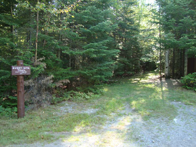
The Burnt Mountain Trail trailhead
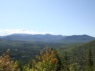
Looking south at the Brothers and southeast at Mt. Katahdin from the Burnt Mountain vista
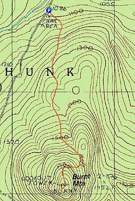

Directions to trailhead: Take the Tote Road northeast from Nesourdnahunk campground. The Burnt Mountain Picnic Area will eventually be on the right, followed immediately by the Burnt Mountain Trail trailhead.
Back to Burnt Mountain Profile
|