Home
States
Colorado
Connecticut
Maine
Massachusetts
New Hampshire
New York
Rhode Island
Utah
Vermont
View All
Lists
NE 4,000 Footers
NE 100 Highest
NH 4,000 Footers
NH 100 Highest
NH 52 With A View
NH Belknap Range
NH Ossipee 10
Links
Trail Conditions
Trip Log
Sunrises
Sunsets
About
|
Cadillac Mountain, Pemetic Mountain
Bar Harbor, ME
Trailheads, measurements, times, distances, and maps are all approximate and relative to the hike(s) as shown below.

The Cadillac West Face on the way up Cadillac Mountain
Route: Cadillac West Face Trail, Cadillac South Ridge Trail, Canon Brook Trail, herd path, carriage road, Jordan Ponds Path, Pemetic East Cliff Trail, Pemetic South Ridge Trail, Pemetic North Ridge Trail
Cadillac West Face Trail was rugged and had a few areas of wet ledge (including a wet scramble). Had considered this as a potential sunrise/sunset route in the past, but am glad I didn't due to the rugged nature of it. Had it and the ridge trail to myself in the first part of the morning.
Cadillac South Ridge Trail was a joy to descend.
Canon Brook Trail is also rugged in some areas, but also has a lot of stone steps. In the vicinity of the low point/a beaver marsh, it becomes the Jordan Ponds Path. Also at this juncture, there is a carriage road almost immediately above the trail for some time, with a herd path to get up to that superior footing.
Pemetic East Cliff Trail was a little bit rugged in places, but not as much so as the Cadillac West Face Trail.
Pemetic South Ridge Trail was also nice and open.
Pemetic North Ridge Trail is also a bit rugged with a few scrambles and very little advanced trail work done yet, but volunteers were out on this day doing some brushing.
| Hike Ratings |
|
Getting To Trailhead: |
Easy |
| Destination: |
Cadillac Mountain |
|
Length: |
Moderate |
|
Steepness: |
Difficult |
|
Navigation: |
Easy |
|
Views: |
Excellent |
|
Crowds: |
Heavy |
| Destination: |
Pemetic Mountain |
|
Length: |
Moderate |
|
Steepness: |
Difficult |
|
Navigation: |
Easy |
|
Views: |
Excellent |
|
Crowds: |
Heavy |
|
| Hike Stats |
|
Date Hiked: |
Thursday, September 17, 2015 |
| Parking Elevation: |
336' |
| Destination: |
Cadillac Mountain |
| Time Elapsed: |
00:51 |
| Trailhead Elevation: |
330' |
| Summit Elevation: |
1,530' |
| Vertical Gain: |
1,250' |
| Destination: |
Pemetic Mountain |
| Time Elapsed: |
01:29 |
| Trailhead Elevation: |
1,530' |
| Summit Elevation: |
1,247' |
| Vertical Gain: |
947' |
|
|
| Hike Time Elapsed: |
03:26 |
| Hike Vertical Gain: |
2,247' |
|

The trailhead

Looking at Bar Harbor Cadillac Mountain

Looking up the Pemetic South Ridge Trail

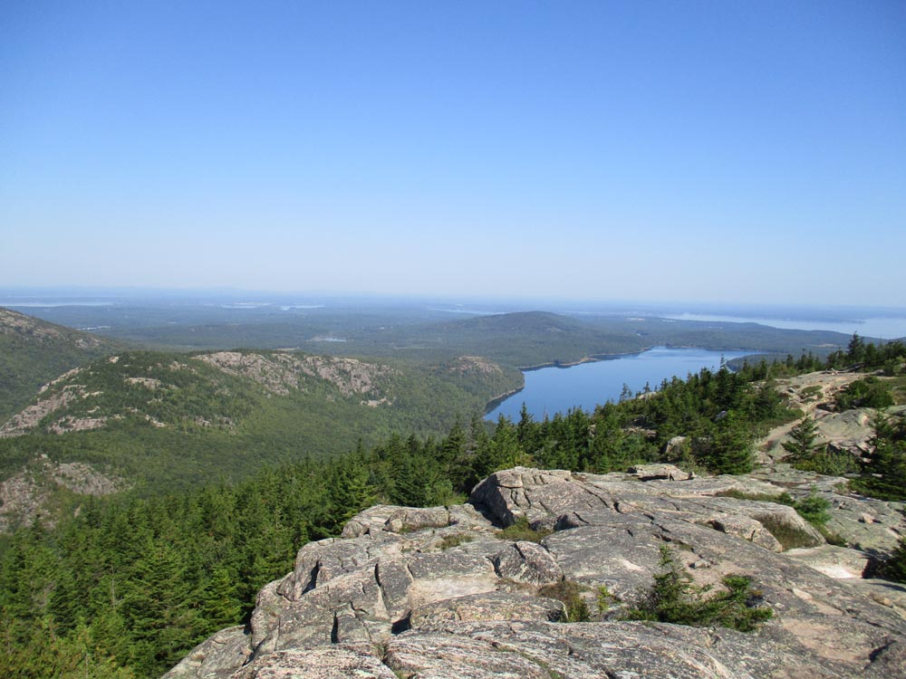
Looking at the Bubbles and Eagle Lake from Pemetic Mountain
Directions to trailhead: From Seal Harbor, take Park Loop Road north to the Bubble Pond parking lot.
Back to Cadillac Mountain Profile
Back to Pemetic Mountain Profile
|