Home
States
Colorado
Connecticut
Maine
Massachusetts
New Hampshire
New York
Rhode Island
Utah
Vermont
View All
Lists
NE 4,000 Footers
NE 100 Highest
NH 4,000 Footers
NH 100 Highest
NH 52 With A View
NH Belknap Range
NH Ossipee 10
Links
Trail Conditions
Trip Log
Sunrises
Sunsets
About
|
Champlain Mountain, The Beehive, Gorham Mountain
Mount Desert, ME
Trailheads, measurements, times, distances, and maps are all approximate and relative to the hike(s) as shown below.

The Orange and Black Path
Route: Orange and Black Path, Champlain North Ridge Trail, Champlain South Ridge Trail, Beehive Trail, Bowl Trail, Gorham Mountain Trail, Park Loop Road
Orange and Black Path had somewhat firm snowpack. Steep snowfield might cause some hesitation, but snowshoes provided adequate traction.
Champlain North Ridge Trail was difficult to follow in places due to open areas and skier traffic. Navigation not a big deal if on snowshoes though. Probably 2-3 feet of snowpack.
Weather and conditions were nice enough to tempt me to go beyond my original plan, so I headed south to The Bowl (frozen over and very peaceful), then up the back side of the Beehive (ie the easy side...had zero interest in the technical side, which appeared to have some blue ice).
I then continued further south to Gorham Mountain, which, while having nice views, was also badly postholed from barebooters coming up from the Sandy Beach parking lot. Generally 2-3 feet of snowpack.
Park Loop Road northbound from there to the Entrance Station had one lane plowed for automobile traffic and the other lane packed out for snowmobiles (didn't encounter any, so I had it to myself). North of the gate, both lanes were packed out via snowmobile/ski/boot traffic. Still mostly snow covered, though a few areas of pavement were melting out.
| Hike Ratings |
|
Getting To Trailhead: |
Easy |
| Destination: |
Champlain Mountain |
|
Length: |
Moderate |
|
Steepness: |
Difficult |
|
Navigation: |
Difficult |
|
Views: |
Excellent |
|
Crowds: |
Minimal |
| Destination: |
The Beehive |
|
Length: |
Moderate |
|
Steepness: |
Difficult |
|
Navigation: |
Difficult |
|
Views: |
Excellent |
|
Crowds: |
Minimal |
| Destination: |
Gorham Mountain |
|
Length: |
Moderate |
|
Steepness: |
Difficult |
|
Navigation: |
Difficult |
|
Views: |
Excellent |
|
Crowds: |
Minimal |
|
| Hike Stats |
|
Date Hiked: |
Friday, March 20, 2015 |
| Parking Elevation: |
360' |
| Destination: |
Champlain Mountain |
| Time Elapsed: |
00:32 |
| Trailhead Elevation: |
80' |
| Summit Elevation: |
1,058' |
| Vertical Gain: |
1,008' |
| Destination: |
The Beehive |
| Time Elapsed: |
00:49 |
| Trailhead Elevation: |
1058' |
| Summit Elevation: |
540' |
| Vertical Gain: |
190' |
| Destination: |
Gorham Mountain |
| Time Elapsed: |
00:19 |
| Trailhead Elevation: |
340' |
| Summit Elevation: |
525' |
| Vertical Gain: |
210' |
|
|
| Hike Time Elapsed: |
02:44 |
| Hike Vertical Gain: |
1,458' |
|

The Orange and Black Path trailhead on Schooner Head Road

Looking down the Champlain North Ridge Trail

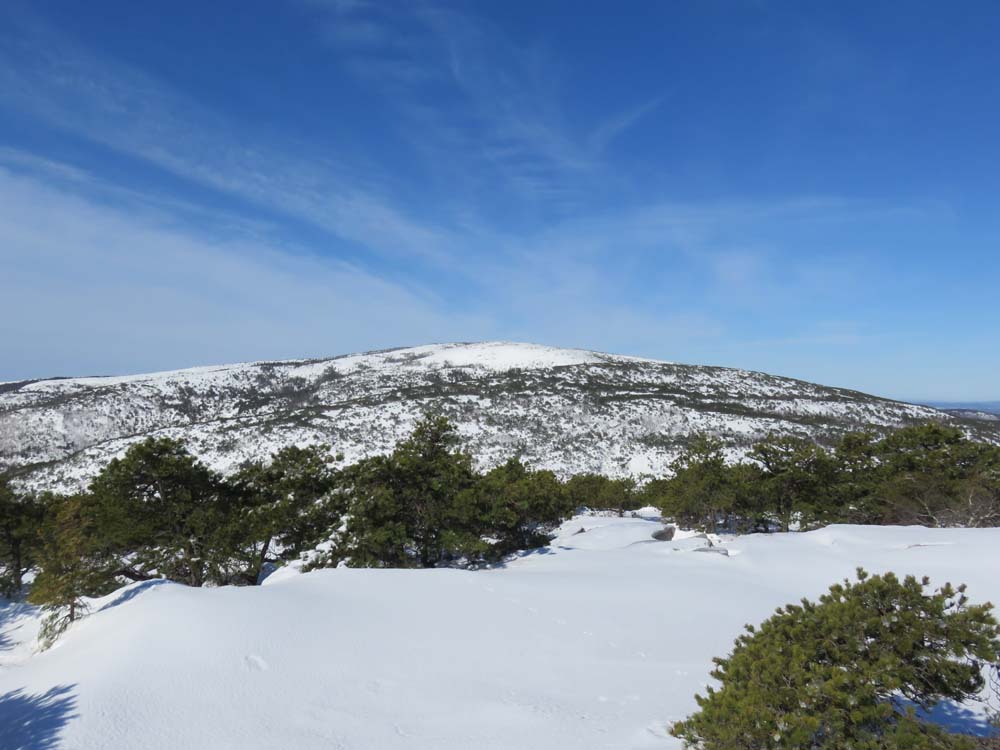
Looking at Cadillac Mountain from Champlain Mountain

The Bowl in winter

Ascending the Beehive

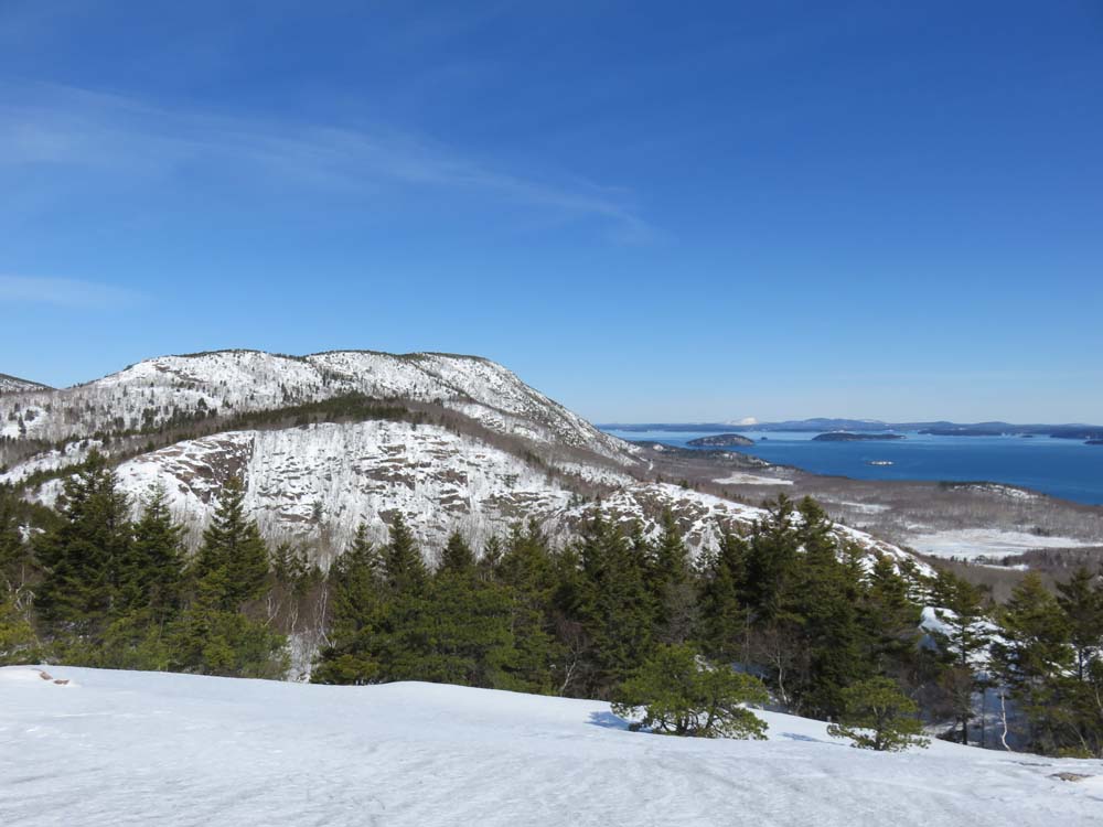
Looking at Champlain Mountain from The Beehive

Ascending Gorham Mountain

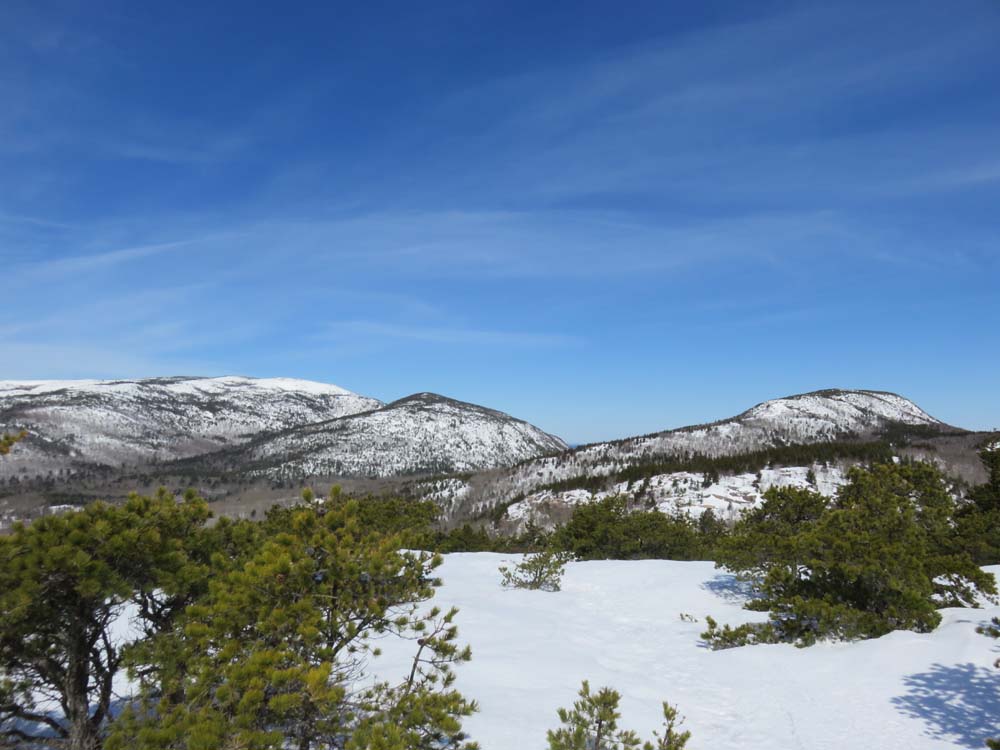
Looking Cadillac, Door, and Champlain from Gorham Mountain


Directions to trailhead: In winter, Park Loop Road is not plowed to the Orange and Black Path trailhead (plowing starts at fee station, accessible from Schooner Head Road). One can access the Orange and Black Path from its Schooner Head Road trailhead, which does not have a formal parking area.
Back to Champlain Mountain Profile
Back to The Beehive Profile
Back to Gorham Mountain Profile
|