Home
States
Colorado
Connecticut
Maine
Massachusetts
New Hampshire
New York
Rhode Island
Utah
Vermont
View All
Lists
NE 4,000 Footers
NE 100 Highest
NH 4,000 Footers
NH 100 Highest
NH 52 With A View
NH Belknap Range
NH Ossipee 10
Links
Trail Conditions
Trip Log
Sunrises
Sunsets
About
|
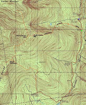
Crocker Mountain, South Crocker Mountain, Mt. Redington
Carrabasset Valley, ME, Redington, ME
Trailheads, measurements, times, distances, and maps are all approximate and relative to the hike(s) as shown below.
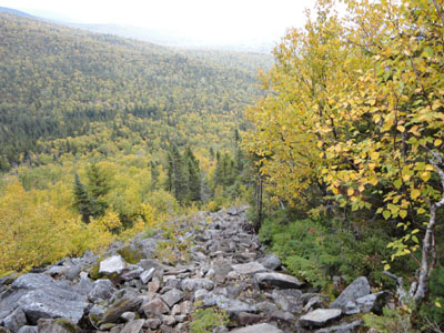
Looking down the Appalchian Trail
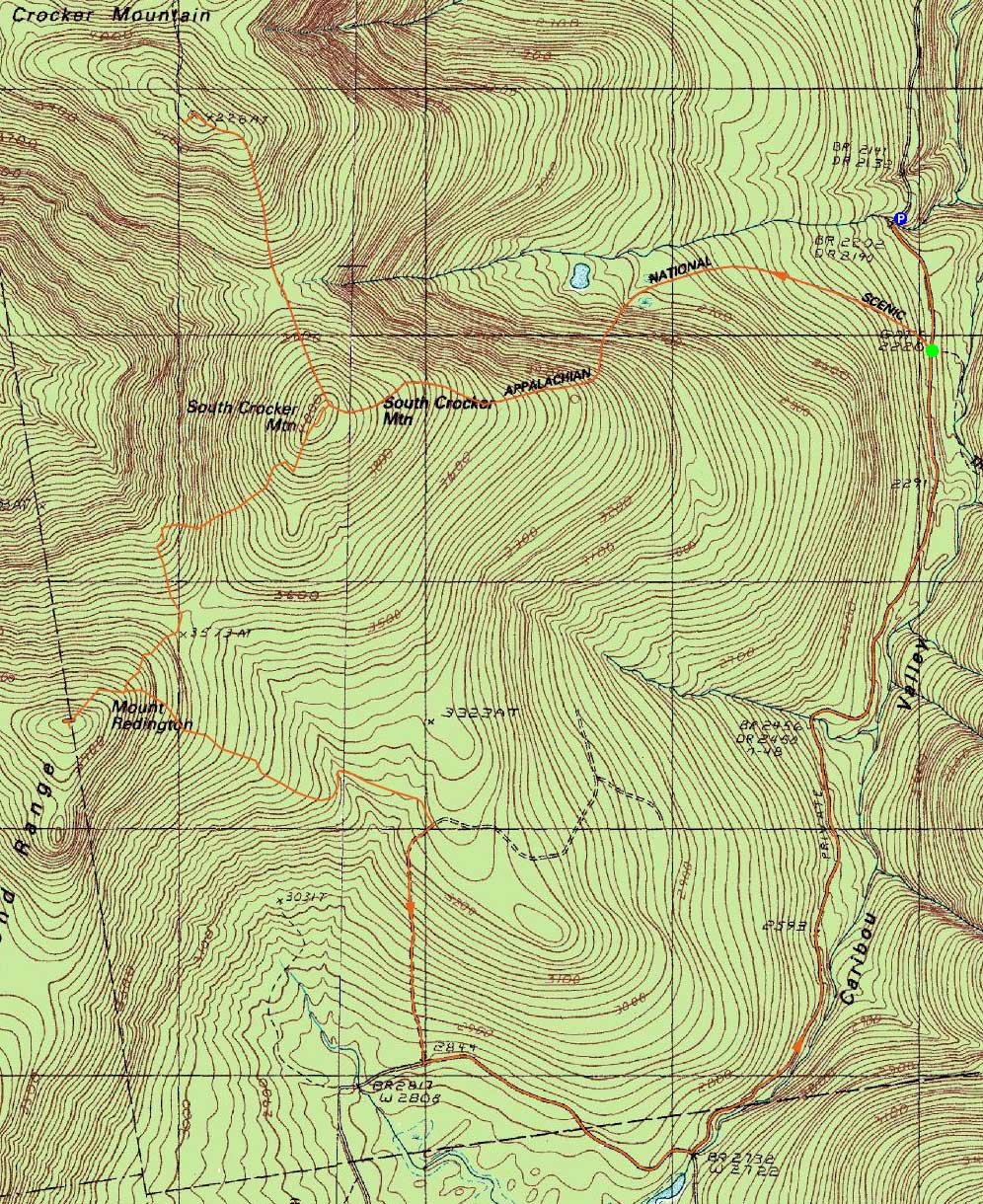
Route: Caribou Valley Road, Appalachian Trail, (Crocker Mountain), Appalachian Trail, spur path, (South Crocker Mountain), herd path, logging road, herd path, (Mt. Redington), herd path, various logging roads, Caribou Valley Road
With a potentially mediocre day forecasted for the Whites, we decided to head north and do another Caribou Valley Road hike.
Parking between the metal grate and next wood bridge, we opted to roadwalk to the AT crossing, rather than do front end alignment damage with the deep ditch on the far side of the wood bridge.
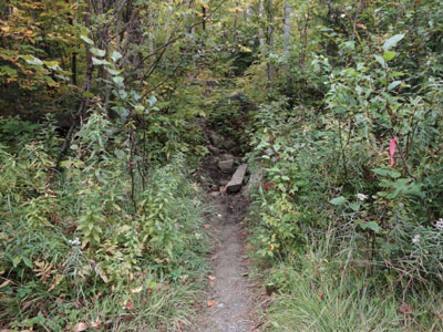
The AT crossing essentially looked like a herd path crossing - certainly easily missed. The trail started off gently, before ascending a bit more steeply beyond the campsite junction. Some nice yellow birch leaves lightened up an otherwise gloomy looking morning.
Shortly after climbing above the cirque, we entered the clouds. Rather than climb the spur twice, we opted to skip South Crocker and go direct to North Crocker. Not surprisingly, we had no views from the summit due to the fog.
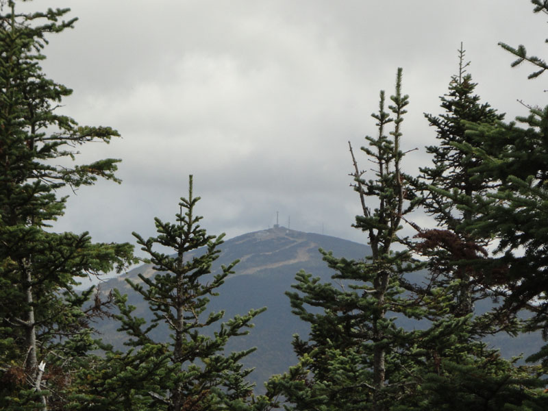
On our back up the steep climb to South Crocker, the sun started to break out. Climbing up the spur trail to South Crocker, we had slight views of Sugarloaf through the trees from the highpoint "vista."
After having lunch, we hopped onto the herdpath behind the highpoint ledge and followed it down, then back up over a subpeak, then down to a boundary cut (a few feet wide with occasional yellow blazes). We took a right onto the boundary cut, followed it around a right turn, then took a left into the woods (prior to reaching a height of land) into a herd path that became much more obvious after about 10 feet.
The herd path was rather easy to follow by keeping one's eye on the footbed whilst going through a few thicker areas. We eventually reached a clearcut and followed the path somewhat diagonally uphill across, eventually reaching a dirt logging road. We then headed up the road to the height of land, were we turned right into the woods onto another herd path marked with a cairn. We tended to go uphill at any junctions, eventually following a red blazed route that became increasingly more well worn as we climbed.
Eventually reaching the summit area, we observed that the knocked over test wind turbine had been removed. The views from the summit vista were quite strong, ranging from Kennebago to Kibby windfarm to the Bigelows. After signing in at the cannister (if standing at the viewpoint, it's at about 4:00), we turned around and headed out.
While we had originally planned to return to South Crocker, we decided to instead follow the alternate-popular-approach down to Caribou Valley Road. At the herd path junction a few minutes below the summit, we beared right.
This herd path eventually reached an ATV road of sorts - we took a left when we reached this (some cairns helped with navigation). Right would not have been an option, as the ATV road almost immediately ends uphill.
This path eventually became more of a proper logging road. Reaching a junction marked with some sort of metallic wire anchor, we wanted to take a left and go uphill, however we followed a cairn downhill (south) to the right.
Though this seemed to be way out of the way, we eventually reached a larger logging road. Taking a left onto this, we eventually made our way back to Caribou Valley Road, just prior to where the road crosses over a river (if one were to go southbound). Taking a left, we headed northbound and eventually made our way back to the Appalachian Trail crossing and then back to where we parked. Though likely longer distancewise, it was probably an energy saver to take the logging road route, rather than reclimb South Crocker.
| Hike Ratings |
|
Getting To Trailhead: |
Difficult |
| Destination: |
Crocker Mountain |
|
Length: |
Moderate |
|
Steepness: |
Difficult |
|
Navigation: |
Easy |
|
Views: |
Minimal (due to weather) |
|
Crowds: |
Minimal |
| Destination: |
South Crocker Mountain |
|
Length: |
Moderate |
|
Steepness: |
Difficult |
|
Navigation: |
Easy |
|
Views: |
Minimal |
|
Crowds: |
Minimal |
| Destination: |
Mt. Redington |
|
Length: |
Moderate |
|
Steepness: |
Moderate |
|
Navigation: |
Difficult |
|
Views: |
Excellent |
|
Crowds: |
Minimal |
|
| Hike Stats |
|
Date Hiked: |
Sunday, September 19, 2010 |
| Hike Commenced: |
9:53 AM |
| Parking Elevation: |
2,220' |
| Destination: |
Crocker Mountain |
| Ascent Commenced: |
9:59 AM |
| Summit Reached: |
12:02 PM |
| Time Elapsed: |
02:03 |
| Trailhead Elevation: |
2,220' |
| Summit Elevation: |
4,228' |
| Distance: |
3.1 miles |
| Vertical Gain: |
2,378' |
| Destination: |
South Crocker Mountain |
| Ascent Commenced: |
12:05 PM |
| Summit Reached: |
12:38 PM |
| Time Elapsed: |
00:33 |
| Trailhead Elevation: |
4,228' |
| Summit Elevation: |
4,050' |
| Distance: |
1 mile |
| Vertical Gain: |
380' |
| Destination: |
Mt. Redington |
| Ascent Commenced: |
12:57 PM |
| Summit Reached: |
1:59 PM |
| Time Elapsed: |
01:02 |
| Trailhead Elevation: |
4,050' |
| Summit Elevation: |
4,010' |
| Vertical Gain: |
680' |
|
|
| Hike Ended: |
4:18 PM |
| Hike Time Elapsed: |
06:25 |
| Hike Vertical Gain: |
3,538' |
|
The Appalachian Trail crossing on Caribou Valley Road
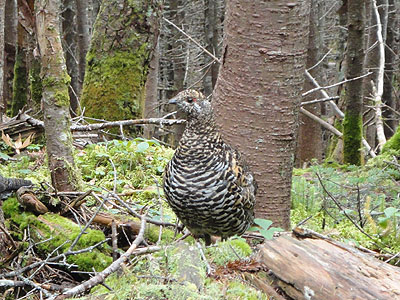
An attack chicken along the Appalachian Trail
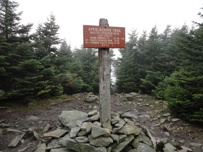
A foggy start on Crocker Mountain
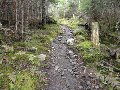
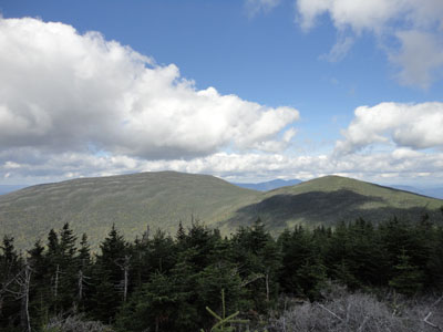
The Appalachian Trail between the Crockers

Sugarloaf as seen from South Crocker Mountain
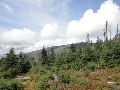
The logged area crossed via the herd path to Mt. Redington
Looking at the Crockers and Bigelows from the Mt. Redington viewpoint
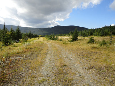
One of the roads below Mt. Redington

Directions to trailhead: Take Route 27 northwest from the entrance to Sugarloaf USA ski area. Just after passing a transfer station on the right (on an uphill), Caribou Valley Road (makeshift Caribou Pond Road sign, summer 2010) will be on the left. As of summer 2010, vehicles with low clearance will not want to attempt this road. Non off-road-capable vehicles will want to park just before the metal grate bridge. The Appalachian Trail crossing is awhile beyond this bridge and a very dicey wood bridge (there is also parking on the left just before the dicey wood bridge). A small parking area will be on the right, just before the unsigned trail crossing.
Back to Crocker Mountain Profile
Back to South Crocker Mountain Profile
Back to Mt. Redington Profile
|