Home
States
Colorado
Connecticut
Maine
Massachusetts
New Hampshire
New York
Rhode Island
Utah
Vermont
View All
Lists
NE 4,000 Footers
NE 100 Highest
NH 4,000 Footers
NH 100 Highest
NH 52 With A View
NH Belknap Range
NH Ossipee 10
Links
Trail Conditions
Trip Log
Sunrises
Sunsets
About
|
Douglas Mountain
Sebago, ME
Trailheads, measurements, times, distances, and maps are all approximate and relative to the hike(s) as shown below.

Looking up the Eagle Scout Trail
Route: Eagle Scout Trail, unknown trail, Nature Trail, (Douglas Mountain), Nature Trail, Eagle Scout Trail
I've found the Sebago Lake area in Maine to be pretty neat ever since I first drove through there a little over a month ago. As a result, I wanted to hike some of the smaller hikes/mountains around it.
Today was Douglas Mountain.
Due to work and missing a turn, I arrived at the parking lot a bit later than I had hoped - and with the posted closing time of 6 PM, I had to move at a good pace. There's a $3 fee to park there (a bit expensive for something like this if you ask me, but there was no one around nor a logical collection spot for it, so it was free for me today).
The Eagle Scout Trail is very heavily blazed - there's probably an orange blaze every 5-10 feet. The trail first dips down, joining with a snowmobile trail, then splitting off to cross a small creek, only to rejoin the snowmobile trail again soon there after.
The trail then breaks away from the snowmobile trail again and heads toward Douglas Mountain. Up until this point, the trail has been either flat or downhill. Once it reaches the foot of the mountain, it ascends steeply (a short section mind you), before ending up on the side of a col. This is where I became confused, as the map in the base area made the trail look like a look of sorts. Yet, at this four way intersection, there was only one sign - "Nature Trail" - and four different blaze patterns including where I came from. Thinking I would continue on the "loop", I followed an orange blaze pattern to the left. Wrong.
Back at the intersection, I decided to follow the Nature Trail, as it seemed to be going in the direction of the peak. After dipping into the col, this trail ascends steeply (a short section again), before reaching the stone summit tower.
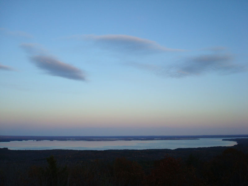
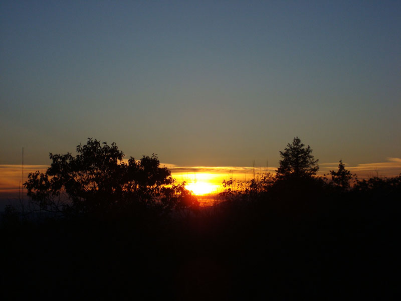
This is a neat little tower - one story tall - with excellent views of Sebago Lake. There are also good views of the northern White Mountains. Unfortunately, the views of the sunset were somewhat obstructed by trees and nearby communications towers.
With very little time to spare, I watched the sunset for a few minutes and then commenced the jog back. via the same route. I made it to the parking lot with just a few minutes to spare before the (no clue how closely its enforced, but I don't want to get locked in via the gate or towed!) area closed.
All in all, a nice little hike. If I do it again, I intend to walk the paved road up instead, as the Eagle Scout Trail is a bit drawn out and rather ugly with the excessive amount of orange blazes.
| Hike Ratings |
|
Getting To Trailhead: |
Easy |
| Destination: |
Douglas Mountain |
|
Length: |
Moderate |
|
Steepness: |
Difficult |
|
Navigation: |
Moderate |
|
Views: |
Excellent |
|
Crowds: |
Minimal |
|
| Hike Stats |
|
Date Hiked: |
Monday, October 29, 2007 |
| Hike Commenced: |
5:00 PM |
| Parking Elevation: |
1,000' |
| Destination: |
Douglas Mountain |
| Ascent Commenced: |
5:00 PM |
| Summit Reached: |
5:27 PM |
| Time Elapsed: |
00:27 |
| Trailhead Elevation: |
1,000' |
| Summit Elevation: |
1,382' |
| Vertical Gain: |
507' |
|
|
| Hike Ended: |
5:55 PM |
| Hike Time Elapsed: |
00:55 |
| Hike Vertical Gain: |
612' |
|

The Eagle Scout Trail trailhead

Looking at Sebago Lake from Douglas Mountain

The sunset as seen from the tower on the Douglas Mountain summit


Directions to trailhead: From 113 in East Baldwin, take Route 107 North. There will eventually be a green street sign for Douglas Mountain on the left. Head up this road, then take a left onto Douglas Mountain Road. The driveway to the hiker (a multiple dollar fee in season) parking lot will be on the left. The Eagle Scout Trail is at the back of the lot. Lot closes at 6:00 PM.
Back to Douglas Mountain Profile
|