Home
States
Colorado
Connecticut
Maine
Massachusetts
New Hampshire
New York
Rhode Island
Utah
Vermont
View All
Lists
NE 4,000 Footers
NE 100 Highest
NH 4,000 Footers
NH 100 Highest
NH 52 With A View
NH Belknap Range
NH Ossipee 10
Links
Trail Conditions
Trip Log
Sunrises
Sunsets
About
|
East Kennebago Mountain
Lang, ME, Tim Pond, ME
Trailheads, measurements, times, distances, and maps are all approximate and relative to the hike(s) as shown below.

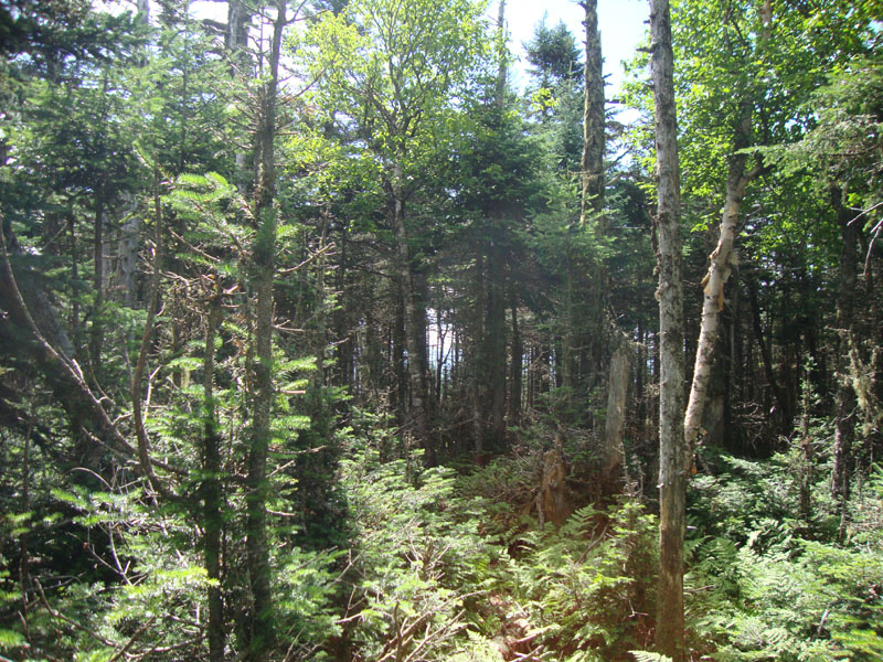
Looking down the logging road on the way to East Kennebago
Route: Logging road, boundary swath, herd path, bushwhack, (East Kennebago Mountain), herd path, boundary swath, logging road
The last hike of the weekend in the Rangeley area was East Kennebago. After navigating the maze of logging roads, I set foot up a grassy one (there were a few blowdowns blocking further driving). After about 5 minutes I crossed a small waterbar/creek (previously a recommended parking location). About three minutes later, I reached the end of the wide open grassy logging road and a junction of two lesser four wheeler roads. A cairn marked the one going uphill to the left, so I headed up that way, soon passing through a few vexing blowdowns.
About a dozen minutes after leaving the open area of the logging road, I reached the town boundary, marked with a yellow stake in the woods to the right and a narrow boundary cut to the left. I followed the narrow boundary cut past a few areas of blowdowns until just before the height of land, where an obvious herd path departed to the right.
I followed the herd path for awhile, but lost it when I reached a stand of young spruce, where I skirted to the left. Had I skirted back right at the top of this stand, I would have rejoined a prominent herd path (which I used on the descent). Instead, I bushwhacked in a southwesterly direction toward the flat, viewless summit area, where I poked around for about five minutes until finding the summit cannister. While it was tempting to see if I could find any views (it looked like there could have been one or two places with obstructed views), I didn't feel like going on any wild goose hunts.
After signing in at the cannister, I followed a herd path most of the way back to the boundary swath.
All in all, a pretty quick morning hike - just what I needed, as I planned to head down to Baldpate for an afternoon hike.
| Hike Ratings |
|
Getting To Trailhead: |
Moderate |
| Destination: |
East Kennebago Mountain |
|
Length: |
Moderate |
|
Steepness: |
Moderate |
|
Navigation: |
Difficult |
|
Views: |
Minimal |
|
Crowds: |
Minimal |
|
| Hike Stats |
|
Date Hiked: |
Sunday, July 18, 2010 |
| Hike Commenced: |
9:14 AM |
| Parking Elevation: |
2,490' |
| Destination: |
East Kennebago Mountain |
| Ascent Commenced: |
9:14 AM |
| Summit Reached: |
10:18 AM |
| Time Elapsed: |
01:04 |
| Trailhead Elevation: |
2,490' |
| Summit Elevation: |
3,791' |
| Vertical Gain: |
1,321' |
|
|
| Hike Ended: |
11:14 AM |
| Hike Time Elapsed: |
02:00 |
| Hike Vertical Gain: |
1,331' |
|

The beginning of the logging road walk

Departing the boundary swath onto a herd path

A lack of views from East Kennebago's summit


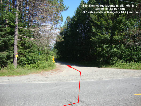
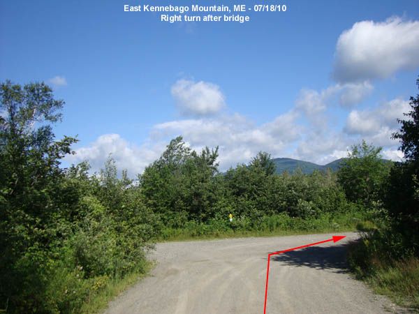
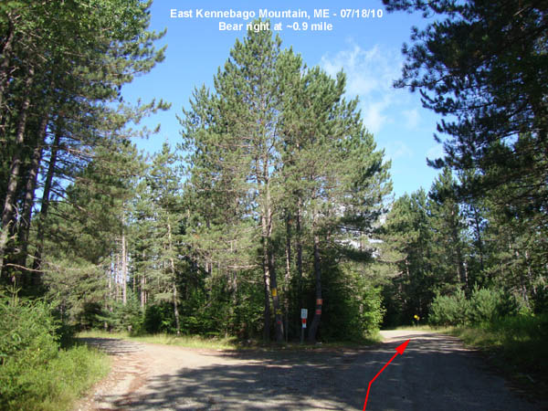
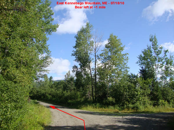
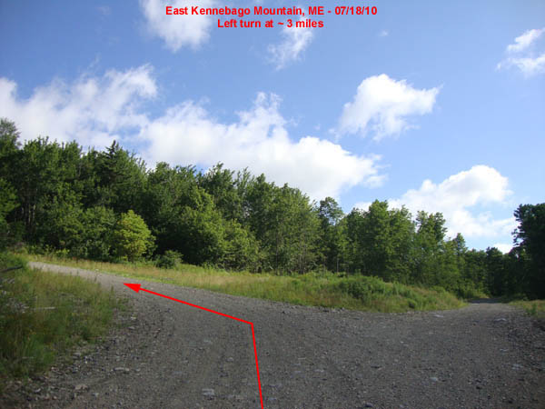
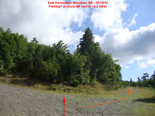
Directions to trailhead: From the Route 4/Route 16 junction in Rangeley, take Route 16 North for 9.5 miles. Take a left onto a dirt road (0.0 miles), almost immediately crossing a wood bridge. After crossing the bridge, take a right. At about 0.9 miles, bear right. At ~1 mile, bear left. At about 3 miles, take a left. At a sharp left turn at about 4.2 miles, there is room to park. Instead of following the sharp left hairpin turn, walk straight on the grassy logging road.
Back to East Kennebago Mountain Profile
|
