Home
States
Colorado
Connecticut
Maine
Massachusetts
New Hampshire
New York
Rhode Island
Utah
Vermont
View All
Lists
NE 4,000 Footers
NE 100 Highest
NH 4,000 Footers
NH 100 Highest
NH 52 With A View
NH Belknap Range
NH Ossipee 10
Links
Trail Conditions
Trip Log
Sunrises
Sunsets
About
|
East Royce Mountain
Bachelder's Grant, ME
Trailheads, measurements, times, distances, and maps are all approximate and relative to the hike(s) as shown below.
Route: East Royce Trail
My original intent for this day was to do the Baldface Loop, however I realized a day or two before that I simply didn't have that in the bad knee. As a result, I decided to try East Royce Mountain, just over the border in Maine.
We started out just a bit after noon at a relatively empty parking lot. The trail quickly steepens up, keeping a moderate pitch in most sections, with a few steeper areas - though this hike is a lot smaller than others in the area, it's still steep enough to give you a good work out!
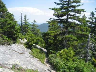
The East Royce Mountain trail is pretty interesting - it starts at the top of Evans Notch, crosses a few small brooks (one which looks to have a nice waterfall when there's more surface water), and features some rock stairs as well as a few minor ledge scrambles.
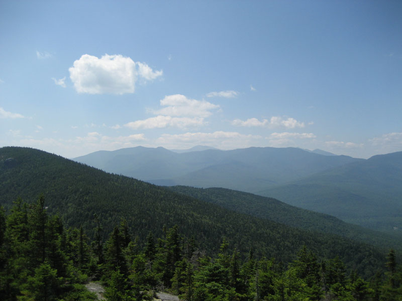
Upon reaching the southern ledges, we took some time to have some trail mix and take in the hazy views. Feeling lazy, I wasn't planning on going to the true summit until some hikers arrived at the ledge. One of them, come to find out a fellow VFTTer, alerted us that there was indeed a view near the real summit - and that it was about a tenth of a mile away. That was all I needed to know!
We took the quasi-herd path (there were a few isolated blazes later on, but the start of the path was not really well noted) over a few bumps before reaching a large rock which proved to be the high point. Just a bit after that we were greeted by a nice view in multiple directions, providing a different perspective than the southern ledges.
The descent was pretty uneventful - just a nice hike on a nice day.
| Hike Ratings |
|
Getting To Trailhead: |
Easy |
| Destination: |
East Royce Mountain |
|
Length: |
Moderate |
|
Steepness: |
Difficult |
|
Navigation: |
Easy |
|
Views: |
Excellent |
|
Crowds: |
Minimal |
|
| Hike Stats |
|
Date Hiked: |
Saturday, August 4, 2007 |
| Hike Commenced: |
12:09 PM |
| Parking Elevation: |
1,415' |
| Destination: |
East Royce Mountain (southern ledges) |
| Ascent Commenced: |
12:10 PM |
| Summit Reached: |
12:59 PM |
| Time Elapsed: |
00:49 |
| Trailhead Elevation: |
1,415' |
| Summit Elevation: |
3,090' |
| Vertical Gain: |
1,690' |
| Destination: |
East Royce Mountain |
| Ascent Commenced: |
1:20 PM |
| Summit Reached: |
1:26 PM |
| Time Elapsed: |
00:06 |
| Trailhead Elevation: |
3,090' |
| Summit Elevation: |
3,114' |
| Vertical Gain: |
114' |
|
|
| Hike Ended: |
2:54 PM |
| Hike Time Elapsed: |
02:45 |
| Hike Vertical Gain: |
1,919' |
|
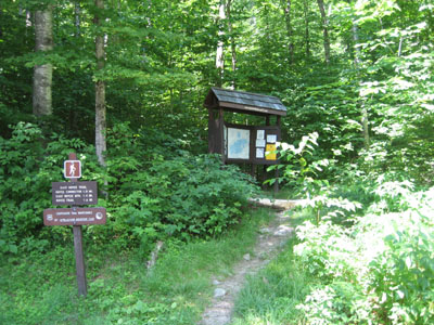
East Royce Trail trailhead
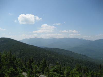
Looking southwest from the northern lookout near the East Royce Mountain summit toward the Carters and Mt. Washington
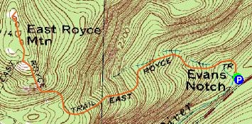

Directions to trailhead: Take Maine 113 North from US 302 to Evans Notch. The East Royce Trail trailhead and WMNF fee parking lot are both located on the left side of the road near the road's highpoint.
Back to East Royce Mountain Profile
|