Home
States
Colorado
Connecticut
Maine
Massachusetts
New Hampshire
New York
Rhode Island
Utah
Vermont
View All
Lists
NE 4,000 Footers
NE 100 Highest
NH 4,000 Footers
NH 100 Highest
NH 52 With A View
NH Belknap Range
NH Ossipee 10
Links
Trail Conditions
Trip Log
Sunrises
Sunsets
About
|
Mt. Katahdin (Hamlin Peak), ME, Mt. Katahdin (Baxter Peak), ME
Mt. Katahdin, ME
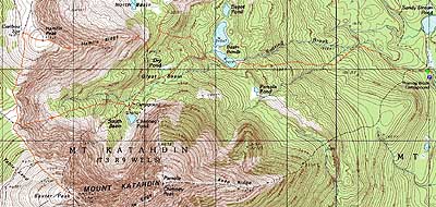
Trailheads, measurements, times, distances, and maps are all approximate and relative to the hike(s) as shown below.
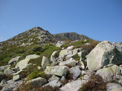
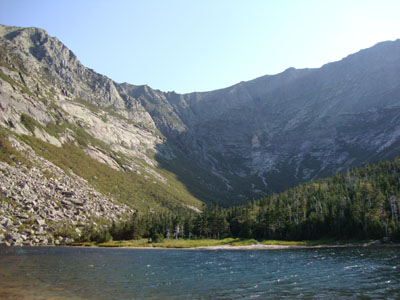
Looking up the Hamlin Ridge Trail
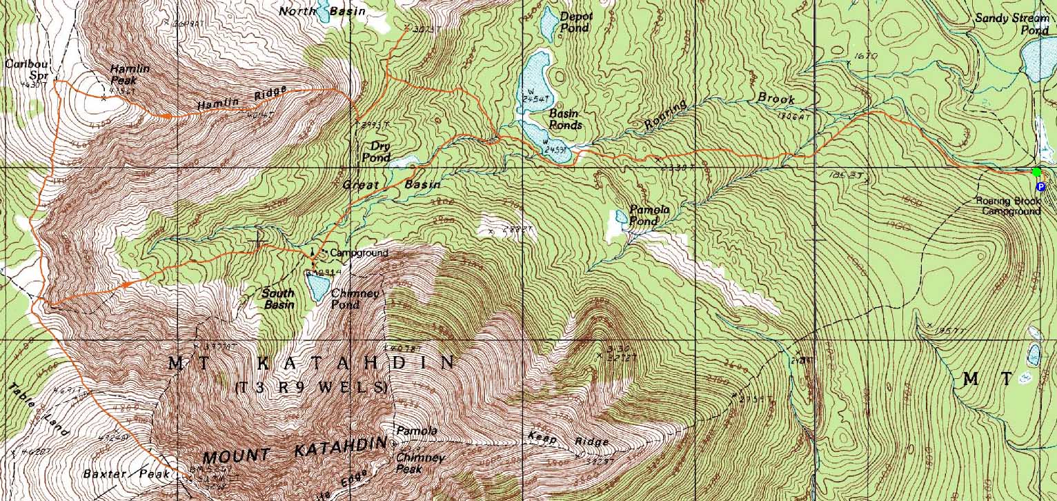
Route: Chimney Pond Trail, North Basin Cut-Off, North Basin Trail, (Blueberry Knoll), North Basin Trail, Hamlin Ridge Trail, (Hamlin Peak), Hamlin Ridge Trail, Northwest Basin Trail, Saddle Trail, (Baxter Peak), Saddle Trail, Chimney Pond Trail
Finally, after over two years of planned trips, I made it up to Baxter State Park in Maine. Arriving the night before, I stayed in Millinocket and was up at the crack of dawn. After hearing how rural Millinocket is, I was shocked to see that it was, in my experience, a decent sized town - two supermarkets, a McDonalds, a few motels, pay-at-the-pump gas stations, etc. Nothing open 24 hours as far as I could tell, but nonetheless, not exactly a tiny town. However, with a decent drive from the town to the gate, and 20 MPH max speed limits within the park, daily trips to Millinocket aren't exactly convenient.
With group campsite reservations at Bear Brook, we apparently had guaranteed access to the Roaring Brook trailhead. After signing in, we headed up the Chimney Pond Trail. I was let down in seeing that the trail, while never overly steep, offered poor footing - lots of random rocks and roots. After checking out a few viewpoints along the way, we headed over to Blueberry Knoll for some unique views into the North Basin and points east.
The main part of our ascent was the Hamlin Ridge Trail. While apparently more tame than many of the other Katahdin ascent routes, it was still filled with plenty of scrambles - and lots of above treeline terrain. In addition to the North Basin, there were tremendous views of the Knife's Edge.
After taking a break on the flat summit of Hamlin Peak, we worked our way over to Baxter Peak. I found the footing to be generally better on the top of the ridge as opposed to down low. In addition, the trail was never overly steep as we worked out way to the highpoint of Mt. Katahdin.
Despite the access restrictions of Baxter State Park, the summit of Baxter Peak was very crowded - not Mt. Washington crowds, but large nonetheless. Though hazy, the views were quite strong.
Since this was the first of many consecutive days in the park, we chose to descend via the Saddle Trail, rather than something involving the Knife's Edge. Despite being easier than some of those routes, it was still essentially a loose slide, similar to the south slide on Mt. Tripyramid. Reaching the bottom, we took in the views at Chimney Pond, before taking the long, slow descent back to the trailhead.
| Hike Ratings |
|
Getting To Trailhead: |
Easy |
| Destination: |
Mt. Katahdin (Hamlin Peak) |
|
Length: |
Moderate |
|
Steepness: |
Very Difficult |
|
Navigation: |
Easy |
|
Views: |
Excellent |
|
Crowds: |
Minimal |
| Destination: |
Mt. Katahdin (Baxter Peak) |
|
Length: |
Difficult |
|
Steepness: |
Moderate |
|
Navigation: |
Easy |
|
Views: |
Excellent |
|
Crowds: |
Heavy |
|
| Hike Stats |
|
Date Hiked: |
Thursday, September 3, 2009 |
| Hike Commenced: |
7:12 AM |
| Parking Elevation: |
1,480' |
| Destination: |
Mt. Katahdin (Hamlin Peak) |
| Ascent Commenced: |
7:14 AM |
| Summit Reached: |
11:30 AM |
| Time Elapsed: |
03:16 |
| Trailhead Elevation: |
1,490' |
| Summit Elevation: |
4,756' |
| Vertical Gain: |
3,466' |
| Destination: |
Mt. Katahdin (Baxter Peak) |
| Ascent Commenced: |
11:42 AM |
| Summit Reached: |
1:18 PM |
| Time Elapsed: |
01:36 |
| Trailhead Elevation: |
4,756' |
| Summit Elevation: |
5,267' |
| Vertical Gain: |
1,077' |
|
|
| Hike Ended: |
6:28 PM |
| Hike Time Elapsed: |
11:06 |
| Hike Vertical Gain: |
4,663' |
|
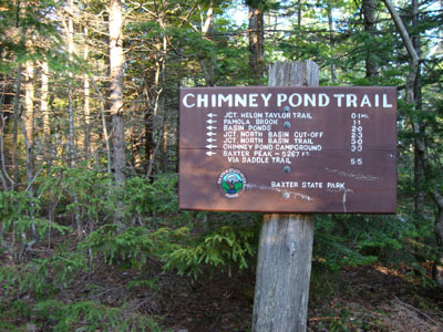
The Chimney Pond Trail trailhead
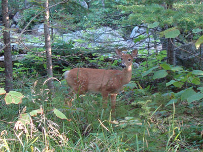
A deer along the Chimney Pond Trail
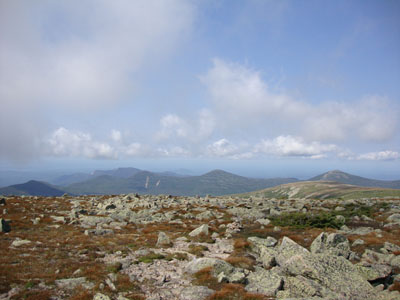
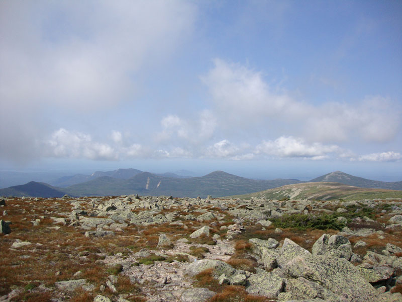
Looking at the Brothers from Hamlin Peak
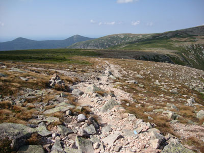
The Saddle Trail between Hamlin Peak and Baxter Peak

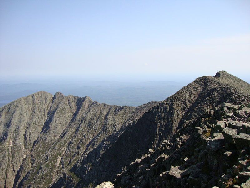
The Knife's Edge as seen from Baxter Peak
Chimney Pond

Directions to trailhead: From the Togue Pond Gate (Millinocket side), take Roaring Brook Road to its end. The Chimney Pond Trail trailhead is beyond the sign-in shack. Weather and crowd restrictions apply.
Back to Mt. Katahdin (Hamlin Peak) Profile
Back to Mt. Katahdin (Baxter Peak) Profile
|