Home
States
Colorado
Connecticut
Maine
Massachusetts
New Hampshire
New York
Rhode Island
Utah
Vermont
View All
Lists
NE 4,000 Footers
NE 100 Highest
NH 4,000 Footers
NH 100 Highest
NH 52 With A View
NH Belknap Range
NH Ossipee 10
Links
Trail Conditions
Trip Log
Sunrises
Sunsets
About
|
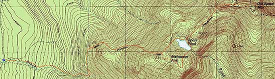
Old Speck Mountain, Mahoosuc Arm
Grafton, ME
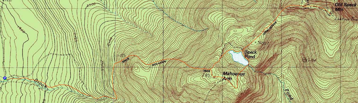
Trailheads, measurements, times, distances, and maps are all approximate and relative to the hike(s) as shown below.
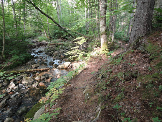
Looking down the Speck Pond Trail
Route: Speck Pond Trail, Mahoosuc Trail, Old Speck Trail, (Old Speck), Old Speck Trail, Mahoosuc Trail, May Cutoff, (Mahoosuc Arm), May Cutoff, Speck Pond Trail
The first third or so of the Speck Pond Trail followed a brook, with reasonably decent footing, in between two logging cuts. The second section passed through logging areas as it slabbed over to the rougher, steeper top third or so, which eventually dove down to Speck Pond.
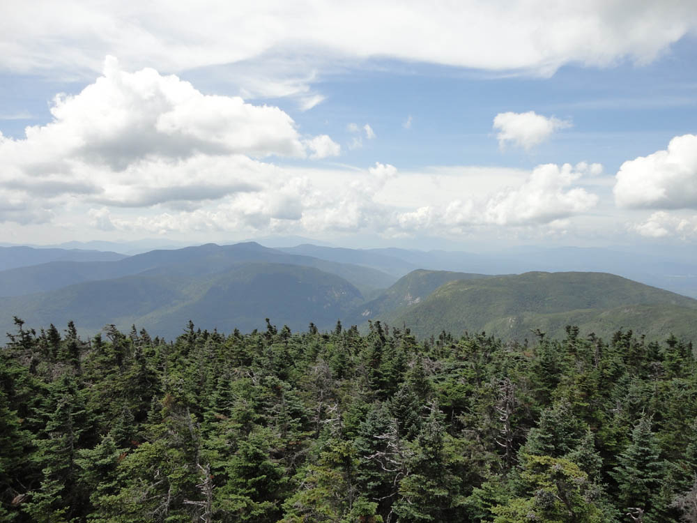
Once on the Mahoosuc Trail, quasi-alpine zones were passed through on the climb up to Old Speck. From the fire tower, there were hazy, though good views.
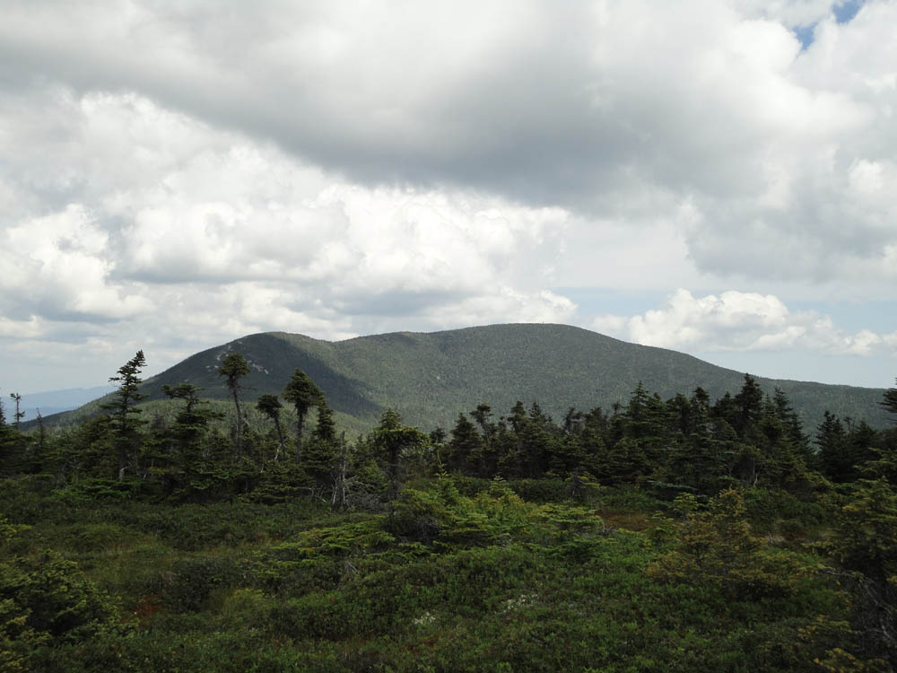
For the return trip, I headed back to Speck Pond, then continued south on the Mahoosuc Trail, passing through some more quasi-alpine zones and turning onto the May Cutoff. While a ledgy area may be considered the highpoint of the former 100 highest peak Mahoosuc Arm, I spotted an old cairn on the north side of the trail on another small crag, not too far above the Speck Pond Trail junction. While the views from the potential summit ledge on Mahoosuc Arm were directional and decent, a view north from the bog/field prior to it was quite nice.
| Hike Ratings |
|
Getting To Trailhead: |
Easy |
| Destination: |
Old Speck Mountain |
|
Length: |
Moderate |
|
Steepness: |
Very Difficult |
|
Navigation: |
Easy |
|
Views: |
Excellent |
|
Crowds: |
Minimal |
| Destination: |
Mahoosuc Arm |
|
Length: |
Moderate |
|
Steepness: |
Difficult |
|
Navigation: |
Easy |
|
Views: |
Excellent |
|
Crowds: |
Minimal |
|
| Hike Stats |
|
Date Hiked: |
Saturday, August 6, 2011 |
| Parking Elevation: |
1,705' |
| Destination: |
Old Speck Mountain |
| Time Elapsed: |
02:27 |
| Trailhead Elevation: |
1,700' |
| Summit Elevation: |
4,180' |
| Distance: |
5 miles |
| Vertical Gain: |
3,080' |
| Destination: |
Mahoosuc Arm |
| Time Elapsed: |
01:12 |
| Trailhead Elevation: |
4,180' |
| Summit Elevation: |
3,765' |
| Vertical Gain: |
605' |
|
|
| Hike Time Elapsed: |
05:23 |
| Hike Distance: |
10.7 miles |
| Hike Vertical Gain: |
3,760' |
|
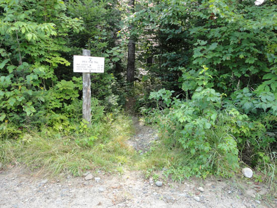
The Speck Pond Trail trailhead
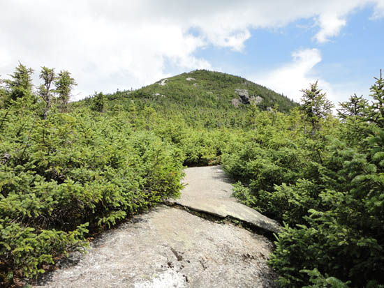
Looking up the Mahoosuc Trail on the way to Old Speck

Looking at Mahoosuc Notch from the Old Speck observation tower
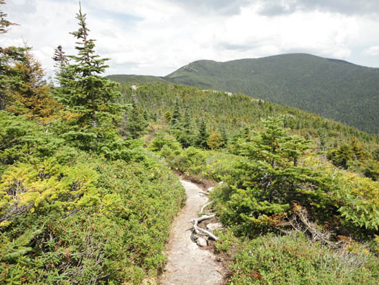
The Mahoosuc Trail on the way to Mahoosuc Arm
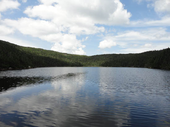
Speck Pond

Looking at Old Speck from near the summit of Mahoosuc Arm

Directions to trailhead: Take Route 16 North from Gorham, NH. Take a right onto Route 16 Truck Route (Unity Street). This will become Coos Street, then Hutchins Street. Take a right onto a road with a brown OHRV sign (Success Pond Road). Head up this dirt road for around 11.4 miles, then bear right at the junction for Success Pond. The Speck Pond Trail trailhead will be on the right in less than a mile. There is room to park just past the trailhead on the left.
Back to Old Speck Mountain Profile
Back to Mahoosuc Arm Profile
|