Home
States
Colorado
Connecticut
Maine
Massachusetts
New Hampshire
New York
Rhode Island
Utah
Vermont
View All
Lists
NE 4,000 Footers
NE 100 Highest
NH 4,000 Footers
NH 100 Highest
NH 52 With A View
NH Belknap Range
NH Ossipee 10
Links
Trail Conditions
Trip Log
Sunrises
Sunsets
About
|
Penobscot Mountain, Gilmore Peak, Sargent Mountain
Mount Desert, ME
Trailheads, measurements, times, distances, and maps are all approximate and relative to the hike(s) as shown below.

Heading to the Hadlock Brook Trail on the carriage roads
Route: Carriage roads, Hadlock Brook Trail, Amphitheater Trail, Sargent South Ridge Trail, Penobscot Mountain Trail, Maple Spring Trail, Parkman Mountain Trail, Grandent Trail
Carriage roads were nicely groomed for foot traffic, snowshoeing, classical, or skate skiing.
Lower portions of Hadlock and Maple Spring were broken out. Some trail finding necessary on Amphitheater and Sargent South. Fantastic snowshoe conditions with well consolidated base of a few feet. Above treeline also had good coverage and I would suggest was more scenic than the Presidentials.
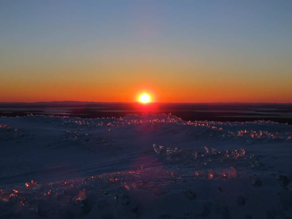
Did a side trip to Gilmore while waiting for the sunset...upper Maple Spring was had to find and navigate. No recent traffic to Gilmore either. Upper Grandgent was also tricky to navigate descending due to being above treeline and minimal cairns. Fantastic sunset from Sargent.
| Hike Ratings |
|
Getting To Trailhead: |
Easy |
| Destination: |
Penobscot Mountain |
|
Length: |
Moderate |
|
Steepness: |
Difficult |
|
Navigation: |
Difficult |
|
Views: |
Excellent |
|
Crowds: |
Minimal |
| Destination: |
Gilmore Peak |
|
Length: |
Moderate |
|
Steepness: |
Difficult |
|
Navigation: |
Difficult |
|
Views: |
Excellent |
|
Crowds: |
Minimal |
| Destination: |
Sargent Mountain |
|
Length: |
Moderate |
|
Steepness: |
Difficult |
|
Navigation: |
Moderate |
|
Views: |
Excellent |
|
Crowds: |
Minimal |
|
| Hike Stats |
|
Date Hiked: |
Thursday, March 19, 2015 |
| Parking Elevation: |
360' |
| Destination: |
Penobscot Mountain |
| Time Elapsed: |
01:11 |
| Trailhead Elevation: |
360' |
| Summit Elevation: |
1,196' |
| Vertical Gain: |
956' |
| Destination: |
Gilmore Peak |
| Time Elapsed: |
00:54 |
| Trailhead Elevation: |
1,373' |
| Summit Elevation: |
1,030' |
| Vertical Gain: |
330' |
| Destination: |
Sargent Mountain |
| Time Elapsed: |
00:22 |
| Trailhead Elevation: |
340' |
| Summit Elevation: |
1,373' |
| Vertical Gain: |
453' |
|
|
| Hike Time Elapsed: |
03:43 |
| Hike Vertical Gain: |
1,739' |
|

The spur to the Around Mountain Carriage Road off Route 3

Looking down the Sargent South Ridge Trail on the way to Penobscot Mountain

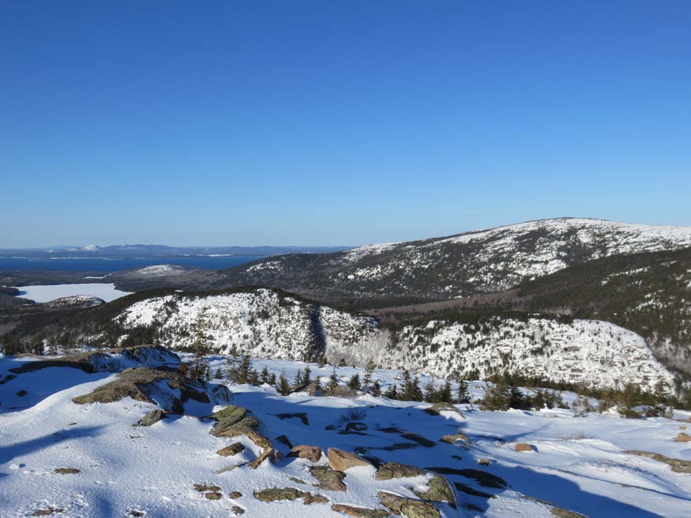
Looking northeast at the Bubbles from Penobscot Mountain

Approaching Gilmore Peak

Looking southwest at Bald Peak from Gilmore Peak

Ascending Sargent Mountain on the Grandent Trail

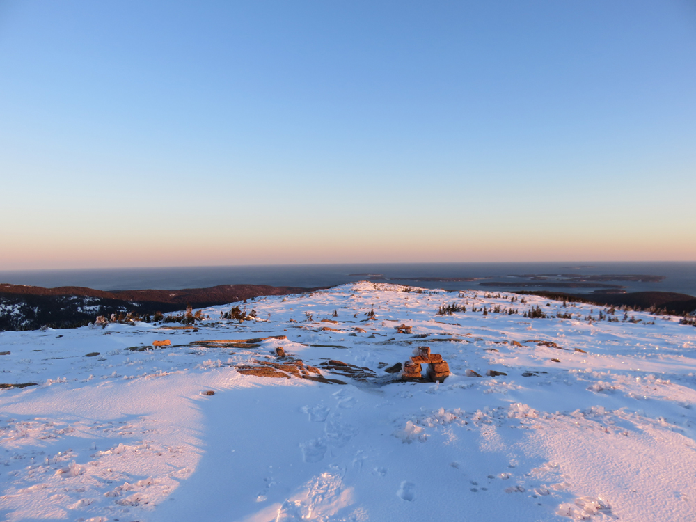
Looking at the ocean from Sargent Mountain

The sunset from Sargent Mountain
Directions to trailhead: Take Route 198 south from Route 233. Shortly after passing Sargent Drive, there will be a small parking area on the left side of the road at a height of land. A short spur to the Carriage Road network is located adjacent to the restroom.
Back to Penobscot Mountain Profile
Back to Gilmore Peak Profile
Back to Sargent Mountain Profile
|