Home
States
Colorado
Connecticut
Maine
Massachusetts
New Hampshire
New York
Rhode Island
Utah
Vermont
View All
Lists
NE 4,000 Footers
NE 100 Highest
NH 4,000 Footers
NH 100 Highest
NH 52 With A View
NH Belknap Range
NH Ossipee 10
Links
Trail Conditions
Trip Log
Sunrises
Sunsets
About
|
Sabattus Mountain
Lovell, ME
Trailheads, measurements, times, distances, and maps are all approximate and relative to the hike(s) as shown below.

Looking up the trail
Route: West loop of unknown trail, (Sabattus Mountain), west loop of unknown trail
The afternoons just keep getting shorter. With clouds lingering in New Hampshire a bit behind the forecast, I decided to head east for a sunset hike.
Having previously hiked the eastern loop up Sabattus Mountain (and having not been able to find the other side of the loop from the top), I opted to try the western loop. The flats down low were a bit muddy, however the balance of it was okay - decent footing without anything overly steep. I suspect portions of this could have possibly been a fire warden's road. While the trail was fairly obvious to ascend and is likely easy to follow in the summer, a lack of blazes (along with freshly fallen leaves) could make it tough to find or follow from the top (as was my experience two years earlier).
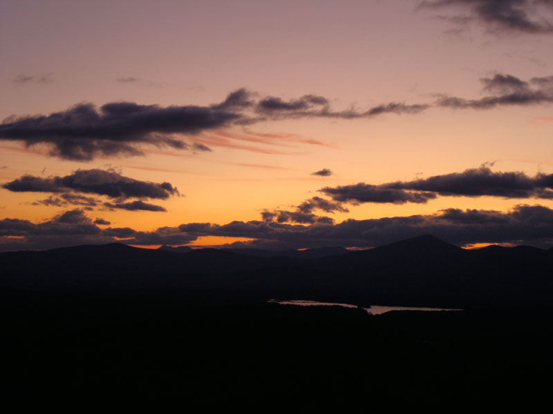
Reaching the summit, I had excellent views to the east and south - though the Whites were a bit obscured by clouds to the west. Nonetheless, I was able to get some sunset colors.
| Hike Ratings |
|
Getting To Trailhead: |
Easy |
| Destination: |
Sabattus Mountain |
|
Length: |
Moderate |
|
Steepness: |
Moderate |
|
Navigation: |
Moderate |
|
Views: |
Excellent |
|
Crowds: |
Heavy |
|
| Hike Stats |
|
Date Hiked: |
Friday, November 6, 2009 |
| Hike Commenced: |
3:56 PM |
| Parking Elevation: |
755' |
| Destination: |
Sabattus Mountain |
| Ascent Commenced: |
3:56 PM |
| Summit Reached: |
4:10 PM |
| Time Elapsed: |
00:14 |
| Trailhead Elevation: |
760' |
| Summit Elevation: |
1,253' |
| Vertical Gain: |
505' |
|
|
| Hike Ended: |
5:01 PM |
| Hike Time Elapsed: |
01:05 |
| Hike Vertical Gain: |
565' |
|

The trailhead for the trails to the Sabattus Mountain summit

Looking at Pleasant Mountain from the Sabattus Mountain ledges

The sunset as seen from the ledges near the fire tower footings


Directions to trailhead: From US 302, take Route 5 North to Center Lovell. Take a right onto Sabattus Mountain Road. Head down this road a bit, then take a right onto a dirt Sabattus Trail road. The parking lot and trailhead will be down the road a bit on the right, marked with a big brown hiker sign.
Back to Sabattus Mountain Profile
|