Home
States
Colorado
Connecticut
Maine
Massachusetts
New Hampshire
New York
Rhode Island
Utah
Vermont
View All
Lists
NE 4,000 Footers
NE 100 Highest
NH 4,000 Footers
NH 100 Highest
NH 52 With A View
NH Belknap Range
NH Ossipee 10
Links
Trail Conditions
Trip Log
Sunrises
Sunsets
About
|
Spruce Hill, Speckled Mountain
Bachelder's Grant, ME, Stoneham, ME
Trailheads, measurements, times, distances, and maps are all approximate and relative to the hike(s) as shown below.
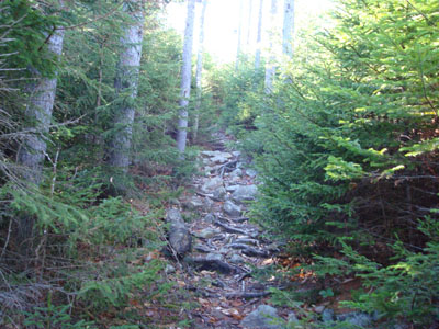
Looking up the Spruce Hill trail - I wonder where it gets its name from?
Route: Spruce Hill Trail, unknown herd path, (Spruce Hill), unknown herd path, Spruce Hill Trail, Bickford Brook Trail, (Speckled Mountain), Bickford Brook Trail, Spruce Hill Trail
Despite the fact that I was getting a free hour (sort of) via daylight savings time, I still didn't have much ambition for doing any sort of long hike. Thus, I decided it was time for Speckled Mountain.
I started at the East Royce parking lot on 113 and ascended up the Spruce Hill Trail. There are some steeps on the way up, but nothing overly taxing. Things flatten out as multiple false summits are passed (don't worry, no views!). The true summit is a few feet off to the left of the trail (once you can see a somewhat significant descent and Ames Mountain ahead through the trees). Not much to see here - just some very obstructed views to the east and to the north and a pile of moose dung.
The Spruce Hill Trail then descends somewhat steeply to a col, before rolling back up to the side of Ames Mountain - and the Bickford Brook Trail junction. From here, it's pretty easy going for quite awhile - pretty much a flat, old road, a la the Garfield Trail.
After passing the Blueberry Ridge Trail junction, the trail continues through somewhat of an open meadow, before another short, steep ascent. The rocky summit is not too long after this.
The views from the summit are excellent - wide open, ranging from Mt. Washington to points to the east. The wind was sustained and very heavy - it was hard to hold the camera steady to even take a photo! The trees were covered in a layer of ice from the previous day's tropical storm.
I only saw three people during the entire ascent. The descent was a bit busier, as I passed two somewhat large groups of people. Nonetheless, it was a quiet day (other than the loud wind).
| Hike Ratings |
|
Getting To Trailhead: |
Easy |
| Destination: |
Spruce Hill |
|
Length: |
Moderate |
|
Steepness: |
Moderate |
|
Navigation: |
Easy |
|
Views: |
Minimal |
|
Crowds: |
Minimal |
| Destination: |
Speckled Mountain |
|
Length: |
Moderate |
|
Steepness: |
Difficult |
|
Navigation: |
Easy |
|
Views: |
Excellent |
|
Crowds: |
Minimal |
|
| Hike Stats |
|
Date Hiked: |
Sunday, November 4, 2007 |
| Hike Commenced: |
10:23 AM |
| Parking Elevation: |
1,415' |
| Destination: |
Spruce Hill |
| Ascent Commenced: |
10:23 AM |
| Summit Reached: |
11:04 AM |
| Time Elapsed: |
00:41 |
| Trailhead Elevation: |
1,420' |
| Summit Elevation: |
2,500' |
| Distance: |
1.6 miles |
| Vertical Gain: |
1,145' |
| Destination: |
Speckled Mountain |
| Ascent Commenced: |
11:05 AM |
| Summit Reached: |
11:42 AM |
| Time Elapsed: |
00:37 |
| Trailhead Elevation: |
2,500' |
| Summit Elevation: |
2,906' |
| Distance: |
1.5 miles |
| Vertical Gain: |
476' |
|
|
| Hike Ended: |
1:13 PM |
| Hike Time Elapsed: |
02:50 |
| Hike Distance: |
6.2 miles |
| Hike Vertical Gain: |
1,731' |
|
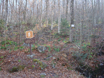
The Spruce Hill Trail trailhead on Route 113
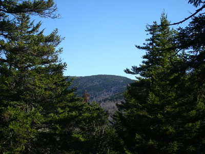
Looking east through the trees from the Spruce Hill summit to Speckled Mountain
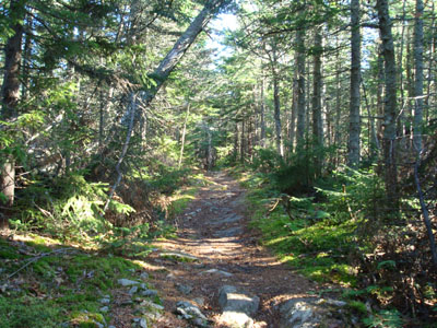
The Bickford Brook Trail on the way to Speckled Mountain
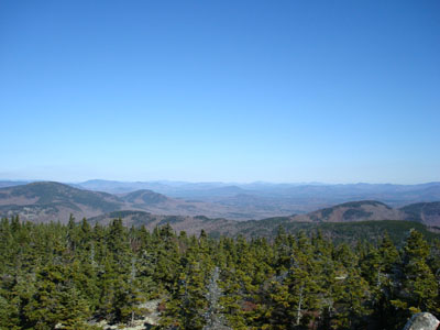
Looking northeast from the Speckled Mountain summit with Caribou Mountain on the left. That isn't tinsel in the tree - that's ice!
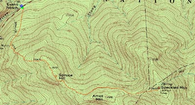

Directions to trailhead: Take Maine 113 North from US 302 to Evans Notch. The East Royce Trail trailhead and WMNF fee parking lot are both located on the left side of the road near the road's highpoint.
Back to Spruce Hill Profile
Back to Speckled Mountain Profile
|


