Home
States
Colorado
Connecticut
Maine
Massachusetts
New Hampshire
New York
Rhode Island
Utah
Vermont
View All
Lists
NE 4,000 Footers
NE 100 Highest
NH 4,000 Footers
NH 100 Highest
NH 52 With A View
NH Belknap Range
NH Ossipee 10
Links
Trail Conditions
Trip Log
Sunrises
Sunsets
About
|
Mt. Institute
Charlemont, MA and Hawley, MA
Trailheads, measurements, times, distances, and maps are all approximate and relative to the hike(s) as shown below. "Summit" photos may in fact not be at the actual summit - but instead at the best nearby vista.

The Mohawk ski trail
I decided to take the opportunity to hike in spring-like mid December weather at a place that would have at least somewhat of a winter feel. Despite the warm weather most of the month, the ski area had man made snow on a few miles of trails, making for an interesting hike.
| Hike Ratings |
|
Getting To Trailhead: |
Easy |
| Destination: |
Mt. Institute |
|
Length: |
Moderate |
|
Steepness: |
Difficult |
|
Navigation: |
Easy |
|
Views: |
Excellent |
|
Crowds: |
Minimal |
|
| Hike Stats |
|
Date Hiked: |
Saturday, December 16, 2006 |
| Hike Commenced: |
12:47 PM |
| Parking Elevation: |
587' |
| Destination: |
Mt. Institute |
| Ascent Commenced: |
12:48 PM |
| Summit Reached: |
1:14 PM |
| Trailhead Elevation: |
590' |
| Summit Elevation: |
1,538' |
| Vertical Gain: |
948' |
| Hike Ended: |
1:38 PM |
| Hike Vertical Gain: |
971' |
|

Looking up the Mohawk ski trail

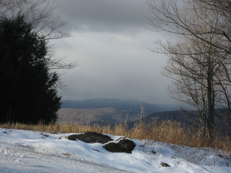
Looking northwest from near the Mt. Institute summit


Directions to trailhead: Take South River Road east from Route 8A, then take a right onto Thunder Mountain Road. Park in the large parking lot.
Back to Mt. Institute Profile
|