Home
States
Colorado
Connecticut
Maine
Massachusetts
New Hampshire
New York
Rhode Island
Utah
Vermont
View All
Lists
NE 4,000 Footers
NE 100 Highest
NH 4,000 Footers
NH 100 Highest
NH 52 With A View
NH Belknap Range
NH Ossipee 10
Links
Trail Conditions
Trip Log
Sunrises
Sunsets
About
|
Mt. Institute
Charlemont, MA and Hawley, MA
Trailheads, measurements, times, distances, and maps are all approximate and relative to the hike(s) as shown below.
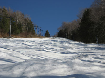
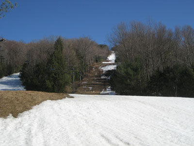
The Flying Cloud ski trail
Having a little time to spare after work and not happy with being out of shape, I decided to hike the Flying Cloud ski trail on Mount Institute. Stabilicers helped with traction on the packed snow and slush.
On my way down, I checked out the summit area of Wilderness Peak - its amazing how quickly it has grown in in the past 5 years.
With the exception of lower Flying Cloud and part of the Outback ski trail, everything was covered with a decent base of snow.
| Hike Ratings |
|
Getting To Trailhead: |
Easy |
| Destination: |
Mt. Institute |
|
Length: |
Moderate |
|
Steepness: |
Very Difficult |
|
Navigation: |
Easy |
|
Views: |
Excellent |
|
Crowds: |
Minimal |
|
| Hike Stats |
|
Date Hiked: |
Thursday, March 29, 2007 |
| Hike Commenced: |
4:26 PM |
| Parking Elevation: |
587' |
| Destination: |
Mt. Institute |
| Ascent Commenced: |
4:28 PM |
| Summit Reached: |
4:50 PM |
| Trailhead Elevation: |
590' |
| Summit Elevation: |
1,538' |
| Vertical Gain: |
948' |
| Hike Ended: |
5:37 PM |
| Hike Vertical Gain: |
1,005' |
|
Looking up the Flying Cloud ski trail
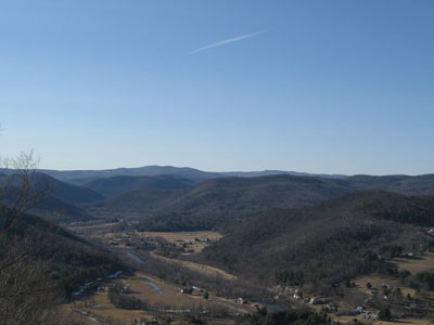
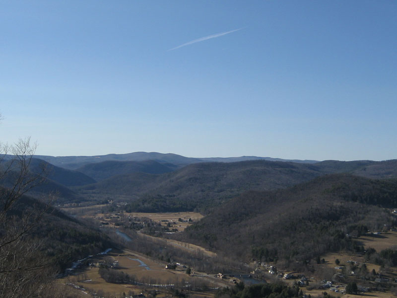
Looking northwest from near the Mt. Institute summit
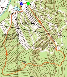

Directions to trailhead: Take South River Road east from Route 8A, then take a right onto Thunder Mountain Road. Park in the large parking lot.
Back to Mt. Institute Profile
|