Home
States
Colorado
Connecticut
Maine
Massachusetts
New Hampshire
New York
Rhode Island
Utah
Vermont
View All
Lists
NE 4,000 Footers
NE 100 Highest
NH 4,000 Footers
NH 100 Highest
NH 52 With A View
NH Belknap Range
NH Ossipee 10
Links
Trail Conditions
Trip Log
Sunrises
Sunsets
About
|
Mt. Institute
Charlemont, MA, and Hawley, MA
Trailheads, measurements, times, distances, and maps are all approximate and relative to the hike(s) as shown below.

Looking up the Riva Ridge ski trail
After hiking Mt. Greylock, I decided to hike up Mt. Institute for some more exercise and to see how the off season work at the ski area was progressing. I ascended the Competition and Upper Competition trails and descended via Minnie Dole, Riva Ridge, Outback, Snow Dance, Exhibition, and Danny's Run.
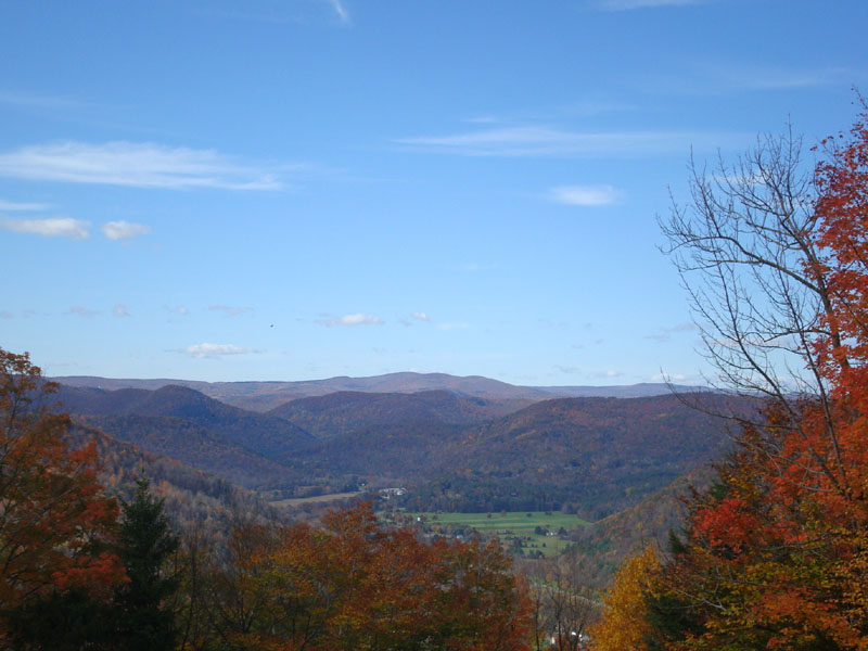
The trails were nicely mowed and fairly dry. There was also some great foliage to be seen.
| Hike Ratings |
|
Getting To Trailhead: |
Easy |
| Destination: |
Mt. Institute |
|
Length: |
Moderate |
|
Steepness: |
Very Difficult |
|
Navigation: |
Easy |
|
Views: |
Excellent |
|
Crowds: |
Minimal |
|
| Hike Stats |
|
Date Hiked: |
Saturday, October 18, 2008 |
| Hike Commenced: |
1:06 PM |
| Parking Elevation: |
580' |
| Destination: |
Mt. Institute |
| Ascent Commenced: |
1:08 PM |
| Summit Reached: |
1:31 PM |
| Time Elapsed: |
00:23 |
| Trailhead Elevation: |
590' |
| Summit Elevation: |
1,538' |
| Vertical Gain: |
953' |
|
|
| Hike Ended: |
2:15 PM |
| Hike Time Elapsed: |
01:09 |
| Hike Vertical Gain: |
978' |
|

At the bottom of the Competition trail

Looking at Negus Mountain from near the Mt. Institute summit


Directions to trailhead: Take South River Road east from Route 8A, then take a right onto Thunder Mountain Road. Park in the large parking lot.
Back to Mt. Institute Profile
|