Home
States
Colorado
Connecticut
Maine
Massachusetts
New Hampshire
New York
Rhode Island
Utah
Vermont
View All
Lists
NE 4,000 Footers
NE 100 Highest
NH 4,000 Footers
NH 100 Highest
NH 52 With A View
NH Belknap Range
NH Ossipee 10
Links
Trail Conditions
Trip Log
Sunrises
Sunsets
About
|
Negus Mountain
Rowe, MA, and Charlemont, MA
Trailheads, measurements, times, distances, and maps are all approximate and relative to the hike(s) as shown below.
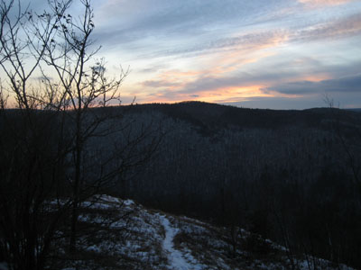
Looking southwest down the trail toward Clark Mountain
After planning to climb it for weeks and never quite getting around to it, I finally was able to hike Negus Mountain in the winter. With little daylight left, I had to hustle to make it to the summit and back before things became too dark.
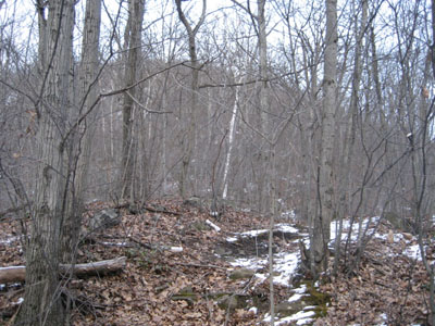
My tracks were the first in a few days, as the trail was covered in a quarter to half inch layer of snow. As I climbed, I encountered lots of ice, including frozen waterfalls where the trail normally runs up steep ledge sections. Though difficult ascending, these sections were tremendously difficult to descend on the way back, especially with the dark.
Conclusion: I plan to go buy some cramp-ons rather soon.
| Hike Ratings |
|
Getting To Trailhead: |
Moderate |
| Destination: |
Negus Mountain |
|
Length: |
Moderate |
|
Steepness: |
Difficult |
|
Navigation: |
Moderate |
|
Views: |
Excellent |
|
Crowds: |
Minimal |
|
| Hike Stats |
|
Date Hiked: |
Tuesday, December 23, 2007 |
| Hike Commenced: |
3:55 PM |
| Parking Elevation: |
750' |
| Destination: |
Negus Mountain |
| Ascent Commenced: |
3:56 PM |
| Summit Reached: |
4:33 PM |
| Trailhead Elevation: |
755' |
| Summit Elevation: |
1,760' |
| Vertical Gain: |
1,095' |
| Hike Ended: |
5:30 PM |
| Hike Vertical Gain: |
1,190' |
|
Trailhead near Zoar Gap
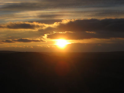
Looking southwest at the sunset from near the Negus Mountain summit
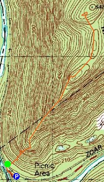

Directions to trailhead: Take Zoar Road to Zoar Gap. Parking is available on both sides of the road. Walk down the dead end road with the yellow fence at the end, cross the railroad tracks - the trailhead should be right there.
Back to Negus Mountain Profile
|

