Home
States
Colorado
Connecticut
Maine
Massachusetts
New Hampshire
New York
Rhode Island
Utah
Vermont
View All
Lists
NE 4,000 Footers
NE 100 Highest
NH 4,000 Footers
NH 100 Highest
NH 52 With A View
NH Belknap Range
NH Ossipee 10
Links
Trail Conditions
Trip Log
Sunrises
Sunsets
About
|
South Sugarloaf Mountain
South Deerfield, MA
Trailheads, measurements, times, distances, and maps are all approximate and relative to the hike(s) as shown below.
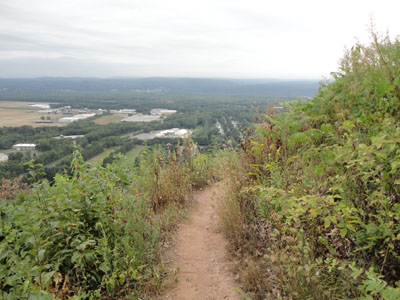
The Pocumtuck Ridge Trail near the summit
Route: Pocumtuck Ridge Trail
While I had planned to quickly hike South Sugarloaf on my way back up from other peaks in the area, incoming rain clouds persuaded me to hike it sooner.
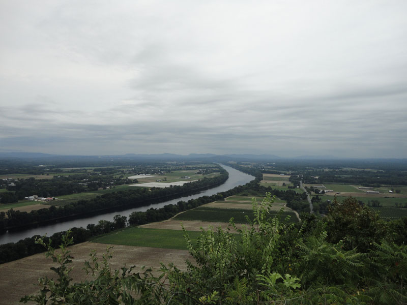
Starting from the dirt parking area just off Route 116, I headed up the trail, over the auto road, then up the steep Pocumtuck Ridge Trail. Nearing the top, there were good views under cloudy skies, stretching to the Mt. Holyoke Range to the south.
I took my time on the descent, as the steepness of the trail, along with loose dirt, makes for interesting walking.
| Hike Ratings |
|
Getting To Trailhead: |
Easy |
| Destination: |
South Sugarloaf Mountain |
|
Length: |
Easy |
|
Steepness: |
Difficult |
|
Navigation: |
Easy |
|
Views: |
Excellent |
|
Crowds: |
Minimal |
|
| Hike Stats |
|
Date Hiked: |
Sunday, August 22, 2010 |
| Hike Commenced: |
7:17 AM |
| Parking Elevation: |
189' |
| Destination: |
South Sugarloaf Mountain |
| Ascent Commenced: |
7:19 AM |
| Summit Reached: |
7:29 AM |
| Time Elapsed: |
00:10 |
| Trailhead Elevation: |
225' |
| Summit Elevation: |
652' |
| Vertical Gain: |
427' |
|
|
| Hike Ended: |
7:44 AM |
| Hike Time Elapsed: |
00:27 |
| Hike Vertical Gain: |
463' |
|
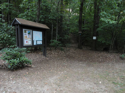
The Pocumtuck Ridge Trail trailhead on the Sugarloaf auto road
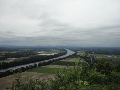
Looking south toward the Mt. Holyoke Range from South Sugarloaf
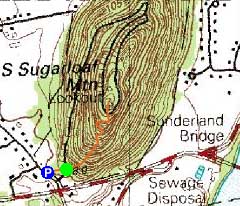

Directions to trailhead: The parking lot and trailhead for South Sugarloaf Mountain are located just off Route 116 in South Deerfield.
Back to South Sugarloaf Mountain Profile
|