Home
States
Colorado
Connecticut
Maine
Massachusetts
New Hampshire
New York
Rhode Island
Utah
Vermont
View All
Lists
NE 4,000 Footers
NE 100 Highest
NH 4,000 Footers
NH 100 Highest
NH 52 With A View
NH Belknap Range
NH Ossipee 10
Links
Trail Conditions
Trip Log
Sunrises
Sunsets
About
|
Bald Knob, Mt. Crosby
Groton, NH
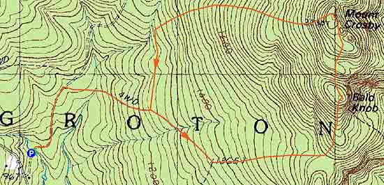
Trailheads, measurements, times, distances, and maps are all approximate and relative to the hike(s) as shown below.
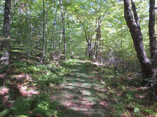
Looking up Old North Groton Road
Route: John F. Woodhouse Trail, Old North Groton Road, Bald Knob Trail, (Bald Knob), unknown trail, (Mt. Crosby), Beeline Trail, High Pasture Loop, Eliza Remick Road, John F. Woodhouse Trail
Trails were generally dry, other than some mud in the logged over areas. A lot of the trails are overgrown at the moment, due to brush growth from logging. Plenty of prickers on the Mt. Crosby side of the High Pasture Loop. Foliage is generally green with a few leaves starting to turn.
Probably best to hike in this area with the leaves still up, as when the leaves come down, the major logging done by the Society for the Protection of New Hampshire Forests a few years ago. Frankly it makes me worry what might happen if they get enough people to give them money to buy the land on Mt. Major.
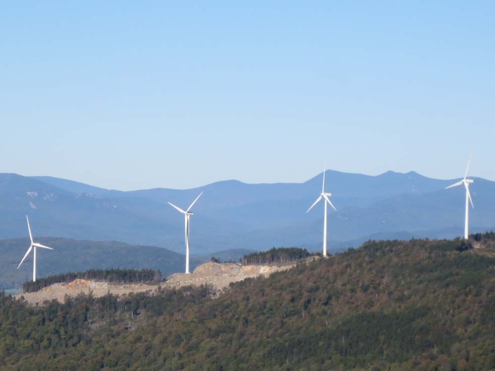
Also interesting to see/listen to the wind farm today. With essentially no wind at this elevation, the turbines were sometimes spinning, sometimes turning off, sometimes spinning at different speeds. Can't help but wonder about the local rumor that the farm isn't feeding the grid yet, and that the Spanish company is running the turbines for appearances and to get the federal compensation (allegedly tied to spinning the turbines, not to actually feeding the grid). A shame to not have the nice view of the Whites from Mt. Crosby anymore, but could see Mt. Washington between a few of the turbines.
| Hike Ratings |
|
Getting To Trailhead: |
Easy |
| Destination: |
Bald Knob |
|
Length: |
Moderate |
|
Steepness: |
Difficult |
|
Navigation: |
Easy |
|
Views: |
Excellent |
|
Crowds: |
Minimal |
| Destination: |
Mt. Crosby |
|
Length: |
Moderate |
|
Steepness: |
Difficult |
|
Navigation: |
Easy |
|
Views: |
Excellent |
|
Crowds: |
Minimal |
|
| Hike Stats |
|
Date Hiked: |
Thursday, September 19, 2013 |
| Parking Elevation: |
970' |
| Destination: |
Bald Knob |
| Time Elapsed: |
00:35 |
| Trailhead Elevation: |
970' |
| Summit Elevation: |
2,050' |
| Vertical Gain: |
1,130' |
| Destination: |
Mt. Crosby |
| Time Elapsed: |
00:10 |
| Trailhead Elevation: |
2,050' |
| Summit Elevation: |
2,230' |
| Vertical Gain: |
280' |
|
|
| Hike Time Elapsed: |
01:35 |
| Hike Vertical Gain: |
1,490' |
|
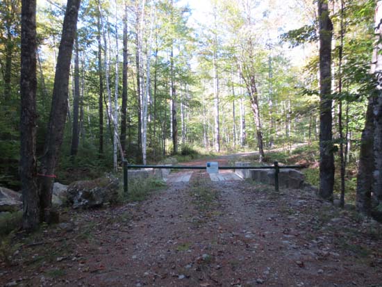
The John F. Woodhouse Trail trailhead off North Groton Road
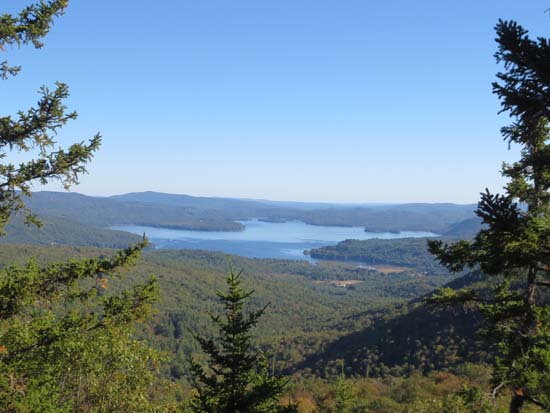
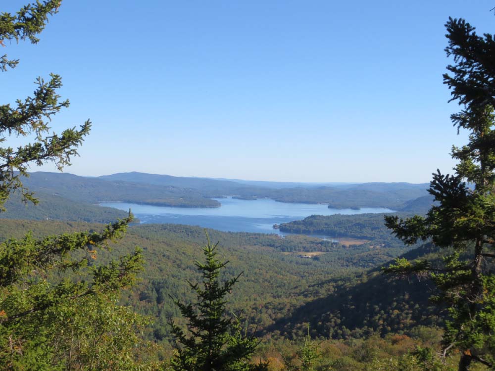
Looking at Newfound Lake from Bald Knob
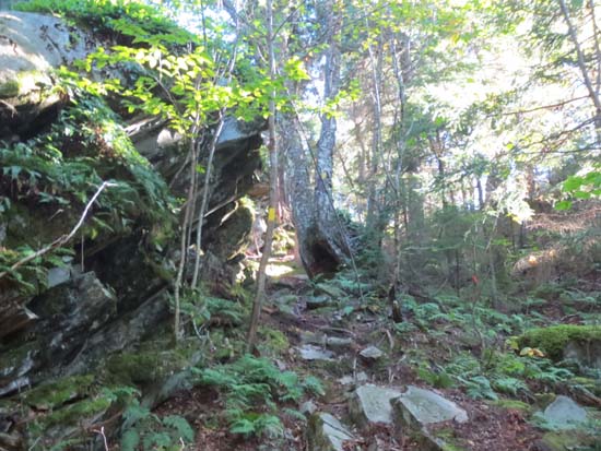
The trail from Bald Knob to Mt. Crosby
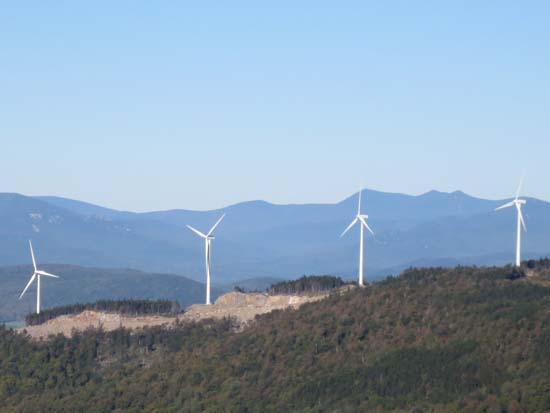
Looking through the Groton Wind Farm toward Waterville Valley from Mt. Crosby

Directions to trailhead: Take Route 3A south from Plymouth. Just prior to reaching Newfound Lake, taken a right onto North Shore Road. Continue straight through Hebron onto Groton Road. Once in Groton, bear right onto North Groton Road. The Cockermouth Forest - John F. Woodhouse Trail sign will eventually be on the right. Follow that dirt road to the gate - there is minimal room for parking adjacent to the gate. The John F. Woodhouse Trail is the logging road behind the gate.
Back to Bald Knob Profile
Back to Mt. Crosby Profile
|