Home
States
Colorado
Connecticut
Maine
Massachusetts
New Hampshire
New York
Rhode Island
Utah
Vermont
View All
Lists
NE 4,000 Footers
NE 100 Highest
NH 4,000 Footers
NH 100 Highest
NH 52 With A View
NH Belknap Range
NH Ossipee 10
Links
Trail Conditions
Trip Log
Sunrises
Sunsets
About
|
Bald Mountain, Mt. Chocorua
Tamworth, NH, Albany, NH
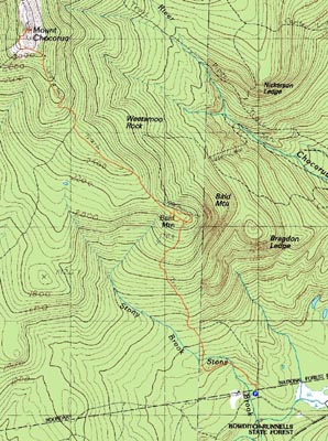
Trailheads, measurements, times, distances, and maps are all approximate and relative to the hike(s) as shown below.
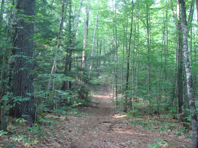
Looking down the Hammond Trail on the way to Bald Mountain
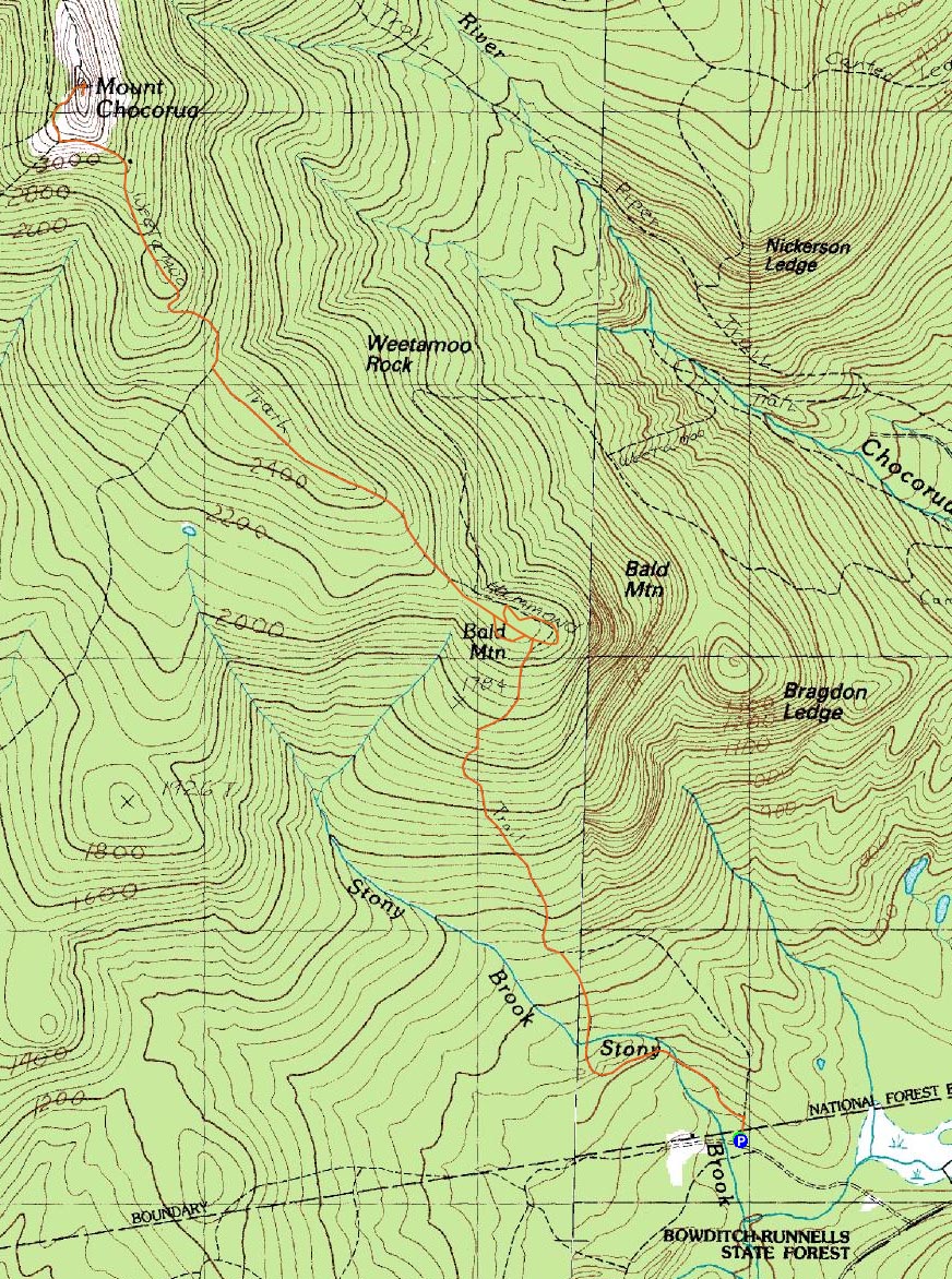
Route: Hammond Trail, bushwhack, (Bald Mountain), bushwhack, Hammond Trail, Liberty Trail, (Mt. Chororua), Liberty Trail, Hammond Trail
The weather forecast had suddenly become encouraging, so I decided to head up to Chocorua and try a new trail.
Arriving at the small parking lot, I quickly set foot up the Hammond Trail - the first part was fairly gradual with some ups and downs. After crossing an old road, the trail became consistently steeper, before becoming a bit more gradual via a series of switchbacks.
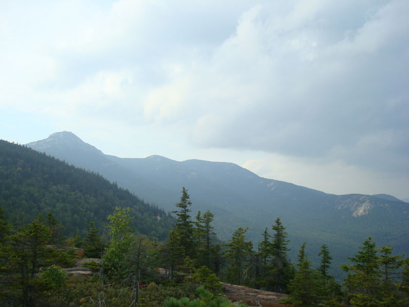
Upon reaching the ledgy yet viewless height of land on Bald Mountain, I started a bushwhack to find some hidden views. At first, I bushwacked to the south and west of the trail fairly unsuccessfully. Not wanting to have my search to be as successful as a French military campaign, I tried another bushwack, this time to the north and east of the trail. At first it seemed like I wasting time in somewhat thick spruce, that is, until I attempted to go back to the trail via a hopefully easier route - I ended up seeing the wide open ledges through the trees and soon arrived at a very neat, wide open area with a great range of views. Unfortunately, the extreme haze and clouds minimized the views - on a clear day, this would be a tremendous view point!
I continued my trek around to the east, finding quite a few open ledges, before finally reaching the trail again. Perhaps the easiest way to access this series of view ledges from the trail is to, just before the trail reaches a large boulder, backtrack slightly, then wrap around to the northeast. The ledges get more impressive as they around to the north.
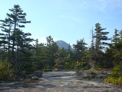
Back on the Hammond Trail, things became quite scenic - like the other Chocorua trails, this trail is filled with views. Particularly neat was seeing Chocorua looming directly ahead - due to the haze, it seemed like the view of the peak was a fake backdrop.
Reaching an empty summit (technically during the beginning of a summer weekend!), the views were decent considering the clouds and haze. While points to the east were hard to see, the west and southwest were starting to clear. After spending a few minutes sitting on the summit, I decided the odds of a good sunset weren't good enough to warrant waiting another half hour or so, then having to do the subsequent 4+ mile walk out.
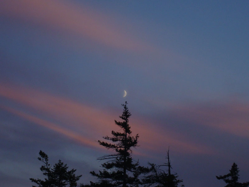
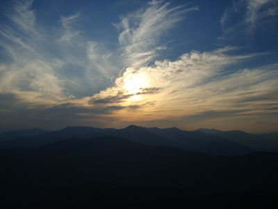
As I reached the Liberty cabin, I could see the sky filling up with color. By the time I reached the ledges half a mile before the summit of Bald Mountain, there were some great purple colors to the south and east. Upon reaching Bald Mountain, it was headlamp time. The last two miles were somewhat interesting, as this lesser travelled trail seemed to result in more wildlife around. Though I didn't see anything other than a snake, I was definitely surrounded by some animals of various sizes. As Dwight Schrute says, bear attacks come when you least expect it.
| Hike Ratings |
|
Getting To Trailhead: |
Easy |
| Destination: |
Bald Mountain |
|
Length: |
Moderate |
|
Steepness: |
Moderate |
|
Navigation: |
Difficult |
|
Views: |
Excellent |
|
Crowds: |
Minimal |
| Destination: |
Mount Chocorua |
|
Length: |
Moderate |
|
Steepness: |
Difficult |
|
Navigation: |
Easy |
|
Views: |
Excellent |
|
Crowds: |
Minimal |
|
| Hike Stats |
|
Date Hiked: |
Friday, September 5, 2008 |
| Hike Commenced: |
3:44 PM |
| Parking Elevation: |
600' |
| Destination: |
Bald Mountain |
| Ascent Commenced: |
3:44 PM |
| Summit Reached: |
4:50 PM |
| Time Elapsed: |
01:06 |
| Trailhead Elevation: |
600' |
| Summit Elevation: |
2,140' |
| Vertical Gain: |
1,620' |
| Destination: |
Mount Chocorua |
| Ascent Commenced: |
5:07 PM |
| Summit Reached: |
6:10 PM |
| Time Elapsed: |
01:03 |
| Trailhead Elevation: |
2,140' |
| Summit Elevation: |
3,474' |
| Vertical Gain: |
1,484' |
|
|
| Hike Ended: |
8:28 PM |
| Hike Time Elapsed: |
04:44 |
| Hike Vertical Gain: |
3,414' |
|
The Hammond Trail trailhead off Scott Road
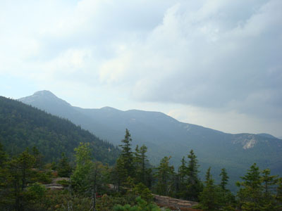
Looking at Mt. Chocorua and the Three Sisters from the Bald Mountain ledges
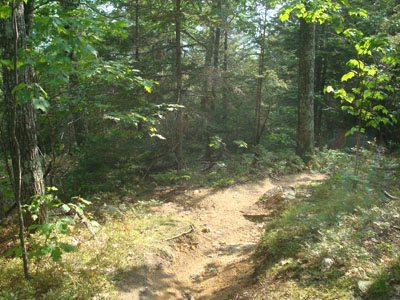
Looking up the Hammond Trail
Looking at Mt. Passaconaway from the Mt. Chocorua summit

Sunset colors as seen from near Bald Mountain

Directions to trailhead: Take Route 16 north from West Ossipee. Shortly after passing Chocorua Lake, take a left onto Scott Road (very small sign, large boulder on the right side of Route 16 at the junction). Head down the dirt road. The Hammond Trail mini parking lot and trailhead will be on the right.
Back to Bald Mountain Profile
Back to Mount Chocorua Profile
|