Home
States
Colorado
Connecticut
Maine
Massachusetts
New Hampshire
New York
Rhode Island
Utah
Vermont
View All
Lists
NE 4,000 Footers
NE 100 Highest
NH 4,000 Footers
NH 100 Highest
NH 52 With A View
NH Belknap Range
NH Ossipee 10
Links
Trail Conditions
Trip Log
Sunrises
Sunsets
About
|
Bayle Mountain
Ossipee, NH
Trailheads, measurements, times, distances, and maps are all approximate and relative to the hike(s) as shown below.
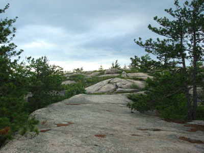
Looking up the trail to Bayle Mountain
Route: Unknown snowmobile trail, red blazed trail, (Bayle Mountain), red blazed trail, unknown snowmobile trail
After watching the local radar and satellite for awhile, I saw a break in the rain/thunderstorms. Since it looked like the clouds were moving to the southeast, I decided to head down to Bayle Mountain for a brief evening hike.
Arriving at the quasi-parking area, I was happy to discover the mosquitoes weren't too bad. Walking quickly through the wet grass on the snowmobile trail, I was soon at the trailhead. While the lower portion of the trail wasn't much of a problem, the middle part was a bit of a challenge, as the extended rock slabs/ledges were wet and thus slippery. Nonetheless, I was able to make my way up to the summit in a reasonable amount of time.
The views from the summit, though cloudy (unfortunately, the clouds had stalled a bit and were actually starting to increase in size), were still excellent. I was particularly surprised to find a few ripe wild low bush blueberries - though a bit tart, they were still an unexpected early season treat.
After signing the log book (only two others had signed since my last visit a month earlier), I hung out on the summit for about twenty minutes, finally deciding to leave when I suspected there was some lightning to the north.
While the slaps were a bit tricky to descend, I nonetheless survived to write my tale. I was fortunate enough to make it out and back before any rain fell - there were some quasi-sun-showers on the ride back on Route 25.
| Hike Ratings |
|
Getting To Trailhead: |
Moderate |
| Destination: |
Bayle Mountain |
|
Length: |
Moderate |
|
Steepness: |
Difficult |
|
Navigation: |
Easy |
|
Views: |
Excellent |
|
Crowds: |
Minimal |
|
| Hike Stats |
|
Date Hiked: |
Tuesday, June 24, 2008 |
| Hike Commenced: |
6:13 PM |
| Parking Elevation: |
1,040' |
| Destination: |
Bayle Mountain |
| Ascent Commenced: |
6:18 PM |
| Summit Reached: |
6:37 PM |
| Time Elapsed: |
00:19 |
| Trailhead Elevation: |
1,100' |
| Summit Elevation: |
1,853' |
| Vertical Gain: |
763' |
|
|
| Hike Ended: |
7:24 PM |
| Hike Time Elapsed: |
01:11 |
| Hike Vertical Gain: |
873' |
|
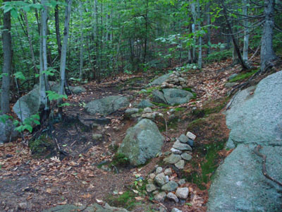
The trailhead to the trail to the Bayle Mountain summit
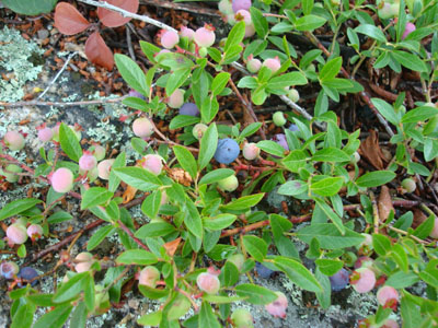
Wild low bush blueberries!
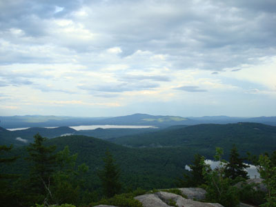
Looking southeast at Green Mountain from the Bayle Mountain summit
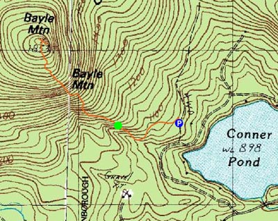

Directions to trailhead: From Route 16 South in West Ossipee, take a right onto Pine Hill Road. At the end of Pine Hill Road, take a right onto Ossipee Mountain Road. 2015 update: There is now a parking area off Marble Road, past Connor Pond.
Back to Bayle Mountain Profile
|

