Home
States
Colorado
Connecticut
Maine
Massachusetts
New Hampshire
New York
Rhode Island
Utah
Vermont
View All
Lists
NE 4,000 Footers
NE 100 Highest
NH 4,000 Footers
NH 100 Highest
NH 52 With A View
NH Belknap Range
NH Ossipee 10
Links
Trail Conditions
Trip Log
Sunrises
Sunsets
About
|
Bayle Mountain
Ossipee, NH
Trailheads, measurements, times, distances, and maps are all approximate and relative to the hike(s) as shown below.
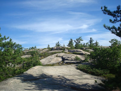
Looking up the trail to Bayle Mountain
Route: Unknown snowmobile trail, red blazed trail, (Bayle Mountain), red blazed trail, unknown snowmobile trail
Since the weather looked like it was going to turn to junk as the day progressed, I decided to do a short local hike.
The snowmobile trail was mostly dry, except for one short muddy section (one can step on rocks to stay dry). The trail up Bayle Mountain was also mostly dry, except for two very brief muddy sections and one slippery ledge section. After all of the rain, it was nice to finally hike dry trail under blue skies!
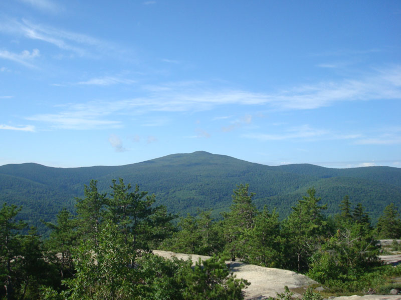
As usual, the views from the top were tremendous. While it was a nice morning on Bayle, I could see that points south and north were under some dark clouds. The blueberries on top were tremendous - the best I've had all year. By the looks of the log book, the traffic to the summit has picked up in the past month (including a couple who got engaged on the summit, congratulations!). I spent an hour on the summit, eating blueberries and enjoying views.
On the way down, I did some work on the trail, building up a few cairns and removing some blowdowns/branches.
Another nice day on Bayle Mountain!
| Hike Ratings |
|
Getting To Trailhead: |
Moderate |
| Destination: |
Bayle Mountain |
|
Length: |
Moderate |
|
Steepness: |
Difficult |
|
Navigation: |
Easy |
|
Views: |
Excellent |
|
Crowds: |
Minimal |
|
| Hike Stats |
|
Date Hiked: |
Sunday, August 10, 2008 |
| Hike Commenced: |
8:31 AM |
| Parking Elevation: |
1,040' |
| Destination: |
Bayle Mountain |
| Ascent Commenced: |
8:36 AM |
| Summit Reached: |
8:58 PM |
| Time Elapsed: |
00:22 |
| Trailhead Elevation: |
1,100' |
| Summit Elevation: |
1,853' |
| Vertical Gain: |
763' |
|
|
| Hike Ended: |
10:51 AM |
| Hike Time Elapsed: |
02:20 |
| Hike Vertical Gain: |
873' |
|
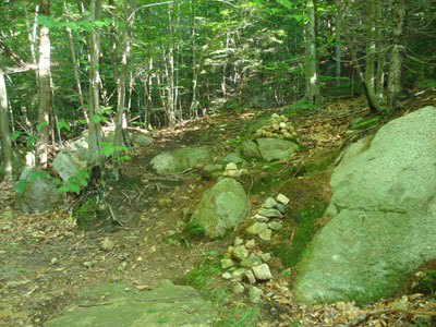
The trailhead to the trail to the Bayle Mountain summit
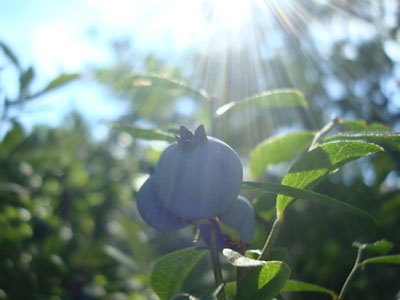
Wild low bush blueberries. Disclaimer: Berries in photo may no longer be on Bayle Mountain.

Looking at Mt. Shaw from the Bayle Mountain summit
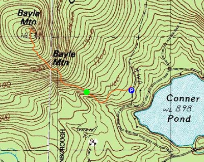

Directions to trailhead: From Route 16 South in West Ossipee, take a right onto Pine Hill Road. At the end of Pine Hill Road, take a right onto Ossipee Mountain Road. 2015 update: There is now a parking area off Marble Road, past Connor Pond.
Back to Bayle Mountain Profile
|