Home
States
Colorado
Connecticut
Maine
Massachusetts
New Hampshire
New York
Rhode Island
Utah
Vermont
View All
Lists
NE 4,000 Footers
NE 100 Highest
NH 4,000 Footers
NH 100 Highest
NH 52 With A View
NH Belknap Range
NH Ossipee 10
Links
Trail Conditions
Trip Log
Sunrises
Sunsets
About
|
Bayle Mountain
Ossipee, NH
Trailheads, measurements, times, distances, and maps are all approximate and relative to the hike(s) as shown below.
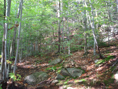
Looking down the trail to Bayle Mountain
Route: Unknown snowmobile trail, red blazed trail, (Bayle Mountain), red blazed trail, unknown snowmobile trail
Despite having rained off and on most of the day, the afternoon appeared to be clearing out. While I was tempted to go north, I decided to stay local and hike Bayle Mountain, this time trying it from a different trailhead.
I found the snowmobile trail off Marble Road (instead of Bayle Mountain Road) to be much more accessible and scenic. Though longer than the other access point, the scenery seemed worth it, whereas the access from Bayle Mountain Road tends to be dark and gloomy down low.
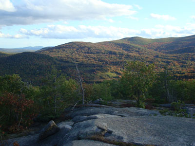
The trail up Bayle Mountain was a bit wet and slippery from the recent rain, but otherwise good. While I had been hoping for some nice foliage, the only colors were along the snowmobile trail and on some neighboring peaks. A few trees off the trail a bit were starting to turn, but for the most part the woods were still pretty green.
After taking some photos and signing the log book on the windy summit, I headed back down. While I do like the express nature of the Bayle Mountain Road access, I think I prefer the slightly longer route that I tried today.
| Hike Ratings |
|
Getting To Trailhead: |
Moderate |
| Destination: |
Bayle Mountain |
|
Length: |
Moderate |
|
Steepness: |
Difficult |
|
Navigation: |
Easy |
|
Views: |
Excellent |
|
Crowds: |
Minimal |
|
| Hike Stats |
|
Date Hiked: |
Friday, October 3, 2008 |
| Hike Commenced: |
4:02 PM |
| Parking Elevation: |
1,005' |
| Destination: |
Bayle Mountain |
| Ascent Commenced: |
4:15 PM |
| Summit Reached: |
4:36 PM |
| Time Elapsed: |
00:21 |
| Trailhead Elevation: |
1,100' |
| Summit Elevation: |
1,853' |
| Vertical Gain: |
763' |
|
|
| Hike Ended: |
5:26 PM |
| Hike Time Elapsed: |
01:24 |
| Hike Vertical Gain: |
1,028' |
|
The trailhead to the trail to the Bayle Mountain summit

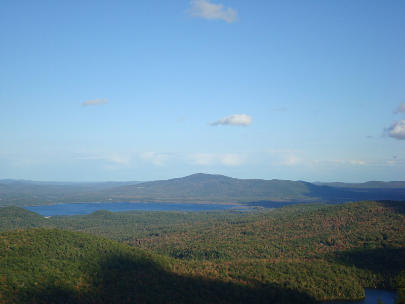
Looking at Green Mountain from the Bayle Mountain summit
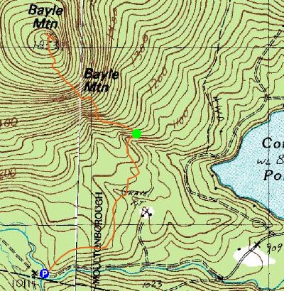

Directions to trailhead: From Route 16 South in West Ossipee, take a right onto Pine Hill Road. At the end of Pine Hill Road, take a right onto Ossipee Mountain Road. Shortly after passing Connor Pond, bear right onto Marble Road. Just before a narrow wooden bridge, the snowmobile trail enters on the right (and then leaves on the left after the bridge), marked slightly off the road with an orange gate. Park here without blocking the roads or trails, and head up the snowmobile trail on the right. The trailhead will be about 10-20 minutes up this snowmobile trail, to the left at a height of land on a curve in the road, marked with a cairn.
Back to Bayle Mountain Profile
|