Home
States
Colorado
Connecticut
Maine
Massachusetts
New Hampshire
New York
Rhode Island
Utah
Vermont
View All
Lists
NE 4,000 Footers
NE 100 Highest
NH 4,000 Footers
NH 100 Highest
NH 52 With A View
NH Belknap Range
NH Ossipee 10
Links
Trail Conditions
Trip Log
Sunrises
Sunsets
About
|
Bear Mountain
Hebron, NH
Trailheads, measurements, times, distances, and maps are all approximate and relative to the hike(s) as shown below.
Looking up the Bear Mountain Trail
Route: Bear Mountain Road, Bear Mountain Trail, Elwell Trail, (Bear Mountain), Elwell Trail, Bear Mountain Trail, Bear Mountain Road
Driving alongside Newfound Lake, there was very little snow to be seen. Fortunately, as I arrived at the end of the paved portion of Bear Mountain Road, there was enough snow to snowshoe (ie would have to carry them on my pack).
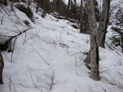
The roadwalk seemed to drag on a bit longer than I would have thought, but soon enough I was at the Bear Mountain Trail trailhead. The trail was clearly hit hard by the recent snow/rain/windstorm - branches down everwhere. No one had been up here anytime recently, so I was breaking trail on about half a foot of spring snow. After crossing over a small brook, climbing, then traversing, the trail suddenly became quite steep. Eventually reaching the Elwell Trail, the destruction was much worse - lots of softwood blowdowns.
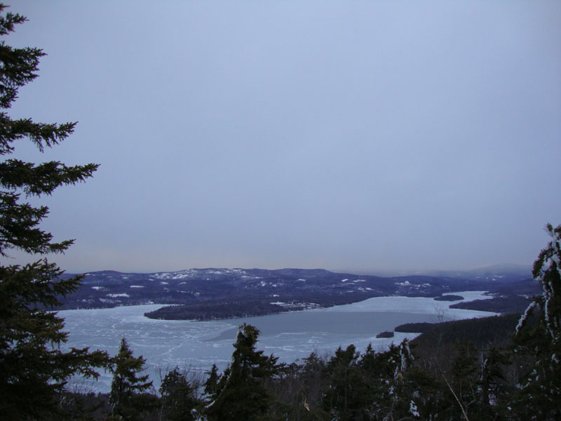
After passing a few false summits, I arrived next to a bump with a decent lake view (there had been a few views earlier as well). Not completely convinced this was the summit, I continued on - downhill a bit, past a meadow of sorts, then up over some other bumps. Looking back, I could tell I had indeed gone over the summit area.
Back at the summit area, I verified that a slightly off trail knob appeared to be the summit - and I found an old trail marker up on it. Seeing that it was past sunset, I bushwhacked to a quasi-west viewpoint (nice look at Cardigan), I had some slight colors to the northwest.
The descent went smoother than expected and, though it was well after sunset, I made it back without needing a headlamp.
| Hike Ratings |
|
Getting To Trailhead: |
Moderate |
| Destination: |
Bear Mountain |
|
Length: |
Moderate |
|
Steepness: |
Very Difficult |
|
Navigation: |
Easy |
|
Views: |
Excellent |
|
Crowds: |
Minimal |
|
| Hike Stats |
|
Date Hiked: |
Thursday, March 4, 2010 |
| Hike Commenced: |
4:11 PM |
| Parking Elevation: |
777' |
| Destination: |
Bear Mountain |
| Ascent Commenced: |
4:24 PM |
| Summit Reached: |
5:13 PM |
| Time Elapsed: |
00:49 |
| Trailhead Elevation: |
940' |
| Summit Elevation: |
1,847' |
| Vertical Gain: |
967' |
|
|
| Hike Ended: |
6:19 PM |
| Hike Time Elapsed: |
02:08 |
| Hike Vertical Gain: |
1,380' |
|
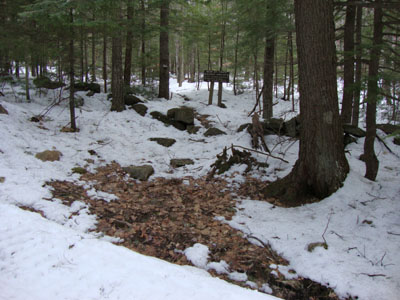
The Bear Mountain Trail trailhead on Bear Mountain Road

Looking at Newfound Lake from near the summit of Bear Mountain
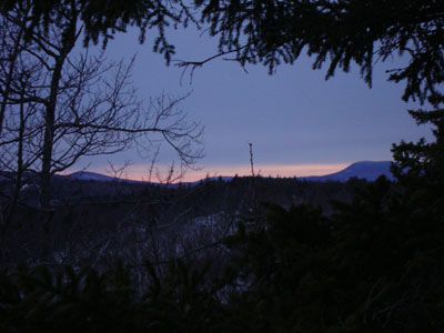
Sunset colors as seen from near the summit of Bear Mountain
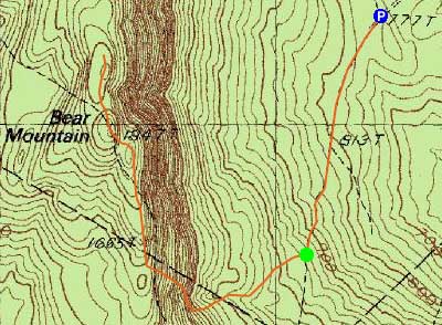

Directions to trailhead: From Bristol, take US 3A North, then take a left onto West Shore Road. Continue right on West Shore Road when Caridgan Mountain Road branches off straight. Eventually, after pulling back away from the lake, take a left onto Bear Mountain Road. In winter, Bear Mountain Road is plowed to the Panorama Lane junction - there may be some room to park on the side of the road. Continue on foot up Bear Mountain Road (a snowmobile trail in winter) - after a little over half a mile, the Bear Mountain Trail trailhead will be on the right (near the top of an uphill portion of the roadwalk).
Back to Bear Mountain Profile
|