Home
States
Colorado
Connecticut
Maine
Massachusetts
New Hampshire
New York
Rhode Island
Utah
Vermont
View All
Lists
NE 4,000 Footers
NE 100 Highest
NH 4,000 Footers
NH 100 Highest
NH 52 With A View
NH Belknap Range
NH Ossipee 10
Links
Trail Conditions
Trip Log
Sunrises
Sunsets
About
|
Belknap Mountain
Gilford, NH
Trailheads, measurements, times, distances, and maps are all approximate and relative to the hike(s) as shown below.
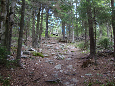
Looking up the Red Trail on the way to the Belknap Mountain summit
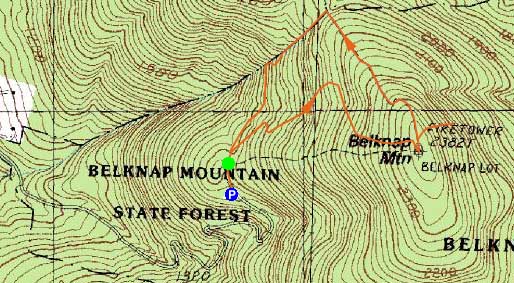
Route: Blue Trail, Red Trail, (Belknap Mountain), Blue Trail, herd path, (1972 plane crash), herd path, Blue Trail
Looking for a light day, and with White Mountain weather not looking too good, I headed south to the Belknaps. Parking at the lot at the top of the Carriage Road, I jogged the flats and hiked the few steeps up the Red Trail. The footing was a bit rough in places with lots of roots and rocks, though the partial view part way up was a redeeming feature. With the Fire Warden on duty at the summit fire tower, I was able to check out the views from inside the cab - it's amazing how much more is visible one more flight of stairs higher.
After leaving the tower, I headed down the Blue Trail, leaving it at the first opening to follow an unmarked herdpath down steep, rocky terrain to the 1972 Piper plane crash.
Back on the Blue Trail, I walked down to the col, then jogged back to the trailhead.
| Hike Ratings |
|
Getting To Trailhead: |
Easy |
| Destination: |
Belknap Mountain |
|
Length: |
Easy |
|
Steepness: |
Difficult |
|
Navigation: |
Easy |
|
Views: |
Excellent |
|
Crowds: |
Minimal |
|
| Hike Stats |
|
Date Hiked: |
Thursday, July 1, 2010 |
| Hike Commenced: |
4:04 PM |
| Parking Elevation: |
1,670' |
| Destination: |
Belknap Mountain |
| Ascent Commenced: |
4:05 PM |
| Summit Reached: |
4:21 PM |
| Time Elapsed: |
00:16 |
| Trailhead Elevation: |
1,710' |
| Summit Elevation: |
2,382' |
| Vertical Gain: |
677' |
|
|
| Hike Ended: |
5:09 PM |
| Hike Time Elapsed: |
01:04 |
| Hike Vertical Gain: |
897' |
|
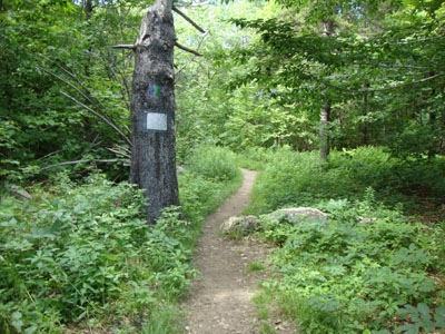
The Blue Trail trailhead
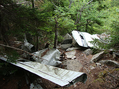
The 1972 Piper plane wreckage on the northern shoulder of Belknap Mountain
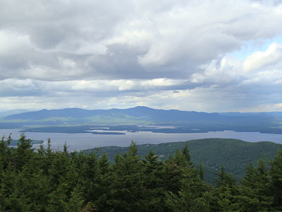
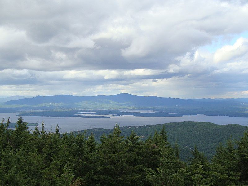
Looking at the Ossipee Mountains from the Belknap Mountain fire tower
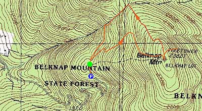

Directions to trailhead: From Route 11A East (from Route 3), take a right on Hoyt Road. Continue down this road as it becomes Belknap Mountain Road. Eventually, take a left onto the Carriage Road. In season, one can drive up the road (closing at 6 PM) and park in the upper parking lot. The Red Trail trailhead is located beyond the shacks near the parking lot.
Back to Belknap Mountain Profile
|