Home
States
Colorado
Connecticut
Maine
Massachusetts
New Hampshire
New York
Rhode Island
Utah
Vermont
View All
Lists
NE 4,000 Footers
NE 100 Highest
NH 4,000 Footers
NH 100 Highest
NH 52 With A View
NH Belknap Range
NH Ossipee 10
Links
Trail Conditions
Trip Log
Sunrises
Sunsets
About
|
Big Ball Mountain
Tuftonboro, NH
Trailheads, measurements, times, distances, and maps are all approximate and relative to the hike(s) as shown below.
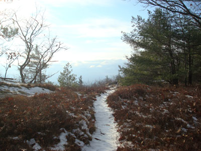
Looking down the Tate Mountain Trail
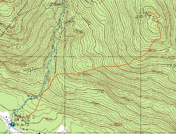
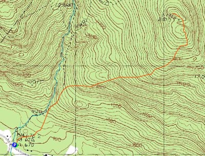
Route: Mt. Shaw Trail, Tate Mountain Trail, Banana Trail, (Big Ball Mountain), Banana Trail, Tate Mountain Trail, Mt. Shaw Trail
While it was looking to be a nice day, as I neared getting ready to head out for a hike, clouds appeared to be moving back in. Nonetheless, I wanted to check out Big Ball Mountain on its own right, as my previous times on it had been via multi-peak hikes.
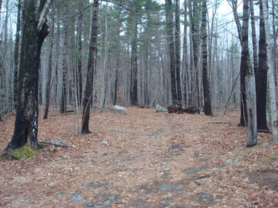
I quickly set foot up the unmarked lower portion of the Mt. Shaw Trail, stopping briefly to check out the ranging waterfalls just before the Tate Mountain Trail junction. Easily seen, the Tate Mountain Trail started as a woods road to the right, marked with green and red blazes.
The trail eventually became more of a proper trail as the woods roads and logging roads split off. Soon, I was making my way through some scenic ledgy areas. Up to this point, the trail was easy to moderate in pitch.
As I reached the Banana Trail, blue sky appeared overhead - not bad! While there hadn't been much snow at all until the last few hundred vertical feet of the ascent, there were some quasi-winter conditions in the small, steep col between the Big Ball Mountain peaks.
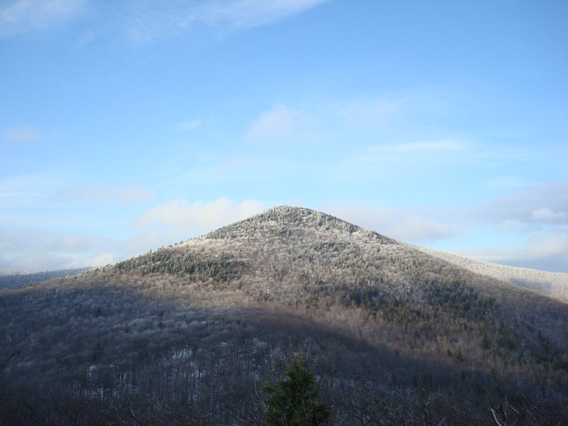
The views from the summit were fairly strong, despite the amount of clouds surrounding the area. There were quasi-sunset colors to the west, as various types of clouds were filtering the light oddly. Above, Black Snoot was towering, draped in fresh snow.
Not a bad hike on its own right - Big Ball Mountain will be added to my after-work list of Ossipee hikes for sure.
| Hike Ratings |
|
Getting To Trailhead: |
Easy |
| Destination: |
Big Ball Mountain |
|
Length: |
Moderate |
|
Steepness: |
Difficult |
|
Navigation: |
Easy |
|
Views: |
Excellent |
|
Crowds: |
Minimal |
|
| Hike Stats |
|
Date Hiked: |
Wednesday, November 26, 2008 |
| Hike Commenced: |
1:25 PM |
| Parking Elevation: |
670' |
| Destination: |
Big Ball Mountain |
| Ascent Commenced: |
1:25 PM |
| Summit Reached: |
2:16 PM |
| Time Elapsed: |
00:51 |
| Trailhead Elevation: |
675' |
| Summit Elevation: |
2,060' |
| Distance: |
1.7 miles |
| Vertical Gain: |
1,455' |
|
|
| Hike Ended: |
3:22 PM |
| Hike Time Elapsed: |
02:57 |
| Hike Distance: |
3.4 miles |
| Hike Vertical Gain: |
1,530' |
|
The Mt. Shaw Trail trailhead
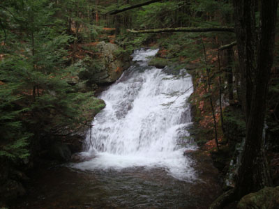
Rapids next to the Mt. Shaw Trail
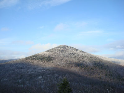
Looking at Black Snoot from the summit of Big Ball Mountain

Directions to trailhead: Take 171 southeast from Route 25, past Castle in the Clouds. Shortly after crossing the Tuftonboro town line, there is a bridge/brook crossing. Immediately after this, there is an informal parking lot on the left (maybe 4 cars). The unmarked trail starts at the back of this lot.
Back to Big Ball Mountain Profile
|