Home
States
Colorado
Connecticut
Maine
Massachusetts
New Hampshire
New York
Rhode Island
Utah
Vermont
View All
Lists
NE 4,000 Footers
NE 100 Highest
NH 4,000 Footers
NH 100 Highest
NH 52 With A View
NH Belknap Range
NH Ossipee 10
Links
Trail Conditions
Trip Log
Sunrises
Sunsets
About
|
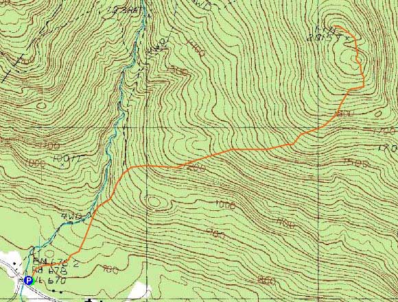
Big Ball Mountain
Tuftonboro, NH
Trailheads, measurements, times, distances, and maps are all approximate and relative to the hike(s) as shown below.
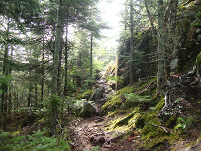
The Banana Trail near the summit of Big Ball Mountain
Route: Mt. Shaw Trail, Tate Mountain Trail, Banana Trail, (Big Ball Mountain), Banana Trail, Tate Mountain Trail, Mt. Shaw Trail
The weather forecast was calling for a chance of the apocalypse, so I decided to do a lower-elevation, local hike.
Jogging the intial portions of the Mt. Shaw and Tate Mountain trails, I switched to walking as I reached wet/slippery ledge areas. After struggling down a slippery scramble, I soon reached the summit, where I was in the fog. The bugs weren't overly bad. The blueberries seemed to be pretty well picked over.
| Hike Ratings |
|
Getting To Trailhead: |
Easy |
| Destination: |
Big Ball Mountain |
|
Length: |
Moderate |
|
Steepness: |
Difficult |
|
Navigation: |
Easy |
|
Views: |
Minimal (due to weather) |
|
Crowds: |
Minimal |
|
| Hike Stats |
|
Date Hiked: |
Saturday, July 24, 2010 |
| Hike Commenced: |
8:04 AM |
| Parking Elevation: |
670' |
| Destination: |
Big Ball Mountain |
| Ascent Commenced: |
8:04 AM |
| Summit Reached: |
8:48 AM |
| Time Elapsed: |
00:44 |
| Trailhead Elevation: |
675' |
| Summit Elevation: |
2,060' |
| Distance: |
1.7 miles |
| Vertical Gain: |
1,455' |
|
|
| Hike Ended: |
9:50 AM |
| Hike Time Elapsed: |
01:46 |
| Hike Distance: |
3.4 miles |
| Hike Vertical Gain: |
1,530' |
|
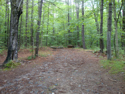
The Mt. Shaw Trail trailhead
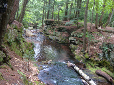
The gorge next to the Mt. Shaw Trail
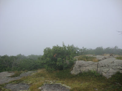
Fog as seen from Big Ball Mountain


Directions to trailhead: Take 171 southeast from Route 25, past Castle in the Clouds. Shortly after crossing the Tuftonboro town line, there is a bridge/brook crossing. Immediately after this, there is an informal parking lot on the left (maybe 4 cars). The unmarked trail starts at the back of this lot.
Back to Big Ball Mountain Profile
|