Home
States
Colorado
Connecticut
Maine
Massachusetts
New Hampshire
New York
Rhode Island
Utah
Vermont
View All
Lists
NE 4,000 Footers
NE 100 Highest
NH 4,000 Footers
NH 100 Highest
NH 52 With A View
NH Belknap Range
NH Ossipee 10
Links
Trail Conditions
Trip Log
Sunrises
Sunsets
About
|
Black Cap
Conway, NH
Trailheads, measurements, times, distances, and maps are all approximate and relative to the hike(s) as shown below.

Looking down the Black Cap Trail
Route: Black Cap Trail
Upon finishing a hike to Mt. Parker, I could see a clearing trend to the south and west. Thus, I decided to head up to Black Cap for a brief sunset hike.
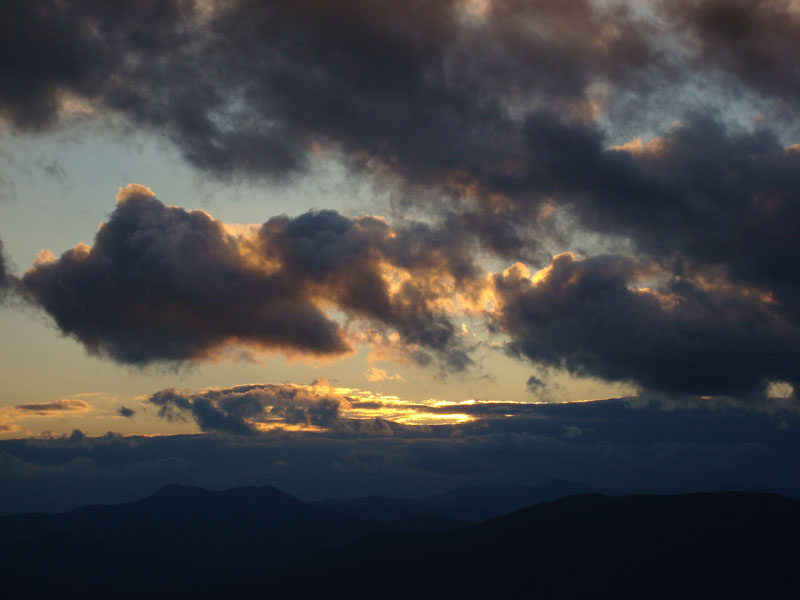
While the trail was a bit from recent rain, the ledges were fortunately fairly dry. After checking out the eastern viewpoint (which seems to be more grown in than I remember it), I went back to the ledges along the trail to get ready for the sunset. Unfortunately, a dark layer of clouds blew in from the Presidentials, covering most of the color. Can't win them all!
| Hike Ratings |
|
Getting To Trailhead: |
Easy |
| Destination: |
Black Cap |
|
Length: |
Easy |
|
Steepness: |
Moderate |
|
Navigation: |
Easy |
|
Views: |
Excellent |
|
Crowds: |
Minimal |
|
| Hike Stats |
|
Date Hiked: |
Sunday, November 9, 2008 |
| Hike Commenced: |
3:29 PM |
| Parking Elevation: |
1,705' |
| Destination: |
Black Cap |
| Ascent Commenced: |
3:29 PM |
| Summit Reached: |
3:52 PM |
| Time Elapsed: |
00:23 |
| Trailhead Elevation: |
1,705' |
| Summit Elevation: |
2,369' |
| Distance: |
1.3 miles |
| Vertical Gain: |
679' |
|
|
| Hike Ended: |
4:54 PM |
| Hike Time Elapsed: |
01:25 |
| Hike Distance: |
2.6 miles |
| Hike Vertical Gain: |
734' |
|

Black Cap Trail trailhead

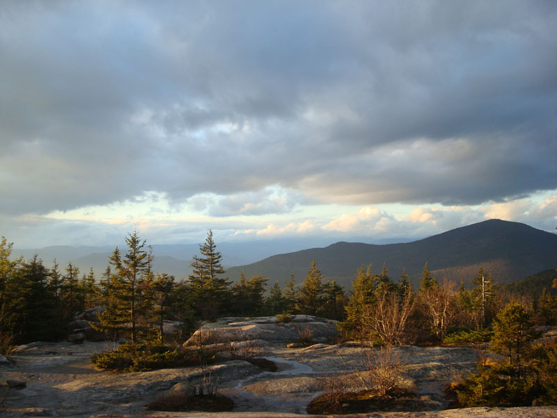
Looking at Kearsarge North Mountain from near the summit of Black Cap

Sunset colors masked by dark clouds as seen from Black Cap


Directions to trailhead: Take Route 16 North from North Conway. Take a right onto Hurricane Mountain Road. Go past the Kearsarge North Trail trailhead, past the gate, and to the top of the mountain. Parking area and trailhead are on the right.
Back to Black Cap Profile
|