Home
States
Colorado
Connecticut
Maine
Massachusetts
New Hampshire
New York
Rhode Island
Utah
Vermont
View All
Lists
NE 4,000 Footers
NE 100 Highest
NH 4,000 Footers
NH 100 Highest
NH 52 With A View
NH Belknap Range
NH Ossipee 10
Links
Trail Conditions
Trip Log
Sunrises
Sunsets
About
|
Black Cap
Conway, NH
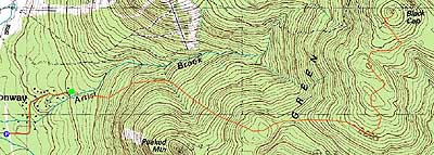
Trailheads, measurements, times, distances, and maps are all approximate and relative to the hike(s) as shown below.
Looking up the Black Cap Connector
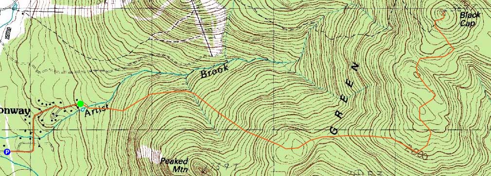
Route: Black Cap Connector
Once again wanting to avoid the recent snowfall, I opted to head to the Green Hills. With Hurricane Mountain Road still closed, I decided to try Black Cap via Thompson Road.
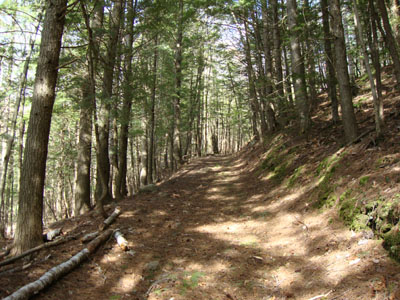
After parking at the conservation parking area, I walked the roughly half mile roadwalk to the trailhead (tow zone). From there, the trail started as somewhat of a wood road, merging with another one (coming from the left), then crossing Artist Brook (running a bit high, but rock hoppable). From there, the trail climbed moderately to the connector to Peaked Mountain, then continued in a washed out fashion up to a high of land.
After dropping down and reclimbing, I soon reached the snowmobile trail junction (Mason Brook Trail), which may warrant further exploration.
Beyond that junction, the navigation was a bit confusing. The trail separated from the snowmobile trail (just an arrow marking it), then rejoined (an arrow facing the other direction), with blazes few and far between and no signs. For awhile I was a bit concerned that I had hopped onto a wrong trail, jumping over mud and water pits, however I eventually came across some small yellow blazes.
After a few more ups and downs, I reached a random trail sign (not at a junction), reconfirming that I indeed wasn't venturing into Maine. Awhile thereafter, I reached the junction for the final short climb (much more gradual than the short spur on the other side) to the ledgy summit area.
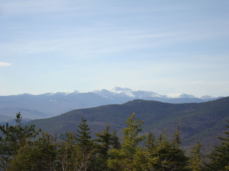
After heading over to the highpoint and Maine view, I went back to the trail junction and took in the Presidential views in nice, bug-free conditions. While I was tempted to find a less muddy way back, I opted to retrace my steps.
| Hike Ratings |
|
Getting To Trailhead: |
Moderate |
| Destination: |
Black Cap |
|
Length: |
Moderate |
|
Steepness: |
Moderate |
|
Navigation: |
Moderate |
|
Views: |
Excellent |
|
Crowds: |
Minimal |
|
| Hike Stats |
|
Date Hiked: |
Friday, April 30, 2010 |
| Hike Commenced: |
3:38 PM |
| Parking Elevation: |
535' |
| Destination: |
Black Cap |
| Ascent Commenced: |
3:47 PM |
| Summit Reached: |
5:01 PM |
| Time Elapsed: |
01:14 |
| Trailhead Elevation: |
702' |
| Summit Elevation: |
2,369' |
| Distance: |
3.6 miles |
| Vertical Gain: |
1,917' |
|
|
| Hike Ended: |
6:15 PM |
| Hike Time Elapsed: |
02:37 |
| Hike Distance: |
8.4 miles |
| Hike Vertical Gain: |
2,334' |
|
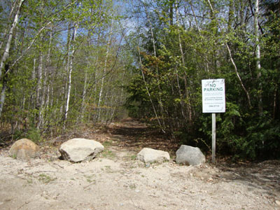
The Black Cap Connector trailhead at the end of Thompson Road
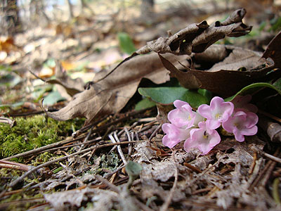
Trailing arbutus as seen along the Black Cap Connector

The Presidentials as seen from Black Cap

Directions to trailhead: From Routes 16/302 in North Conway, take Artist Falls Road past the railroad tracks. Take a right onto Thompson Road. A small Town of Conway/Pudding Pond Conservation Area signed parking lot will be on the right shortly thereafter. From there, one walk up Thompson Road, bearing left around a corner, then bearing left at a junction further up. The Black Cap Connector starts at the top of the road at a private turn-around area.
Back to Black Cap Profile
|