Home
States
Colorado
Connecticut
Maine
Massachusetts
New Hampshire
New York
Rhode Island
Utah
Vermont
View All
Lists
NE 4,000 Footers
NE 100 Highest
NH 4,000 Footers
NH 100 Highest
NH 52 With A View
NH Belknap Range
NH Ossipee 10
Links
Trail Conditions
Trip Log
Sunrises
Sunsets
About
|
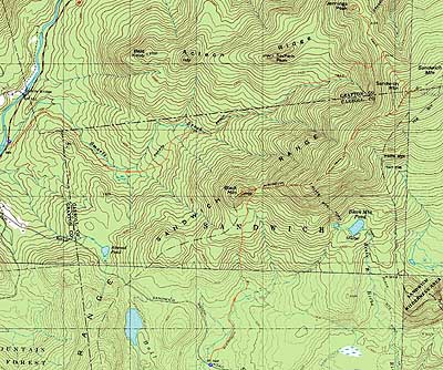
Black Mountain, Sandwich Mountain, Jennings Peak
Sandwich, NH, Waterville Valley, NH, Thornton, NH
Trailheads, measurements, times, distances, and maps are all approximate and relative to the hike(s) as shown below.
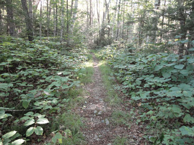
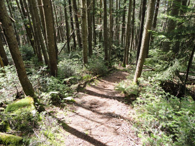
The Algonquin Trail on the way to Black Mountain
Route: Algonquin Trail, bushwhack, (Black Mountain), bushwhack, Algonquin Trail, Sandwich Mountain Trail, (Sandwich Dome), Sandwich Mountain Trail, Jennings Peak Spur, (Jennings Peak), Jennings Peak Spur, Sandwich Mountain Trail, Smarts Brook Trail
With a nice day forecasted, we decided to do a Sandwich Dome traverse. After spotting a vehicle at the Smarts Brook Trail trailhead on Route 49, we headed up Sandwich Notch Road and set foot on the Algonquin Trail.
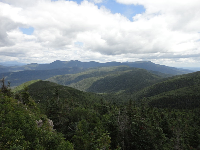
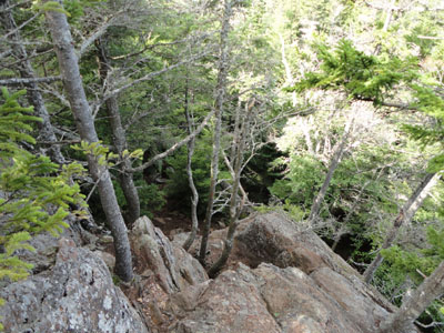
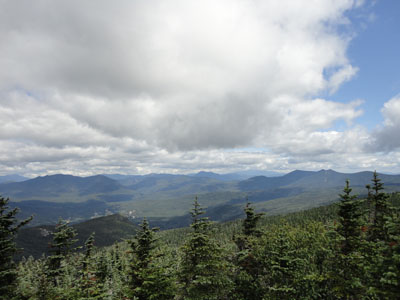
After passing through the flats and crossing a brook, the trail eventually steepened as it worked up to the col. Reaching the col, we bushwhacked to our left up to Black Mountain. After reaching the highpoint (at or near a cairn), we pushed over to an excellent view ledge, revealing superb 180 degree views of the Lakes Region.
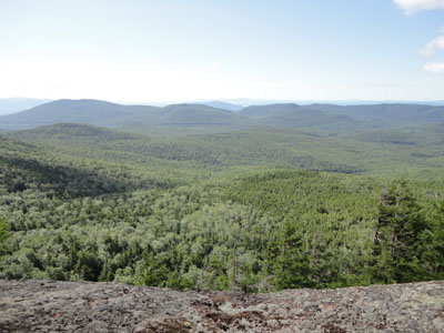
Back on the Algonquin Trail, we headed up the somewhat challenging scrambles and eventually found ourselves on the scrubby subpeak of Sandwich Dome, where we had excellent on trail views.
After dropping into the col, the trail worked its way to the Sandwich Mountain Trail and then the quick walk to the summit.
Though the skies were much cloudier than forecasted in previous days, the views were still decent. I can't help but wonder if the views will disappear in the next decade or so as the trees continue to grow.
After a lunch break on the increasingly crowded summit, we headed down the Sandwich Mountain Trail over to the Jennings Peak Spur. Interestingly enough, Jennings Peak was mobbed in comparison to the busy Sandwich Dome summit. Nonetheless, there were good views from the various ledges.
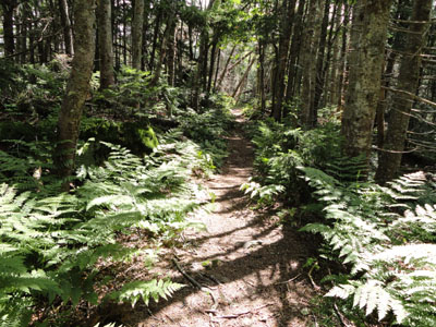
Climbing back up to the Smarts Brook Trail (which we had passed on the way to Jennings), we headed down steeply at first, then gradually for the balance of the walk out. While the footing was generally descent (except for a rocky area near a water crossing), the trail seemed to drag on for quite awhile, especially as it turned into a logging road (working its way through various clearcuts).
Navigation was a bit tricky in these lower elevations, as the yellow blazes went in multiple directions in a few places. In addition, the trail signs down low were also a bit confusing, as it was hard to see which was the hiking trail and ski trail. It was obvious, however, that we had to continue downhill, so we followed the logging road bit and eventually took the turnoff to drop down and head out to the highway.
Perhaps it wasn't fair to hike the Smarts Brook Trail on the same day as the superb Algonquin Trail, but nonetheless it didn't seem to be in the same league as Algonquin, Sandwich Mountain, or Drakes Brook.
| Hike Ratings |
|
Getting To Trailhead: |
Easy |
| Destination: |
Black Mountain |
|
Length: |
Moderate |
|
Steepness: |
Difficult |
|
Navigation: |
Difficult |
|
Views: |
Excellent |
|
Crowds: |
Minimal |
| Destination: |
Sandwich Dome |
|
Length: |
Moderate |
|
Steepness: |
Very Difficult |
|
Navigation: |
Difficult |
|
Views: |
Excellent |
|
Crowds: |
Heavy |
| Destination: |
Jennings Peak |
|
Length: |
Moderate |
|
Steepness: |
Difficult |
|
Navigation: |
Easy |
|
Views: |
Excellent |
|
Crowds: |
Heavy |
|
| Hike Stats |
| Date Hiked: |
Saturday, July 31, 2010 |
| Hike Commenced: |
8:09 AM |
| Parking Elevation: |
1,420' |
| Destination: |
Black Mountain |
| Ascent Commenced: |
8:09 AM |
| Summit Reached: |
9:09 AM |
| Time Elapsed: |
01:00 |
| Trailhead Elevation: |
1,430' |
| Summit Elevation: |
2,732' |
| Vertical Gain: |
1,337' |
| Destination: |
Sandwich Dome |
| Ascent Commenced: |
9:20 AM |
| Summit Reached: |
11:14 AM |
| Time Elapsed: |
01:54 |
| Trailhead Elevation: |
2,732' |
| Summit Elevation: |
3,980' |
| Vertical Gain: |
1,520' |
| Destination: |
Jennings Peak |
| Ascent Commenced: |
11:39 AM |
| Summit Reached: |
12:12 PM |
| Time Elapsed: |
00:33 |
| Trailhead Elevation: |
3,980' |
| Summit Elevation: |
3,460' |
| Vertical Gain: |
205' |
|
|
| Hike Ended: |
2:58 PM |
| Hike Time Elapsed: |
06:49 |
| Hike Vertical Gain: |
3,232' |
|
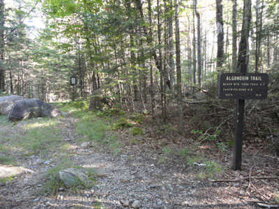
The Algonquin Trail trailhead
Looking at the Squam Range from Black Mountain
Looking down the Algonquin Trail on the way to Sandwich Dome
Looking the Osceolas and Tripyramids from Sandwich Dome
The Sandwich Mountain Trail on the way to Jennings Peak
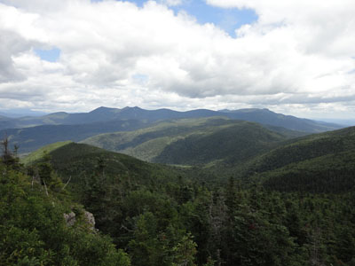
Looking at the Sandwich Range from Jennings Peak
Looking down the upper portion of Smarts Brook Trail
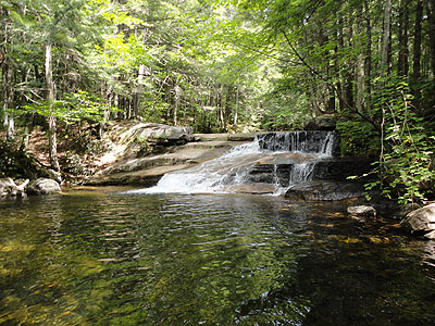
Waterfalls near the Smarts Brook Trail

Directions to trailhead: Take Route 109 into Center Sandwich. Route 113 will enter on your right and bear left shortly thereafter. Go straight onto Grove Street instead, then bear left onto Diamond Ledge Road. Sandwich Notch Road will be on the left a few minutes up this road. The Algonquin Trail trailhead and very small parking area will be on the right a few minutes after passing under some high tension power lines, and just before a water crossing. To reach the Smarts Brook Trail, take Route 49 North from Sandwich Notch Road. The WMNF fee parking area will be on the right shortly thereafter. The Smarts Brook Trail trailhead is just south of the parking area, on the other side of the brook.
Back to Black Mountain Profile
Back to Sandwich Dome Profile
Back to Jennings Peak Profile
|