Home
States
Colorado
Connecticut
Maine
Massachusetts
New Hampshire
New York
Rhode Island
Utah
Vermont
View All
Lists
NE 4,000 Footers
NE 100 Highest
NH 4,000 Footers
NH 100 Highest
NH 52 With A View
NH Belknap Range
NH Ossipee 10
Links
Trail Conditions
Trip Log
Sunrises
Sunsets
About
|
Cranmore Mountain
Conway, NH
Trailheads, measurements, times, distances, and maps are all approximate and relative to the hike(s) as shown below.
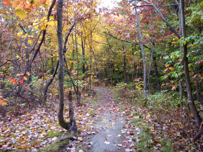
Looking down the Mt. Cranmore Trail
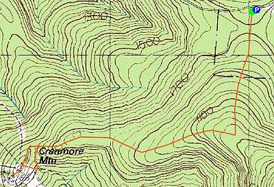
Route: Black Cap Trail, Mt. Cranmore Trail, Easy Street, (Cranmore Mountain), unknown road, Mt. Cranmore Trail, Black Cap Trail
With the intent of hiking Iron Mountain, I changed my plans when I saw rain starting at Kearsarge North Mountain and points north. Thus, I stayed just to the south and headed up Hurricane Mountain Road.
The Black Cap Trail was fairly tame up to the Mt. Cranmore Trail junction. From there, the Mt. Cranmore Trail descended gently, with the exception of a steeper drop near the communications tower. At the tower, the trail markings vanished - one could go forward or left. I went left, then headed down a road, which emptied out onto the ski slopes a bit below the summit.
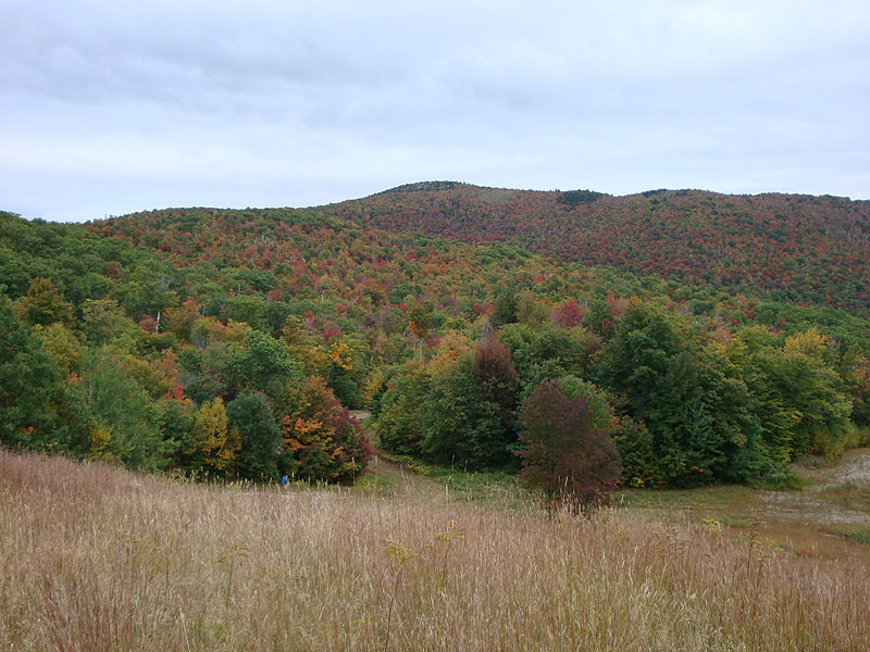
The views were quite good - the foliage below Black Cap and Peaked was particularly striking. For the return trip, I followed a road off the summit toward another tower, which then lead to the first tower and the trail.
| Hike Ratings |
|
Getting To Trailhead: |
Easy |
| Destination: |
Cranmore Mountain |
|
Length: |
Moderate |
|
Steepness: |
Moderate |
|
Navigation: |
Moderate |
|
Views: |
Excellent |
|
Crowds: |
Minimal |
|
| Hike Stats |
|
Date Hiked: |
Wednesday, September 30, 2009 |
| Hike Commenced: |
3:59 PM |
| Parking Elevation: |
1,705' |
| Destination: |
Cranmore Mountain |
| Ascent Commenced: |
3:59 PM |
| Summit Reached: |
4:42 PM |
| Time Elapsed: |
00:43 |
| Trailhead Elevation: |
1,705' |
| Summit Elevation: |
1,667' |
| Vertical Gain: |
372' |
|
|
| Hike Ended: |
5:35 PM |
| Hike Time Elapsed: |
01:36 |
| Hike Vertical Gain: |
752' |
|
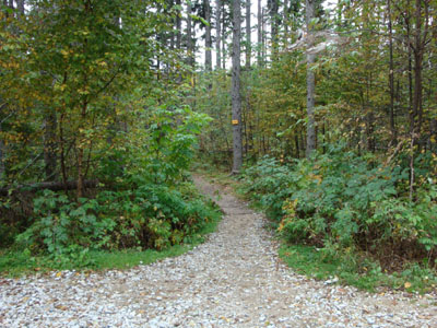
Black Cap Trail trailhead

Looking at Black Cap near the summit of Cranmore Mountain

Directions to trailhead: Take Route 16 North from North Conway. Take a right onto Hurricane Mountain Road. Go past the Kearsarge North Trail trailhead, past the gate, and to the top of the mountain. Parking area and trailhead are on the right.
Back to Cranmore Mountain Profile
|