Home
States
Colorado
Connecticut
Maine
Massachusetts
New Hampshire
New York
Rhode Island
Utah
Vermont
View All
Lists
NE 4,000 Footers
NE 100 Highest
NH 4,000 Footers
NH 100 Highest
NH 52 With A View
NH Belknap Range
NH Ossipee 10
Links
Trail Conditions
Trip Log
Sunrises
Sunsets
About
|
Diamond Peaks
Second College Grant, NH
Trailheads, measurements, times, distances, and maps are all approximate and relative to the hike(s) as shown below.
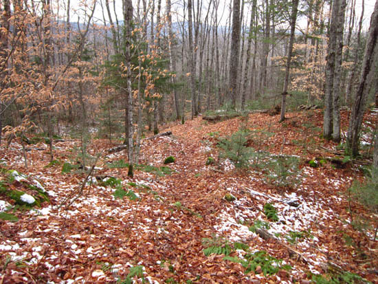
The Diamond Peaks Trail
Route: Dead Diamond Road, Diamond Peaks Trail
Though a relatively short hiking trail, the route up Diamond Peaks is a bit longer due to a 2.2 mile road walk. The highpoint of the ridge appeared to be just off trail before the final cliff viewpoint.
| Hike Ratings |
|
Getting To Trailhead: |
Difficult |
| Destination: |
Diamond Peaks |
|
Length: |
Moderate |
|
Steepness: |
Moderate |
|
Navigation: |
Moderate |
|
Views: |
Excellent |
|
Crowds: |
Minimal |
|
| Hike Stats |
|
Date Hiked: |
Saturday, November 12, 2011 |
| Parking Elevation: |
1,260' |
| Time To Trailhead: |
00:40 |
| Distance to Trailhead: |
2.2 miles |
| Destination: |
Diamond Peaks |
| Time Elapsed: |
00:35 |
| Trailhead Elevation: |
1,350' |
| Summit Elevation: |
2,050' |
| Distance: |
1.1 miles |
| Vertical Gain: |
760' |
|
|
| Hike Time Elapsed: |
02:38 |
| Hike Vertical Gain: |
1,000' |
|
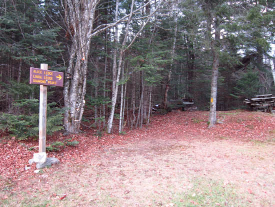
The Diamond Peaks Trail trailhead
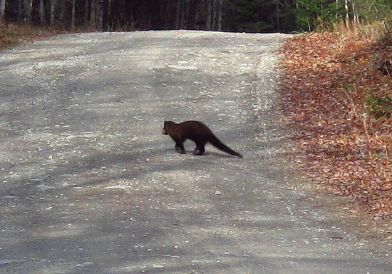
A critter crossing Dead Diamond Road
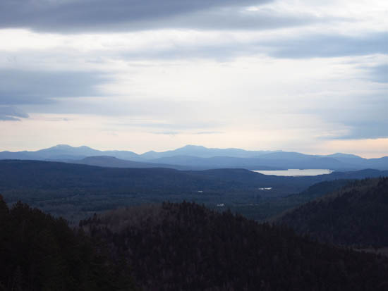
Looking south at Grafton Notch from Diamond Peak
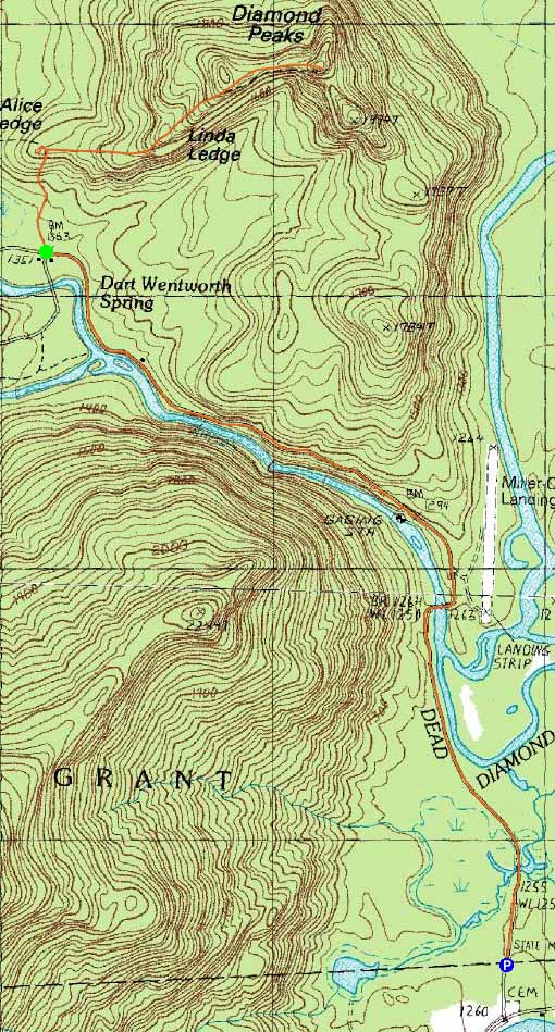

Directions to trailhead: Take Route 16 North from Errol, past the Mt. Dunstan Store. Take a left onto Dead Diamond Road. There is a small parking area on the right just before the gate. Continue on foot up the road. The Diamond Peaks Trail trailhead will eventually be on the right, across from the Dartmouth Management Center complex.
Back to Diamond Peaks Profile
|

