Home
States
Colorado
Connecticut
Maine
Massachusetts
New Hampshire
New York
Rhode Island
Utah
Vermont
View All
Lists
NE 4,000 Footers
NE 100 Highest
NH 4,000 Footers
NH 100 Highest
NH 52 With A View
NH Belknap Range
NH Ossipee 10
Links
Trail Conditions
Trip Log
Sunrises
Sunsets
About
|
Welch Mountain, Dickey Mountain
Thornton, NH, Waterville Valley, NH
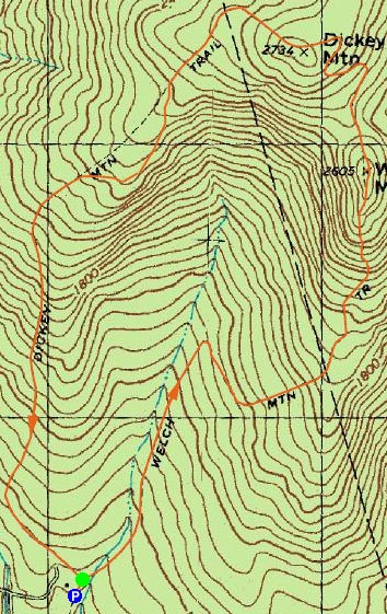
Trailheads, measurements, times, distances, and maps are all approximate and relative to the hike(s) as shown below.
Heading up the Welch Mountain Trail to the Welch Mountain summit
Route: Welch Mountain Trail, Dickey Mountain Trail
What a fun hike!
I started at the trailhead a bit later than I had planned. With a limited window of sunlight (due to time of day and approaching clouds), I was certainly feeling rushed.
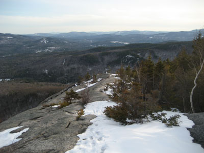
Starting up the Welch Mountain Trail part of the Welch-Dickey Loop, things became really scenic after about half an hour, reaching the ledges below the summit. From here there are excellent views in nearly every direction. This is also where the trail goes from a moderate pitch to some very basic scrambling, as there are some small rock faces that either need to be climbed up or traversed.
The view from the top of Welch Mountain was excellent - ranging from the Tripyramids to Kearsarge (South) to Gunstock.
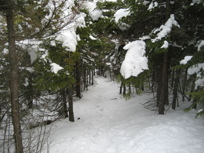
The trail then dips into a small evergreen forest (it makes you feel like a giant!), before ascending to the top of Dickey Mountain via some short, steep rocky sections. The better views are just before the summit - I was in a rush, so I didn't get a chance to take these in for too long. The summit itself is viewless, however there are additional views from ledges east and south of it.
One of the neatest parts of the hike comes a little bit south of the summit, as the trail follows along the side of a huge rock outcropping. As nice as the other views are earlier, I would say this would be the place to eat lunch if you were to make a day hike out of this...just don't get too close to the side!
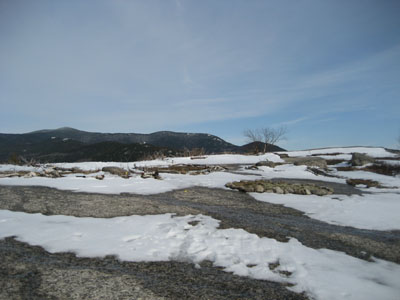
From here, the trail continues moderately back to the parking lot.
On the whole, this isn't an overly challenging hike, however with the slush and the small climbing sections, it certainly provided a little bit of difficulty.
| Hike Ratings |
|
Getting To Trailhead: |
Easy |
| Destination: |
Welch Mountain |
|
Length: |
Moderate |
|
Steepness: |
Difficult |
|
Navigation: |
Easy |
|
Views: |
Excellent |
|
Crowds: |
Minimal |
| Destination: |
Dickey Mountain |
|
Length: |
Moderate |
|
Steepness: |
Difficult |
|
Navigation: |
Easy |
|
Views: |
Excellent |
|
Crowds: |
Minimal |
|
| Hike Stats |
|
Date Hiked: |
Tuesday, April 10, 2007 |
| Hike Commenced: |
4:26 PM |
| Parking Elevation: |
1,080' |
| Destination: |
Welch Mountain |
| Ascent Commenced: |
4:27 PM |
| Summit Reached: |
5:21 PM |
| Time Elapsed: |
00:54 |
| Trailhead Elevation: |
1,090' |
| Summit Elevation: |
2,605' |
| Distance: |
2 miles |
| Vertical Gain: |
1,545' |
| Destination: |
Dickey Mountain |
| Ascent Commenced: |
5:24 PM |
| Summit Reached: |
5:35 PM |
| Time Elapsed: |
00:11 |
| Trailhead Elevation: |
2,600' |
| Summit Elevation: |
2,734' |
| Distance: |
.5 mile |
| Vertical Gain: |
314' |
|
|
| Hike Ended: |
6:41 PM |
| Hike Time Elapsed: |
02:15 |
| Hike Distance: |
4.5 miles |
| Hike Vertical Gain: |
1,899' |
|
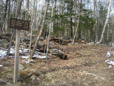
Welch Mountain Trail trailhead
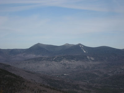
Looking northeast at Mt. Tripyramid from the Welch Mountain summit
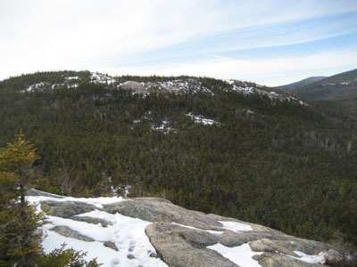
Trail to Dickey Mountain from Welch Mountain
Heading over to Dickey Mountain from Welch Mountain
Heading down the Dickey Mountain Trail to the trailhead
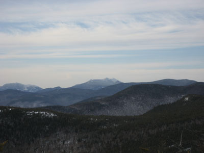
Looking northwest at the Franconia Notch area from near the Dickey Mountain summit

Directions to trailhead: Take Route 49 to Six Mile Bridge - take a left there and go up the hill. Take a right onto Orris Road. National Forest pay parking lot will be on the right after a short drive.
Back to Dickey Mountain Profile
Back to Welch Mountain Profile
|


