Home
States
Colorado
Connecticut
Maine
Massachusetts
New Hampshire
New York
Rhode Island
Utah
Vermont
View All
Lists
NE 4,000 Footers
NE 100 Highest
NH 4,000 Footers
NH 100 Highest
NH 52 With A View
NH Belknap Range
NH Ossipee 10
Links
Trail Conditions
Trip Log
Sunrises
Sunsets
About
|
Eustis Hill
Littleton, NH
Trailheads, measurements, times, distances, and maps are all approximate and relative to the hike(s) as shown below.
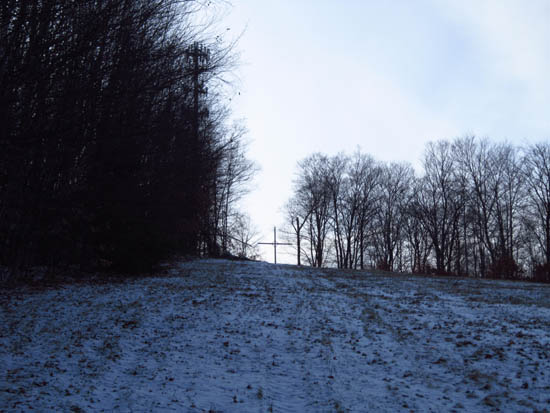
Looking up the Eustis Hill ski slope
Route: Access road, ski trail, herd path
A quick hike up the Mt. Eustis ski area followed by a faint herd path/old trail to the wooded summit.
| Hike Ratings |
|
Getting To Trailhead: |
Easy |
| Destination: |
Eustis Hill |
|
Length: |
Moderate |
|
Steepness: |
Difficult |
|
Navigation: |
Difficult |
|
Views: |
Excellent |
|
Crowds: |
Minimal |
|
| Hike Stats |
|
Date Hiked: |
Saturday, December 17, 2011 |
| Parking Elevation: |
1,140' |
| Destination: |
Eustis Hill |
| Time Elapsed: |
00:13 |
| Trailhead Elevation: |
1,140' |
| Summit Elevation: |
1,373' |
| Vertical Gain: |
233' |
|
|
| Hike Time Elapsed: |
00:26 |
| Hike Vertical Gain: |
233' |
|
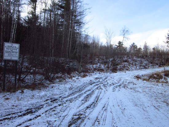
The beginning of the old ski area access road

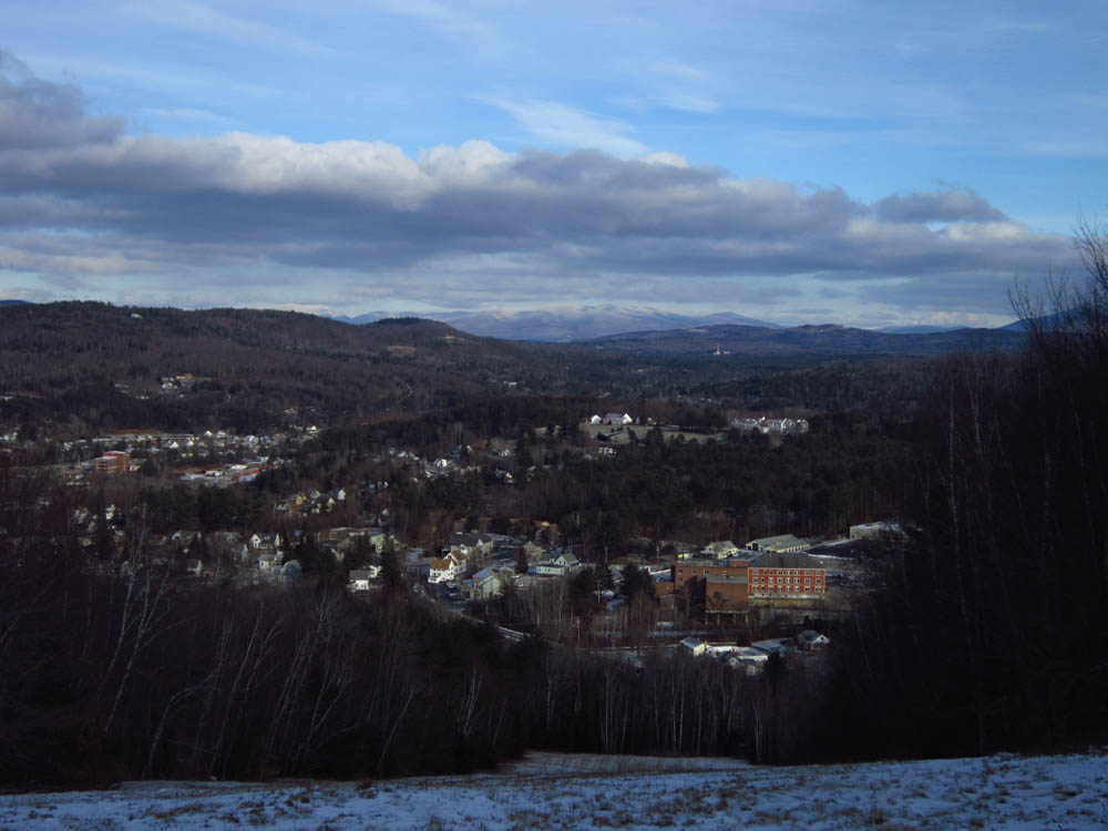
Looking in the distance at the Kilkenny region from the top of the old ski area on Eustis Hill
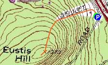

Directions to trailhead: From US 302 on the east side of Littleton, take Mt. Eustis Road under I-93. Almost immediately after passing I-93 and a side road, there is a parking area on the right, where the access road to the ski area starts.
Back to Eustis Hill Profile
|