Home
States
Colorado
Connecticut
Maine
Massachusetts
New Hampshire
New York
Rhode Island
Utah
Vermont
View All
Lists
NE 4,000 Footers
NE 100 Highest
NH 4,000 Footers
NH 100 Highest
NH 52 With A View
NH Belknap Range
NH Ossipee 10
Links
Trail Conditions
Trip Log
Sunrises
Sunsets
About
|
Foss Mountain
Eaton, NH
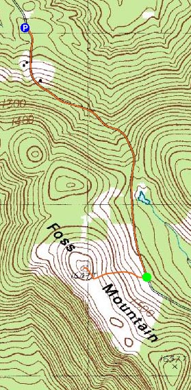
Trailheads, measurements, times, distances, and maps are all approximate and relative to the hike(s) as shown below.
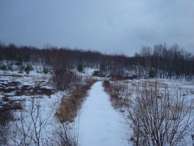
Looking up the Foss Mountain Trail
Route: Foss Mountain Road, Foss Mountain Trail, (Foss Mountain North Peak), Foss Mountain Trail, Foss Mountain Road
Though the cloud cover looked discouraging, we nonetheless decided to continue with plans to hike Foss Mountain for the sunset. With the recent snow and rain, we decided to park at the winter parking lot. Though it was probably possible to make it to the the summer parking area, the upper portion of the road was unplowed, with upwards of 8" of crust and ice coated snow.
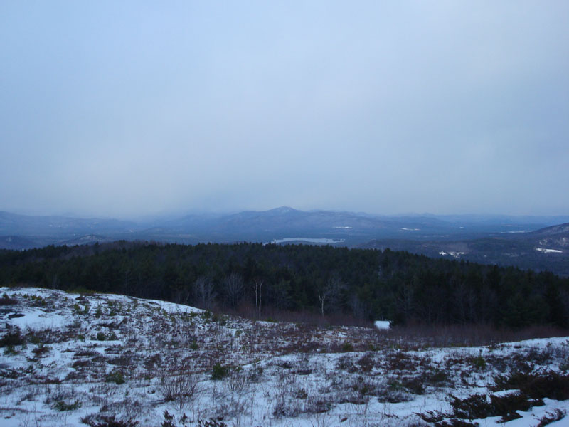
As we climbed the Foss Mountain Trail, we could see some light to the southeast. Upon clearing the ridge, we were quite happy to see the southwest was also in the clear. Meanwhile, the White Mountains looked to be in the midst of a snowstorm.
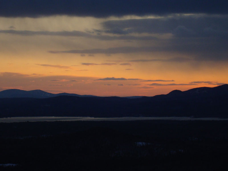
Though it was rather cold standing on the windy, open summit, we nonetheless waited until sunset and were rewarded with some excellent colors over the Belknaps and southern Ossipee Mountains.
Thanks to the snow, we were able to return to the winter parking lot without needing to use headlamps. A rewarding hike!
| Hike Ratings |
|
Getting To Trailhead: |
Moderate |
| Destination: |
Foss Mountain (North Peak) |
|
Length: |
Moderate |
|
Steepness: |
Moderate |
|
Navigation: |
Easy |
|
Views: |
Excellent |
|
Crowds: |
Minimal |
|
| Hike Stats |
|
Date Hiked: |
Tuesday, December 2, 2008 |
| Hike Commenced: |
2:46 PM |
| Parking Elevation: |
1,070' |
| Destination: |
Foss Mountain (North Peak) |
| Ascent Commenced: |
3:17 PM |
| Summit Reached: |
3:29 PM |
| Time Elapsed: |
00:12 |
| Trailhead Elevation: |
1,420' |
| Summit Elevation: |
1,647' |
| Distance: |
.5 mile |
| Vertical Gain: |
247' |
|
|
| Hike Ended: |
5:03 PM |
| Hike Time Elapsed: |
02:17 |
| Hike Vertical Gain: |
717' |
|
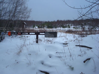
The Foss Mountain Trail trailhead next to the seasonal portion of Foss Mountain Road
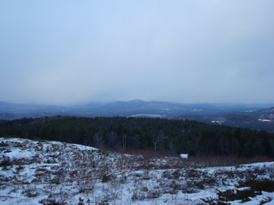
Looking north at Kearsarge North Mountain from the north peak of Foss Mountain
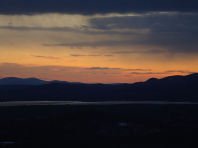
Sunset colors above Ossipee Lake and between the Belknaps and Ossipees as seen from the north peak of Foss Mountain

Directions to trailhead: Take Route 153 North to Brownfield Road. Take a right onto Bull Pasture Road. Take a right onto Stewart Road. Take a left onto Foss Mountain Road. The winter parking area is up the road a bit on the right hand side. The Foss Mountain Trail trailhead is about a mile further up the road on the right.
Back to Foss Mountain Profile
|