Home
States
Colorado
Connecticut
Maine
Massachusetts
New Hampshire
New York
Rhode Island
Utah
Vermont
View All
Lists
NE 4,000 Footers
NE 100 Highest
NH 4,000 Footers
NH 100 Highest
NH 52 With A View
NH Belknap Range
NH Ossipee 10
Links
Trail Conditions
Trip Log
Sunrises
Sunsets
About
|
Frenchs Ledge
Plainfield, NH
Trailheads, measurements, times, distances, and maps are all approximate and relative to the hike(s) as shown below.

The blue trail to Frenchs Ledge
Route: Blue trail, French's Ledges Trail
Trails were snow free and mostly dry.
Took the shortest route to the peak, which meandered around some marshes and ledges. Blue Trail may be a good one to avoid during mosquito season.
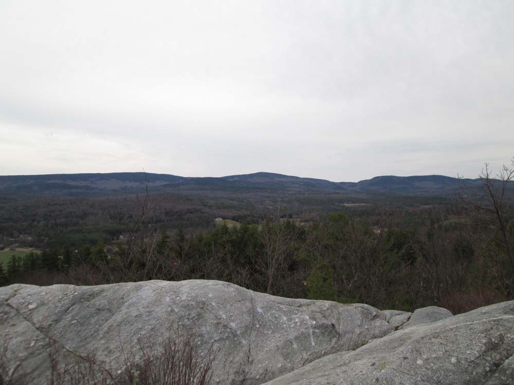
Surprisingly fantastic views from the summit dome - nearly 360 degrees. Excellent looks at Ascutney, Okemo, Killington, peaks to the north, and nearby Croydon. Would be an excellent summit for a sunrise or sunset.
| Hike Ratings |
|
Getting To Trailhead: |
Easy |
| Destination: |
Frenchs Ledge |
|
Length: |
Easy |
|
Steepness: |
Difficult |
|
Navigation: |
Easy |
|
Views: |
Excellent |
|
Crowds: |
Minimal |
|
| Hike Stats |
|
Date Hiked: |
Friday, April 25, 2014 |
| Parking Elevation: |
1,210' |
| Destination: |
Frenchs Ledge |
| Time Elapsed: |
00:12 |
| Trailhead Elevation: |
1,210' |
| Summit Elevation: |
1,370' |
| Vertical Gain: |
200' |
|
|
| Hike Time Elapsed: |
00:28 |
| Hike Vertical Gain: |
240' |
|

The blue trail trailhead on Columbus Jordan Road

Looking southeast at Croydon Mountain from Frenchs Ledge


Directions to trailhead: From Route 120 in Meriden, take Main Street west, then take a left onto Colby Hill Road (crossing a covered bridge). Take a left onto Columbus Jordan Road. The blue trail trailhead and small parking area will eventually be on the left shortly after passing a field on the left.
Back to Frenchs Ledge Profile
|