Home
States
Colorado
Connecticut
Maine
Massachusetts
New Hampshire
New York
Rhode Island
Utah
Vermont
View All
Lists
NE 4,000 Footers
NE 100 Highest
NH 4,000 Footers
NH 100 Highest
NH 52 With A View
NH Belknap Range
NH Ossipee 10
Links
Trail Conditions
Trip Log
Sunrises
Sunsets
About
|
Galehead Mountain, South Twin Mountain, North Twin Mountain
Bethlehem, NH, Franconia, NH
Trailheads, measurements, times, distances, and maps are all approximate and relative to the hike(s) as shown below.

The Gale River Trail
Route: Gale River Trail, Garfield Ridge Trail, Frost Trail, (Galehead Mountain), Frost Trail, (Galehead Hut), Frost Trail, Twinway, (South Twin Mountain), North Twin Spur, (North Twin Mountain), North Twin Spur, (South Twin Mountain), Twinway, Frost Trail, (Galehead Hut), Frost Trail, Garfield Ridge Trail, Gale River Trail
A forecasted sunny day - holy cow! A day off was in order so that I could witness this thing they call blue sky.
The Gale River Trail was a bit muddy to start, likely due to weeks of rain. Though a bit high, the water crossings were nonetheless doable.
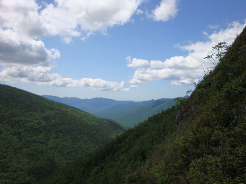
Reaching the hut, I was glad to see the Twins were mostly in the clear. After reaching the summit of Galehead, I headed down to the view ledge (and then down to a ledge just below it) and enjoyed the view to the south for a bit.
After passing the hut, I realized I was very low on energy - not enough sleep after an afternoon/evening hike. Nonetheless, I eventually made it to the top of South Twin and then North Twin.
Back at South Twin and happy to know the last of the significant vertical climbs were behind me, I lounged in the sun and took in the views for a good half hour.
The Gale River Trail seemed less muddy, yet longer, during the descent. Nonetheless, a nice rain-free day - finally!
| Hike Ratings |
|
Getting To Trailhead: |
Easy |
| Destination: |
Galehead Mountain |
|
Length: |
Moderate |
|
Steepness: |
Difficult |
|
Navigation: |
Easy |
|
Views: |
Moderate |
|
Crowds: |
Moderate |
| Destination: |
South Twin Mountain |
|
Length: |
Difficult |
|
Steepness: |
Difficult |
|
Navigation: |
Easy |
|
Views: |
Excellent |
|
Crowds: |
Moderate |
| Destination: |
North Twin Mountain |
|
Length: |
Difficult |
|
Steepness: |
Moderate |
|
Navigation: |
Easy |
|
Views: |
Excellent |
|
Crowds: |
Moderate |
|
| Hike Stats |
|
Date Hiked: |
Friday, July 10, 2009 |
| Hike Commenced: |
8:32 AM |
| Parking Elevation: |
1,610' |
| Destination: |
Galehead Mountain |
| Ascent Commenced: |
8:32 AM |
| Summit Reached: |
10:51 AM |
| Time Elapsed: |
02:19 |
| Trailhead Elevation: |
1,610' |
| Summit Elevation: |
4,024' |
| Distance: |
5.1 miles |
| Vertical Gain: |
2,609' |
| Destination: |
South Twin Mountain |
| Ascent Commenced: |
11:00 AM |
| Summit Reached: |
11:49 AM |
| Time Elapsed: |
00:49 |
| Trailhead Elevation: |
4,024' |
| Summit Elevation: |
4,902' |
| Distance: |
1.3 miles |
| Vertical Gain: |
1,187' |
| Destination: |
North Twin Mountain |
| Ascent Commenced: |
11:54 AM |
| Summit Reached: |
12:28 PM |
| Time Elapsed: |
00:34 |
| Trailhead Elevation: |
4,902' |
| Summit Elevation: |
4,761' |
| Distance: |
1.3 miles |
| Vertical Gain: |
321' |
|
|
| Hike Ended: |
4:36 PM |
| Hike Time Elapsed: |
08:04 |
| Hike Distance: |
14.4 miles |
| Hike Vertical Gain: |
4,754' |
|

The Gale River Trail trailhead

Wildflowers near the Galehead hut

Looking south from near the summit of Galehead Mountain

The Twinway to South Twin Mountain

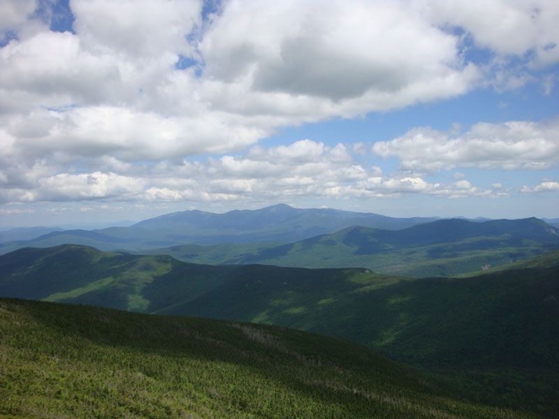
Looking at Mt. Washington from the South Twin Mountain summit

The North Twin Spur Trail on the way to North Twin Mountain

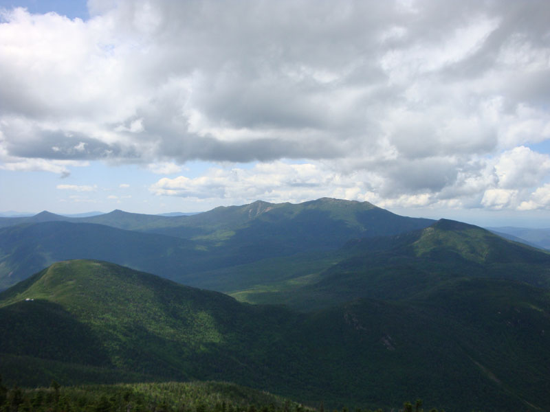
Looking Galehead, the Franconias, and Garfield from near the summit of North Twin Mountain


Directions to trailhead: Take Route 3 South from US 302. Take a left for the Gale River camping/hiking area. Shortly after, bear left at the fork in the road. Continue down the road, then take a right at the hiker sign. The WMNF fee parking area is on the left. There is a Gale River Trail trailhead on the side of the parking area.
Back to Galehead Mountain Profile
Back to South Twin Mountain Profile
Back to North Twin Mountain Profile
|