Home
States
Colorado
Connecticut
Maine
Massachusetts
New Hampshire
New York
Rhode Island
Utah
Vermont
View All
Lists
NE 4,000 Footers
NE 100 Highest
NH 4,000 Footers
NH 100 Highest
NH 52 With A View
NH Belknap Range
NH Ossipee 10
Links
Trail Conditions
Trip Log
Sunrises
Sunsets
About
|
Great Hill
Tamworth, NH
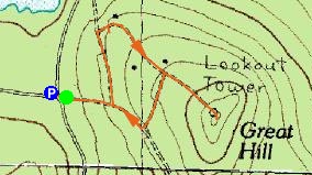
Trailheads, measurements, times, distances, and maps are all approximate and relative to the hike(s) as shown below.
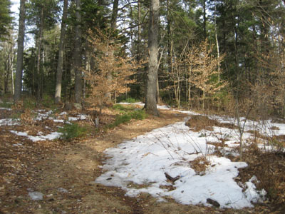
Heading up toward the abandoned cabins to the Great Hill summit
Missing out on hiking on Friday and Saturday, two of the nicest days of the spring so far, was certainly a let down. With a storm moving in and limited time before I had to get back to Massachusetts, I decided to do a quick hike up to the firetower on Great Hill.
Great Hill isn't really visible from the valley around it. Initially, I was going to hike on via the north side. However, after seeing it was a long flat road, I decided to try the southeastern approach - shorter and more to the point.
The trail, actually a cross country ski trail, was muddy, slushy, and icy. There is no obvious signage pointing to the firetower. On my ascent, I took the first left and followed the trail through some odd abandoned houses and cabins.
Once in the cabin of the fire tower, I was rewarded with a tremendous view of Chocorua, Whiteface, Red Hill, and more.
While not a destination hike by any means, this is certainly a worthwhile one if you're in the area.
| Hike Ratings |
|
Getting To Trailhead: |
Easy |
| Destination: |
Great Hill |
|
Length: |
Easy |
|
Steepness: |
Easy |
|
Navigation: |
Moderate |
|
Views: |
Excellent |
|
Crowds: |
Minimal |
|
| Hike Stats |
|
Date Hiked: |
Sunday, April 1, 2007 |
| Hike Commenced: |
4:30 PM |
| Parking Elevation: |
1,020' |
| Destination: |
Great Hill |
| Ascent Commenced: |
4:31 PM |
| Summit Reached: |
4:43 PM |
| Time Elapsed: |
00:12 |
| Trailhead Elevation: |
1,025' |
| Summit Elevation: |
1,270' |
| Vertical Gain: |
255' |
|
|
| Hike Ended: |
5:00 PM |
| Hike Time Elapsed: |
00:30 |
| Hike Vertical Gain: |
265' |
|
Trailhead to Great Hill summit
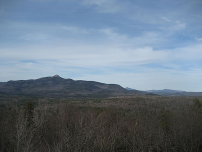
Looking north from the Great Hill summit at Mount Chocorua, Mt. Kearsarge North, and Cranmore Mountain.

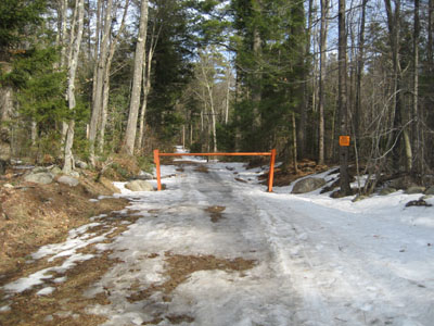
Directions to trailhead: Take Great Hill Road from Tamworth Village. Parking area a few miles up once road turns to dirt. Trail to firetower starts at orange gate on uphill side of parking area.
Back to Great Hill Profile
|

