Home
States
Colorado
Connecticut
Maine
Massachusetts
New Hampshire
New York
Rhode Island
Utah
Vermont
View All
Lists
NE 4,000 Footers
NE 100 Highest
NH 4,000 Footers
NH 100 Highest
NH 52 With A View
NH Belknap Range
NH Ossipee 10
Links
Trail Conditions
Trip Log
Sunrises
Sunsets
About
|
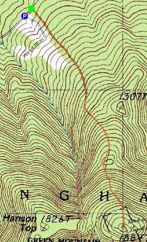
Green Mountain
Effingham, NH
Trailheads, measurements, times, distances, and maps are all approximate and relative to the hike(s) as shown below.
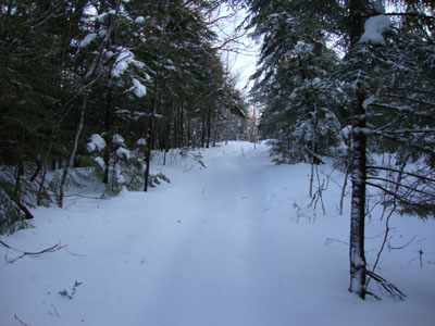
Heading up the High Watch Trail to the Green Mountain summit
Route: High Watch Trail
Though the forecast wasn't looking great, the skies were clearing. Thus, I opted to do a somewhat quick local hike.
While there was only about an inch or two of new wet granular at the base, I decided to don my snowshoes. This proved to be a good decision, as the snow was closer to 5" deep up higher (in addition to the consolidated base under it). Taking off my snowshoes to climb the tower, I postholed a foot deep.
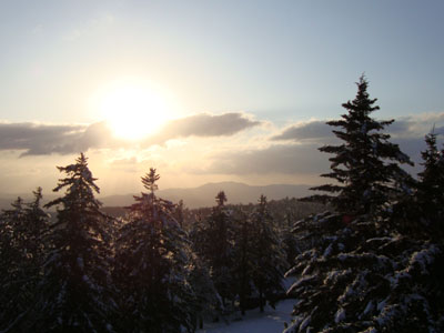
With the steps quite icy, I only climbed up four flights of stairs - just enough to get some hazy views of the Ossipee Mountains.
I tried to pack out the trail a bit more on the descent, and ended up back at the parking area around sunset.
| Hike Ratings |
|
Getting To Trailhead: |
Easy |
| Destination: |
Green Mountain |
|
Length: |
Moderate |
|
Steepness: |
Difficult |
|
Navigation: |
Easy |
|
Views: |
Excellent |
|
Crowds: |
Minimal |
|
| Hike Stats |
|
Date Hiked: |
Friday, February 26, 2010 |
| Hike Commenced: |
3:51 PM |
| Parking Elevation: |
738' |
| Destination: |
Green Mountain |
| Ascent Commenced: |
3:53 PM |
| Summit Reached: |
4:33 PM |
| Time Elapsed: |
00:40 |
| Trailhead Elevation: |
735' |
| Summit Elevation: |
1,907' |
| Distance: |
1.3 miles |
| Vertical Gain: |
1,182' |
|
|
| Hike Ended: |
5:22 PM |
| Hike Time Elapsed: |
01:31 |
| Hike Distance: |
2.6 miles |
| Hike Vertical Gain: |
1,205' |
|
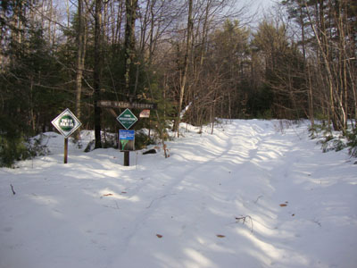
High Watch Trail trailhead
Looking at Mt. Shaw from the Green Mountain summit tower

Directions to trailhead: Take Green Mountain Road from Route 25 to High Watch Road (there will be a small 'Fire Tower' sign). At the end of this road, there will be a class four road sign. The trailhead is shortly after this on the right.
Back to Green Mountain Profile
|

