Home
States
Colorado
Connecticut
Maine
Massachusetts
New Hampshire
New York
Rhode Island
Utah
Vermont
View All
Lists
NE 4,000 Footers
NE 100 Highest
NH 4,000 Footers
NH 100 Highest
NH 52 With A View
NH Belknap Range
NH Ossipee 10
Links
Trail Conditions
Trip Log
Sunrises
Sunsets
About
|
Gunstock Mountain
Mt. Rowe
Gilford, NH
Trailheads, measurements, times, distances, and maps are all approximate and relative to the hike(s) as shown below.
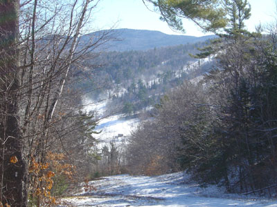
Trail to Mt. Rowe summit
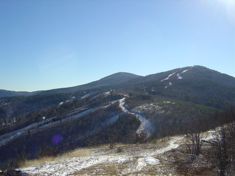
Mt. Rowe was the original location of Gunstock and its chairlift. As time passed, the ski area expanded out onto Gunstock Mountain and closed most of the Mt. Rowe complex.
Mt. Rowe is a somewhat brief, moderately steep hike which opens into the first of a hoard of views as the ridgeline is hiked to Gunstock Mountain.
| Hike Ratings |
|
Getting To Trailhead: |
Easy |
| Destination: |
Mt. Rowe |
|
Length: |
Easy |
|
Steepness: |
Moderate |
|
Navigation: |
Moderate |
|
Views: |
Excellent |
|
Crowds: |
Moderate |
| Destination: |
Gunstock |
|
Length: |
Moderate |
|
Steepness: |
Moderate |
|
Navigation: |
Difficult |
|
Views: |
Excellent |
|
Crowds: |
Minimal |
|
| Hike Stats |
|
Date Hiked: |
Saurday, December 4, 2004 |
| Hike Commenced: |
12:37 PM |
| Parking Elevation: |
935' |
| Destination: |
Mt. Rowe |
| Summit Reached: |
1:11 PM |
| Trailhead Elevation: |
950' |
| Summit Elevation: |
1,680' |
| Vertical Gain: |
730' |
| Destination: |
Gunstock |
| Ascent Commenced: |
1:18 PM at Mt. Rowe summit |
| Summit Reached: |
2:18 PM |
| Trailhead Elevation: |
1,660' |
| Summit Elevation: |
2,245' |
| Vertical Gain: |
795' |
| Hike Vertical Gain: |
1,526' |
|

Looking south at Gunstock Mountain from near the Mt. Rowe summit
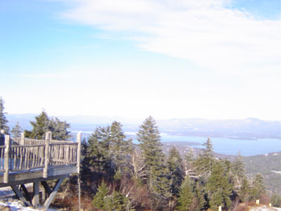
Gunstock summit, looking north-northeast at Lake Winnipesaukee
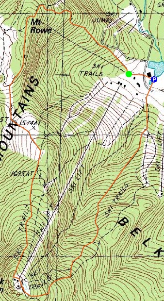

Directions to trailhead: Take Route 11A to Gunstock entrance, parking lot near the base lodge of the ski area.
Back to Mt. Rowe Profile
Back to Gunstock Mountain Profile
|