Home
States
Colorado
Connecticut
Maine
Massachusetts
New Hampshire
New York
Rhode Island
Utah
Vermont
View All
Lists
NE 4,000 Footers
NE 100 Highest
NH 4,000 Footers
NH 100 Highest
NH 52 With A View
NH Belknap Range
NH Ossipee 10
Links
Trail Conditions
Trip Log
Sunrises
Sunsets
About
|
Gunstock Mountain, Belknap Mountain
Gilmanton, NH, Gilford, NH
Trailheads, measurements, times, distances, and maps are all approximate and relative to the hike(s) as shown below.

Looking up the Gunstock Mountain Trail
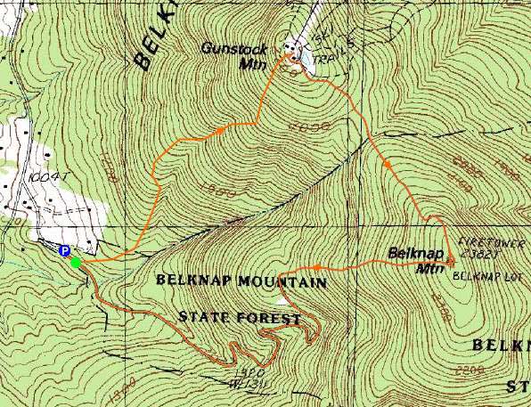
Route: Carriage Road, Gunstock Mountain Trail, (Gunstock Mountain), Saddle Trail, Blue Trail, (Belknap Mountain), Green Trail, Carriage Road
While I started off jogging, reality set in as the Gunstock Mountain Trail steepened up. While the trail was generally snow free, the Saddle Trail toward Belknap was a bit icy, forcing me to put on my Microspikes. The Blue Trail was still fairly well endowed with snow, a good one to two feet deep in places.
The Green Trail was extremely icy - frankly, Microspikes were outmatched by the blue ice from runoff in December. The Carriage Road was mostly bare.
| Hike Ratings |
|
Getting To Trailhead: |
Easy |
| Destination: |
Gunstock Mountain |
|
Length: |
Moderate |
|
Steepness: |
Moderate |
|
Navigation: |
Easy |
|
Views: |
Excellent |
|
Crowds: |
Minimal |
| Destination: |
Belknap Mountain |
|
Length: |
Moderate |
|
Steepness: |
Moderate |
|
Navigation: |
Moderate |
|
Views: |
Excellent |
|
Crowds: |
Minimal |
|
| Hike Stats |
|
Date Hiked: |
Thursday, April 21, 2011 |
| Time to Trailhead: |
00:01 |
| Parking Elevation: |
1,030' |
| Destination: |
Gunstock Mountain |
| Time Elapsed: |
00:26 |
| Trailhead Elevation: |
1,020' |
| Summit Elevation: |
2,245' |
| Vertical Gain: |
1,225' |
| Destination: |
Belknap Mountain |
| Time Elapsed: |
00:25 |
| Trailhead Elevation: |
2,245' |
| Summit Elevation: |
2,382' |
| Vertical Gain: |
407' |
|
|
| Hike Time Elapsed: |
01:31 |
| Hike Vertical Gain: |
1,682' |
|

The Gunstock Mountain Trail trailhead on the Carriage Road

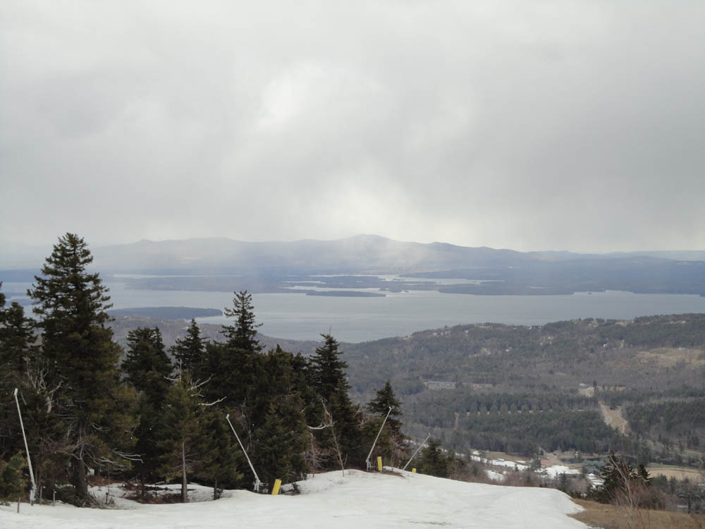
Looking at the Ossipees from Gunstock Mountain

The Blue Trail between Gunstock Mountain and Belknap Mountain

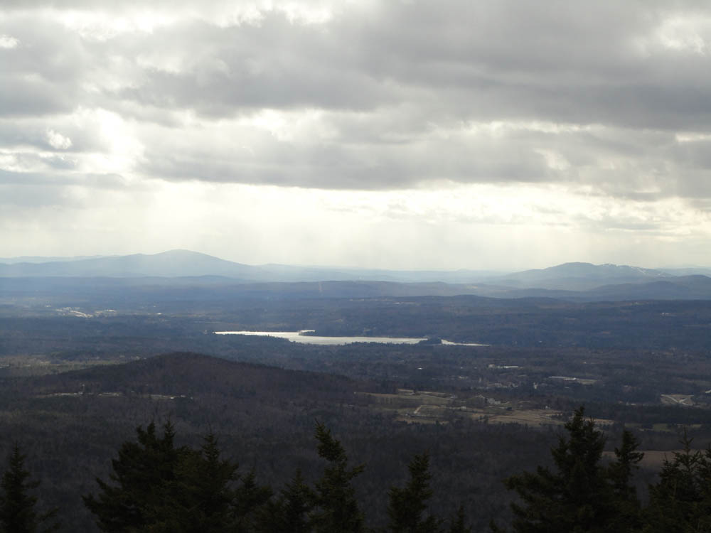
Kearsarge and Ragged as seen from the Belknap Mountain fire tower


Directions to trailhead: From Route 11A East (from Route 3), take a right on Hoyt Road. Continue down this road as it becomes Belknap Mountain Road. Look for Carriage Road on your left - offseason parking is at the gate.
Back to Gunstock Mountain Profile
Back to Belknap Mountain Profile
|