Home
States
Colorado
Connecticut
Maine
Massachusetts
New Hampshire
New York
Rhode Island
Utah
Vermont
View All
Lists
NE 4,000 Footers
NE 100 Highest
NH 4,000 Footers
NH 100 Highest
NH 52 With A View
NH Belknap Range
NH Ossipee 10
Links
Trail Conditions
Trip Log
Sunrises
Sunsets
About
|
Gunstock Mountain, Belknap Mountain
Gilmanton, NH, Gilford, NH
Trailheads, measurements, times, distances, and maps are all approximate and relative to the hike(s) as shown below.

Looking up the Gunstock Mountain Trail
Route: Carriage Road, Gunstock Mountain Trail, (Gunstock Mountain), Saddle Trail, Blue Trail, (Belknap Mountain), Green Trail, Carriage Road
Trails were mostly dry and in good shape. As noted above, Gunstock Mountain Trail has been reblazed orange, but white blazes still remain in places as well. Portions of the upper half of the trail have been slightly rerouted.
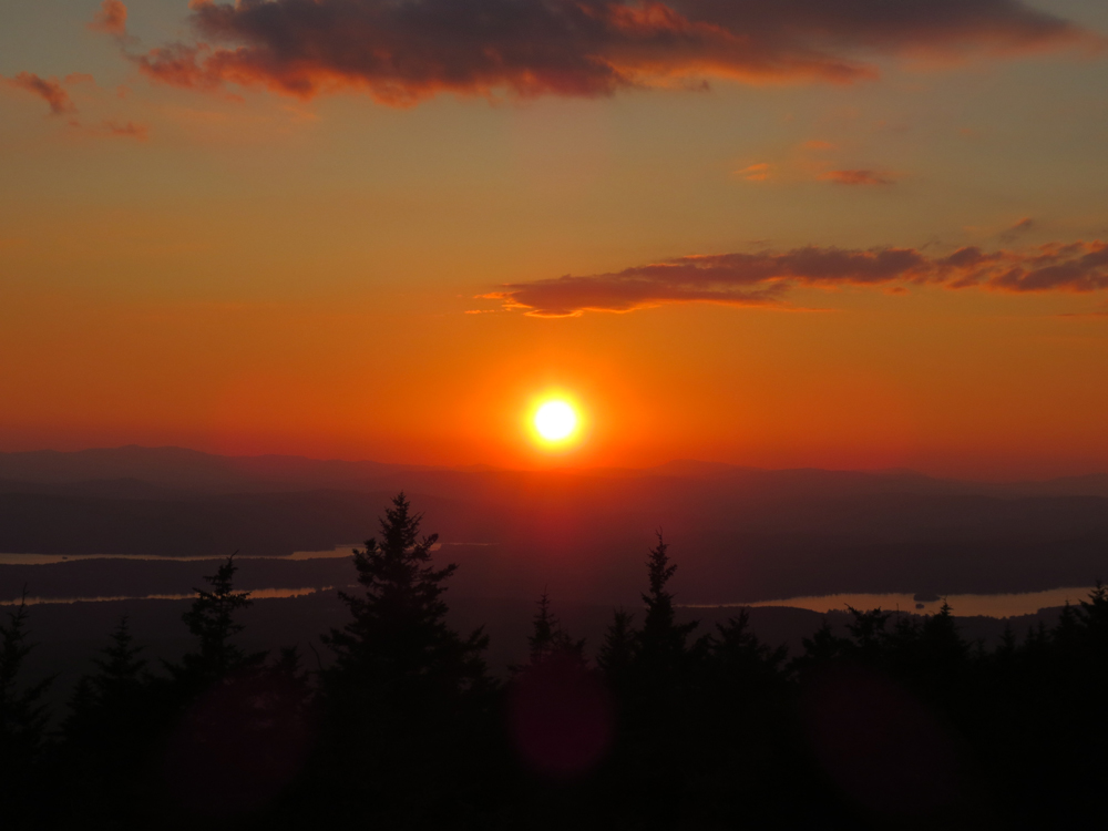
Decent patch of blueberries in the open area on the Belknap side of the Gunstock-Belknap col. Saw a coyote in the col as well.
Nice sunset from the Belknap fire tower, as the communications devices have been relocated (the devices used to obscure the views).
| Hike Ratings |
|
Getting To Trailhead: |
Easy |
| Destination: |
Gunstock Mountain |
|
Length: |
Moderate |
|
Steepness: |
Moderate |
|
Navigation: |
Easy |
|
Views: |
Excellent |
|
Crowds: |
Minimal |
| Destination: |
Belknap Mountain |
|
Length: |
Moderate |
|
Steepness: |
Moderate |
|
Navigation: |
Easy |
|
Views: |
Excellent |
|
Crowds: |
Minimal |
|
| Hike Stats |
|
Date Hiked: |
Tuesday, July 16, 2013 |
| Time to Trailhead: |
00:01 |
| Parking Elevation: |
1,030' |
| Destination: |
Gunstock Mountain |
| Time Elapsed: |
00:24 |
| Trailhead Elevation: |
1,020' |
| Summit Elevation: |
2,245' |
| Vertical Gain: |
1,225' |
| Destination: |
Belknap Mountain |
| Time Elapsed: |
00:18 |
| Trailhead Elevation: |
2,245' |
| Summit Elevation: |
2,382' |
| Vertical Gain: |
407' |
|
|
| Hike Vertical Gain: |
1,682' |
|

The Gunstock Mountain Trail trailhead on the Carriage Road

Looking at the Red Hill from Gunstock Mountain

The Blue Trail between Gunstock Mountain and Belknap Mountain

Mt. Kearsarge as seen from the Belknap Mountain fire tower

The sunset as seen from the Belknap Mountain fire tower


Directions to trailhead: From Route 11A East (from Route 3), take a right on Hoyt Road. Continue down this road as it becomes Belknap Mountain Road. Look for Carriage Road on your left - offseason parking is at the gate.
Back to Gunstock Mountain Profile
Back to Belknap Mountain Profile
|