Home
States
Colorado
Connecticut
Maine
Massachusetts
New Hampshire
New York
Rhode Island
Utah
Vermont
View All
Lists
NE 4,000 Footers
NE 100 Highest
NH 4,000 Footers
NH 100 Highest
NH 52 With A View
NH Belknap Range
NH Ossipee 10
Links
Trail Conditions
Trip Log
Sunrises
Sunsets
About
|
Hurricane Mountain
Conway, NH
Trailheads, measurements, times, distances, and maps are all approximate and relative to the hike(s) as shown below.
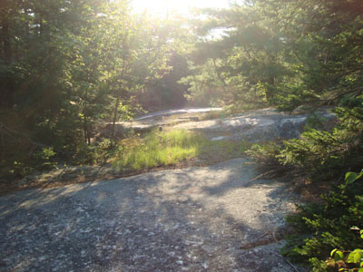
Looking up the trail to Hurricane Mountain
Route: Unnamed trail
Taking care of some stuff in Conway, I headed up Hurricane Mountain Road for a quick jog/hike combo. After parking at the Black Cap lot, I walked back downhill for a hundred or so feet, then took a right onto an old road. Though there were quite a few blowdowns at first, there was evidence of use (and some blazing).
The trail soon turned off the road bed and climbed over some ledges with decent views to the south at one point. Passing some old mine pits, the trail levelled off and worked its way to the highpoint. Other than a slight view of Kearsarge North through the trees, there wasn't much to see.
Just prior to the highpoint, I had noticed "View" spraypainted on a tree. I followed this herdpath to another mine pit, but saw no continuation of the trail, nor a view.
| Hike Ratings |
|
Getting To Trailhead: |
Moderate |
| Destination: |
Hurricane Mountain |
|
Length: |
Easy |
|
Steepness: |
Easy |
|
Navigation: |
Moderate |
|
Views: |
Minimal |
|
Crowds: |
Minimal |
|
| Hike Stats |
|
Date Hiked: |
Tuesday, July 6, 2010 |
| Hike Commenced: |
7:03 PM |
| Parking Elevation: |
1,705' |
| Destination: |
Hurricane Mountain |
| Ascent Commenced: |
7:04 PM |
| Summit Reached: |
7:17 PM |
| Time Elapsed: |
00:13 |
| Trailhead Elevation: |
1,680' |
| Summit Elevation: |
2,112' |
| Vertical Gain: |
452' |
|
|
| Hike Ended: |
7:34 PM |
| Hike Time Elapsed: |
00:31 |
| Hike Vertical Gain: |
517' |
|
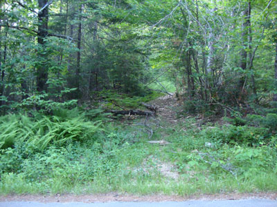
The trailhead for the trail to Hurricane Mountain
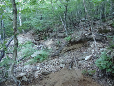
Old mine pits near the summit of Hurricane Mountain
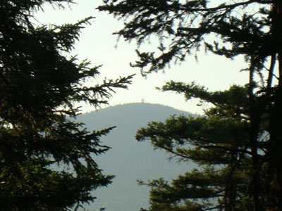
Looking through the trees at Kearsarge North Mountain from Hurricane Mountain
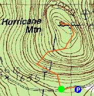

Directions to trailhead: Take Route 16 North from North Conway. Take a right onto Hurricane Mountain Road. Go past the Kearsarge North Trail trailhead, past the gate, and to the top of the mountain. The parking lot is at the height of land, on the right. From there, walk back out onto the road, go left (downhill) briefly, then turn right onto an old road.
Back to Hurricane Mountain Profile
|

