Home
States
Colorado
Connecticut
Maine
Massachusetts
New Hampshire
New York
Rhode Island
Utah
Vermont
View All
Lists
NE 4,000 Footers
NE 100 Highest
NH 4,000 Footers
NH 100 Highest
NH 52 With A View
NH Belknap Range
NH Ossipee 10
Links
Trail Conditions
Trip Log
Sunrises
Sunsets
About
|
Imp Face, Middle Carter Mountain
Martin's Location, NH, Bean's Purchase, NH
Trailheads, measurements, times, distances, and maps are all approximate and relative to the hike(s) as shown below.
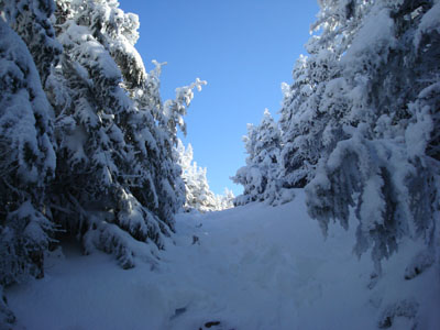
The Imp trail between Imp Face viewpoints
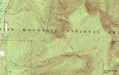
Route: Imp Trail, (Imp Face), Imp Trail, North Carter Trail, Carter-Moriah Trail, (Middle Carter Mountain), Carter-Moriah Trail, North Carter Trail, Imp Trail, (Imp Face), Imp Trail
In reality, I probably should have picked up Middle Carter Mountain when I did Carter Dome and South Carter. I had time, I had energy, and the weather was good. Nonetheless, I didn't, thus it was still dangling over my head in my leisurely pursuit of the New Hampshire 4,000 footers. I had intended to get back rather soon and pick up Middle Carter, however weather, time, energy, Red Sox, etc. all kept me away.
With one of the best late fall days possible forecasted, I decided to go for it. I had a somewhat late start, however I knew I had plenty of daylight, so no worries.
The first part of the Imp Trail isn't overly challenging - it basically sits up above a brook, before crossing it. I had read that this was a tricky crossing, however I didn't think it was tough by any means - even with a bit of ice on the sides.
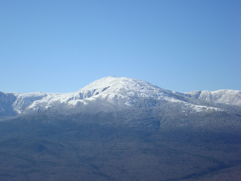
After this, the trail does some slightly steep ascents, followed by some flats, and then a steeper ascent up the side of Imp Face. With the leaves down, there were nice glances at a white Mt. Washington.
Soon, I was at the dramatic ledges of Imp Face. Amazing views of the Presidentials, as well as the Carters and the Wildcats.
Just a few minutes above this cliff is the wooded high point - a bit off the trail on the left. From here, the Imp Trail drops a bit to another nice cliff view, before doing a long, somewhat rolly traverse over to the North Carter Trail. I found this to be probably the most challenging piece of trail on this hike, as the brook crossings were icy and the trail had a few sustained ice patches.
The North Carter Trail moderately ascended into winter - snow, white treetops, awesome blue sky. Birds chirping.
At the Carter-Moriah Trail junction, I decided to get some warmer stuff on - as I went to switch my baseball cap for a stocking hat, my hair froze almost instantly! Wa wa wee wa! Despite the cold temperatures and somewhat strong winds, I was still okay with a tee shirt, long sleeve tee shirt, and a fall vest (along with gloves and the hat).
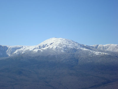
The Carter-Moriah Trail was a winter wonderland - it felt like a great January day! The various little peaks and view points made it a very enjoyable trek. My favorite viewpoint was just before the summit - great views of the northern Carters, the Presidentials, and other points in between.
The actual Middle Carter Mountain summit was nothing too special - just a sign on the side of the trail with no views. No worries - the trees helped cut down the wind a bit as I chatted with another hiker.
I took another quick break a few minutes back up the Carter-Moriah Trail in a small wind-protected col. I wasn't quite sure how to get to Mt. Lethe, a peak between the North Carter Trail junction and Middle Carter. The map I had with me had too many minutes to make the contours helpful and I had too few minutes of patience, so I decided to bag it (in the normal slang usage, not the peakbagger usage) and head back.
Since I was too stubborn to actually use my Stablicers, I took a nice little tumble on the icy upper portion of the Imp Trail. Derp. The views from Imp Face on the descent weren't nearly as good as the ascent due to a haze settling into the notch. Still, Imp Face was much warmer and less windy than Middle Carter, so it was a nice place to sit and look around for a few minutes.
All things considered, a very nice early winter hike. Git r done.
| Hike Ratings |
|
Getting To Trailhead: |
Easy |
| Destination: |
Imp Face |
|
Length: |
Moderate |
|
Steepness: |
Difficult |
|
Navigation: |
Easy |
|
Views: |
Excellent |
|
Crowds: |
Minimal |
| Destination: |
Middle Carter Mountain |
|
Length: |
Moderate |
|
Steepness: |
Difficult |
|
Navigation: |
Easy |
|
Views: |
Excellent |
|
Crowds: |
Minimal |
|
| Hike Stats |
|
Date Hiked: |
Sunday, November 11, 2007 |
| Hike Commenced: |
9:43 AM |
| Parking Elevation: |
1,270' |
| Destination: |
Imp Face |
| Ascent Commenced: |
9:43 AM |
| Summit Reached: |
10:50 AM |
| Time Elapsed: |
01:07 |
| Trailhead Elevation: |
1,270' |
| Summit Elevation: |
3,165' |
| Distance: |
2.2 miles |
| Vertical Gain: |
1,920' |
| Destination: |
Middle Carter Mountain |
| Ascent Commenced: |
10:50 AM |
| Summit Reached: |
12:19 PM |
| Time Elapsed: |
01:29 |
| Trailhead Elevation: |
3,165' |
| Summit Elevation: |
4,610' |
| Distance: |
2.7 miles |
| Vertical Gain: |
1,770' |
|
|
| Hike Ended: |
3:02 PM |
| Hike Time Elapsed: |
05:19 |
| Hike Distance: |
9.8 miles |
| Hike Vertical Gain: |
4,045' |
|
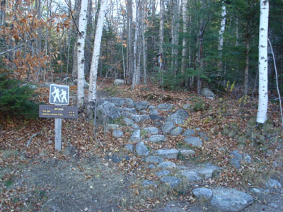
The northern Imp Trail trailhead on Route 16
Looking at Mt. Washington from the Imp Face cliffs
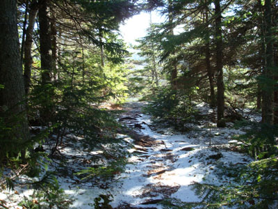
Looking up the Carter-Moriah Trail
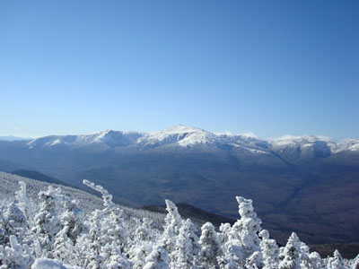
Looking at the Presidentials from the outlook near the Middle Carter Mountain summit

Directions to trailhead: Take Route 16 North past the Mt. Washington Auto Road entrance. The northern Imp Trail is the second Imp Trail roadside parking area on the right.
Back to Imp Face Profile
Back to Middle Carter Mountain Profile
|