Home
States
Colorado
Connecticut
Maine
Massachusetts
New Hampshire
New York
Rhode Island
Utah
Vermont
View All
Lists
NE 4,000 Footers
NE 100 Highest
NH 4,000 Footers
NH 100 Highest
NH 52 With A View
NH Belknap Range
NH Ossipee 10
Links
Trail Conditions
Trip Log
Sunrises
Sunsets
About
|
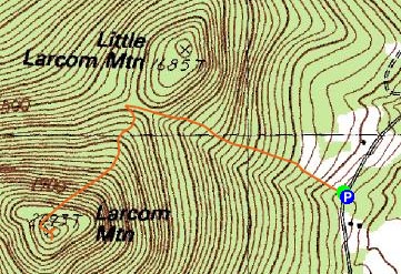
Larcom Mountain
Tamworth, NH
Trailheads, measurements, times, distances, and maps are all approximate and relative to the hike(s) as shown below.
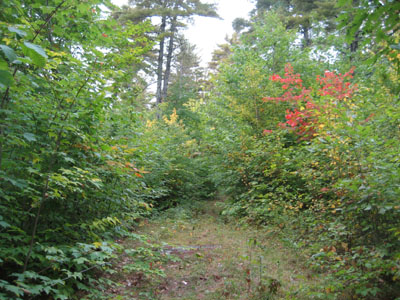
Looking up the trail to Larcom Mountain
Route: Larcom Mountain Trail
Another botched weather forecast! Apparently there was only a slight chance of rain - instead, it rained for most of the morning and part of the afternoon. As such, I decided to do something local.
While much of the leaves in the region are near or at peak, the small trees at the top of the field at the beginning of the trail were still rather green - since there are a lot of maple, this could prove to be a nice later-foliage season hike.
Since it looked like I was hiking into the fog, I decided to go straight to the summit and wait things out, skipping Little Larcom. While the trail was slippery from the multiple days of rain, there was very little mud to speak of (though there were a few new blow downs).
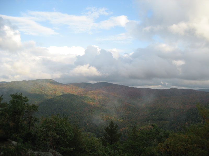
Arriving at the summit, there were no views due to the fog. Heading to the lower ledge area, I waited out the fog for quite awhile, finally getting some nice glimpses of the colorful surrounding Ossipee mountains. Back at the main viewpoint, there still wasn't much to see to the north, as pretty much everything above 2,000ish feet was socked in.
I still need to check out this peak on a clear day - I suspect that the views are tremendous!
| Hike Ratings |
|
Getting To Trailhead: |
Easy |
| Destination: |
Larcom Mountain |
|
Length: |
Moderate |
|
Steepness: |
Difficult |
|
Navigation: |
Moderate |
|
Views: |
Excellent |
|
Crowds: |
Minimal |
|
| Hike Stats |
|
Date Hiked: |
Tuesday, September 30, 2008 |
| Hike Commenced: |
3:45 PM |
| Parking Elevation: |
1,050' |
| Destination: |
Larcom Mountain |
| Ascent Commenced: |
3:45 PM |
| Summit Reached: |
4:18 PM |
| Time Elapsed: |
00:33 |
| Trailhead Elevation: |
1,050' |
| Summit Elevation: |
2,093' |
| Vertical Gain: |
1,058' |
|
|
| Hike Ended: |
5:41 PM |
| Hike Time Elapsed: |
01:56 |
| Hike Vertical Gain: |
1,078' |
|
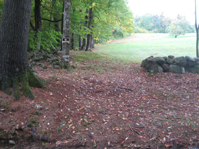
The beginning of the trail on Mountain Road

Looking east southeast from the Larcom Mountain summit

Directions to trailhead: ---Please note, as of Winter 2009, this trailhead is reportedly closed to hikers.--- Take Route 25 west from West Ossipee to South Tamworth. Just after hitting the reduced speed limit, take a left onto Mountain Road. Drive up this road, cross a bridge, then head up to the height of land (apple orchard and a small shack on the right). Just after the height of land and at the south edge of the field that contains the apple orchard, there is a small parking area on the left. The trail starts on the right, following the edge of the field, then entering the woods at the top.
Back to Larcom Mountain Profile
|