Home
States
Colorado
Connecticut
Maine
Massachusetts
New Hampshire
New York
Rhode Island
Utah
Vermont
View All
Lists
NE 4,000 Footers
NE 100 Highest
NH 4,000 Footers
NH 100 Highest
NH 52 With A View
NH Belknap Range
NH Ossipee 10
Links
Trail Conditions
Trip Log
Sunrises
Sunsets
About
|
Larcom Mountain
Tamworth, NH
Trailheads, measurements, times, distances, and maps are all approximate and relative to the hike(s) as shown below.
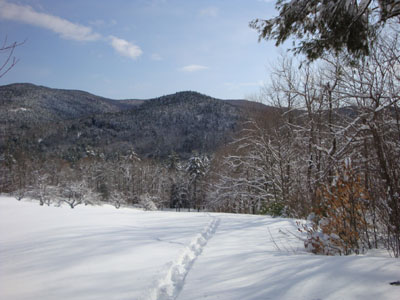
Looking down the Larcom Mountain Trail
Route: Larcom Mountain Trail
Wanting to stretch my legs, I headed over to Larcom Mountain during lunch. Arriving at the trailhead, I could see I would be breaking trail after the previous day's snowfall.
As I was ascending the back side of the mountain, I looked up to see a moose getting up from a nap. By the time I had my camera out, the moose had taken off. While I pursued it for a bit, the tracks dipped down the west side of the mountain - not enough time follow!
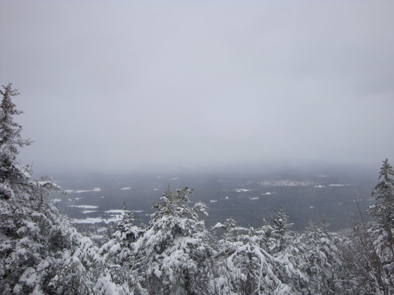
Though it was blue sky when I started the hike, snow flurries had moved in by the time I was at the summit. Nonetheless, nearby mountains in the range could be seen, as well as the valley to the north.
All in all, not a bad day for Larcom Mountain.
| Hike Ratings |
|
Getting To Trailhead: |
Easy |
| Destination: |
Larcom Mountain |
|
Length: |
Moderate |
|
Steepness: |
Difficult |
|
Navigation: |
Moderate |
|
Views: |
Moderate (due to weather) |
|
Crowds: |
Minimal |
|
| Hike Stats |
|
Date Hiked: |
Friday, February 20, 2009 |
| Hike Commenced: |
11:27 AM |
| Parking Elevation: |
1,050' |
| Destination: |
Larcom Mountain |
| Ascent Commenced: |
11:27 AM |
| Summit Reached: |
12:10 PM |
| Time Elapsed: |
00:43 |
| Trailhead Elevation: |
1,050' |
| Summit Elevation: |
2,093' |
| Vertical Gain: |
1,058' |
|
|
| Hike Ended: |
12:41 PM |
| Hike Time Elapsed: |
01:14 |
| Hike Vertical Gain: |
1,078' |
|
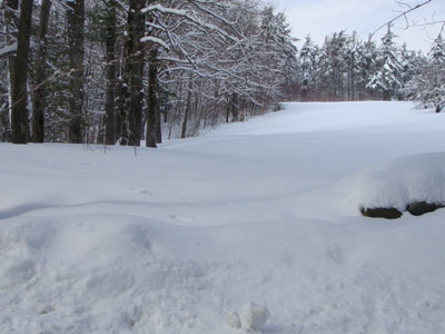
The beginning of the Larcom Mountain Trail on Mountain Road
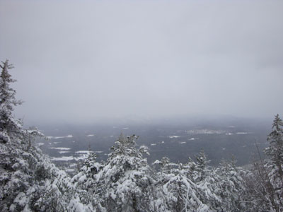
Looking at north from the Larcom Mountain summit
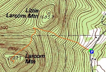

Directions to trailhead: ---Please note, as of Winter 2009, this trailhead is reportedly closed to hikers.--- Take Route 25 west from West Ossipee to South Tamworth. Just after hitting the reduced speed limit, take a left onto Mountain Road. Drive up this road, cross a bridge, then head up to the height of land (apple orchard and a small shack on the right). Just after the height of land and at the south edge of the field that contains the apple orchard, there is a small parking area on the left. The trail starts on the right, following the edge of the field, then entering the woods at the top.
Back to Larcom Mountain Profile
|