Home
States
Colorado
Connecticut
Maine
Massachusetts
New Hampshire
New York
Rhode Island
Utah
Vermont
View All
Lists
NE 4,000 Footers
NE 100 Highest
NH 4,000 Footers
NH 100 Highest
NH 52 With A View
NH Belknap Range
NH Ossipee 10
Links
Trail Conditions
Trip Log
Sunrises
Sunsets
About
|
Little Sugarloaf, Sugarloaf
Alexandria, NH
Trailheads, measurements, times, distances, and maps are all approximate and relative to the hike(s) as shown below.
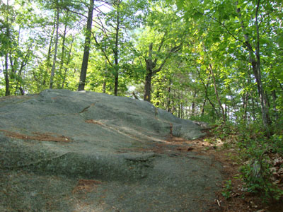
Looking up the Elwell Trail on the way to Little Sugarloaf
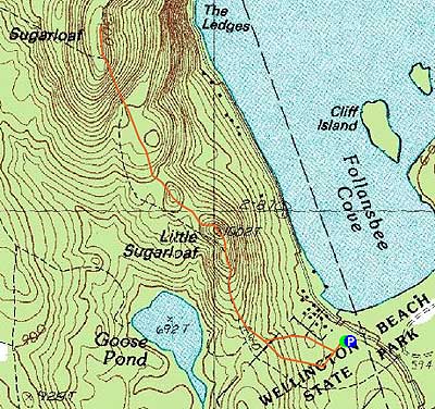
Route: Elwell Trail, (Little Sugarloaf), Elwell Trail, (Sugarloaf), Elwell Trail, Little Sugarloaf view loop, Elwell Trail, Orange Trail
Watching the radar, I found an opening to the west and thus headed toward Newfound Lake. After driving through rain, blue sky appeared as I pulled into the Elwell Trail parking lot.
The mosquitoes were a bit rough down low. After applying some deet, I headed up the rest of the way to Little Sugarloaf. Though ledgy in a few places, the terrain was never particularly steep. After passing near a false summit, I soon reached the true summit. Just a bit downhill from it, there was a spur trail with nice lake views.
Continuing from Little Sugarloaf, the Elwell Trail dropped somewhat steeply into a col, went over a few ups and downs, then climbed up to Sugarloaf proper, passing a cairn. There was higher land not too far beyond the cairn, as well as excellent views of Newfound Lake.
For the return trip, I opted to take the view spur trail around the top of Little Sugarloaf. A few minutes after that, back on the Elwell Trail, I took a left onto the Orange Trail, opting for better footing and a few less mosquitoes.
| Hike Ratings |
|
Getting To Trailhead: |
Easy |
| Destination: |
Little Sugarloaf |
|
Length: |
Easy |
|
Steepness: |
Moderate |
|
Navigation: |
Easy |
|
Views: |
Excellent |
|
Crowds: |
Minimal |
| Destination: |
Sugarloaf |
|
Length: |
Moderate |
|
Steepness: |
Difficult |
|
Navigation: |
Easy |
|
Views: |
Excellent |
|
Crowds: |
Minimal |
|
| Hike Stats |
|
Date Hiked: |
Thursday, June 3, 2010 |
| Hike Commenced: |
4:13 PM |
| Parking Elevation: |
620' |
| Destination: |
Little Sugarloaf |
| Ascent Commenced: |
4:13 PM |
| Summit Reached: |
4:35 PM |
| Time Elapsed: |
00:22 |
| Trailhead Elevation: |
620' |
| Summit Elevation: |
1,002' |
| Distance: |
.7 miles |
| Vertical Gain: |
472' |
| Destination: |
Sugarloaf |
| Ascent Commenced: |
4:35 PM |
| Summit Reached: |
5:00 PM |
| Time Elapsed: |
00:25 |
| Trailhead Elevation: |
1,002' |
| Summit Elevation: |
1,370' |
| Distance: |
1 mile |
| Vertical Gain: |
580' |
|
|
| Hike Ended: |
5:49 PM |
| Hike Time Elapsed: |
01:36 |
| Hike Vertical Gain: |
1,292' |
|
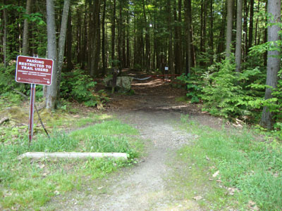
The Elwell Trail trailhead
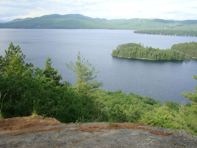
Looking at Newfound Lake from near the summit of Little Sugarloaf
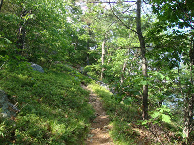
Looking up the Elwell Trail on the way Sugarloaf
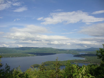
Looking at Newfound Lake from Sugarloaf

Directions to trailhead: From Bristol, take US 3A North, then take a left onto West Shore Road. Continue right on West Shore Road when Caridgan Mountain Road branches off straight. Shortly after passing the Alexandria town line, the Elwell Trail parking lot entrance road will be on the left. The Elwell Trail trailhead is at the corner of this parking lot.
Back to Little Sugarloaf Profile
Back to Sugarloaf Profile
|


