Home
States
Colorado
Connecticut
Maine
Massachusetts
New Hampshire
New York
Rhode Island
Utah
Vermont
View All
Lists
NE 4,000 Footers
NE 100 Highest
NH 4,000 Footers
NH 100 Highest
NH 52 With A View
NH Belknap Range
NH Ossipee 10
Links
Trail Conditions
Trip Log
Sunrises
Sunsets
About
|
Mary's Mountain
Freedom, NH
Trailheads, measurements, times, distances, and maps are all approximate and relative to the hike(s) as shown below.
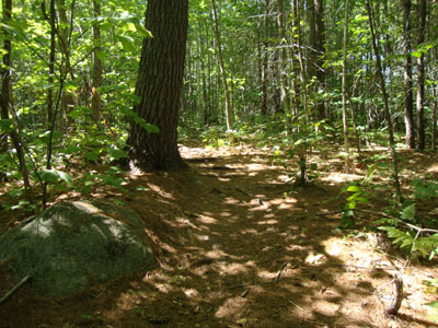
Mary's Mountain Trail
Route: Mary's Mountain Trail
After driving near it a day earlier on my way back from Durgin Hill, I opted to head to Mary's Mountain for a quick jog.
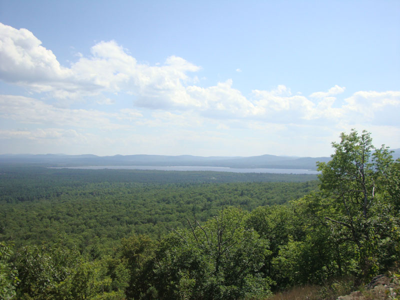
The trail was mostly dry and good shape. With the high pressure system moving in, the views were quite strong, ranging from Foss Mountain to the Ossipees. There were no bugs to speak of.
| Hike Ratings |
|
Getting To Trailhead: |
Easy |
| Destination: |
Mary's Mountain |
|
Length: |
Easy |
|
Steepness: |
Moderate |
|
Navigation: |
Moderate |
|
Views: |
Excellent |
|
Crowds: |
Minimal |
|
| Hike Stats |
|
Date Hiked: |
Friday, August 6, 2010 |
| Hike Commenced: |
3:10 PM |
| Parking Elevation: |
480' |
| Destination: |
Mary's Mountain |
| Ascent Commenced: |
3:10 PM |
| Summit Reached: |
3:20 PM |
| Time Elapsed: |
00:10 |
| Trailhead Elevation: |
495' |
| Summit Elevation: |
944' |
| Distance: |
.7 mile |
| Vertical Gain: |
469' |
|
|
| Hike Ended: |
3:33 PM |
| Hike Time Elapsed: |
00:23 |
| Hike Distance: |
1.4 miles |
| Hike Vertical Gain: |
489' |
|
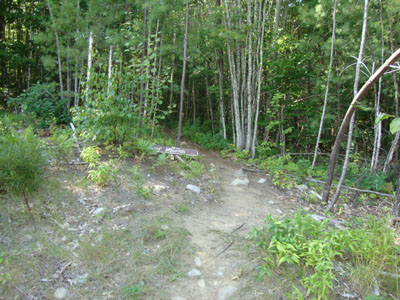
The Mary's Mountain Trail trailhead
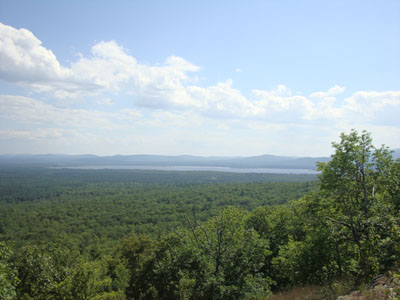
Ossipee Lake as seen from near the summit of Mary's Mountain
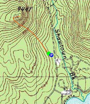

Directions to trailhead: Take Route 16 North from West Ossipee to Route 41 East. Take a right on Ossipee Lake Road. Head down this for a few minutes, then take a left onto Shawtown Road (Danforth Bay Campground sign). Go straight on this road, then take a left and park in the RV/day parking lot. The Mary's Mountain Trail trailhead is located just above the northwest corner of the parking lot.
Back to Mary's Mountain Profile
|